 |
|
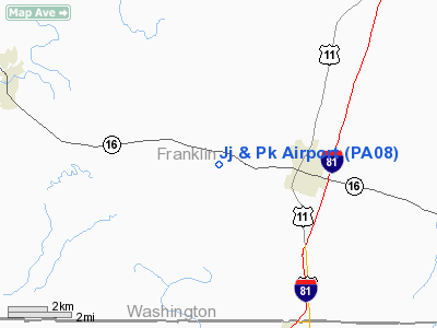
Location & QuickFacts
| FAA Information Effective: | 2008-09-25 |
| Airport Identifier: | PA08 |
| Airport Status: | Operational |
| Longitude/Latitude: | 077-46-40.9800W/39-47-36.3340N
-77.778050/39.793426 (Estimated) |
| Elevation: | 542 ft / 165.20 m (Estimated) |
| Land: | 0 acres |
| From nearest city: | 3 nautical miles W of Greencastle, PA |
| Location: | Franklin County, PA |
| Magnetic Variation: | 09W (1985) |
Owner & Manager
| Ownership: | Privately owned |
| Owner: | James R. Kegerreis |
| Address: | 10214 Orenda Dr
Greencastle, PA 17225 |
| Phone number: | 717-597-7248 |
| Manager: | James R. Kegerreis |
| Address: | 10214 Orenda Dr.
Greencastle, PA 17225 |
| Phone number: | 717-597-7248 |
Airport Operations and Facilities
| Airport Use: | Private |
| Wind indicator: | Yes |
| Segmented Circle: | No |
| Control Tower: | No |
| Landing fee charge: | No |
| Sectional chart: | Washington |
| Region: | AEA - Eastern |
| Boundary ARTCC: | ZDC - Washington |
| Tie-in FSS: | IPT - Williamsport |
| FSS on Airport: | No |
| FSS Toll Free: | 1-800-WX-BRIEF |
Airport Services
| Airframe Repair: | NONE |
| Power Plant Repair: | NONE |
Runway Information
Runway N/S
| Dimension: | 1750 x 150 ft / 533.4 x 45.7 m |
| Surface: | TURF, |
| |
Runway N |
Runway S |
| Traffic Pattern: | Left | Left |
|
Radio Navigation Aids
| ID |
Type |
Name |
Ch |
Freq |
Var |
Dist |
| EUD | NDB | York | | 254.00 | 11W | 42.2 nm |
| TZ | NDB | Cogan | | 364.00 | 10W | 44.6 nm |
| CBE | NDB | Cumberland | | 317.00 | 07W | 45.7 nm |
| GAI | NDB | Gaithersburg | | 385.00 | 09W | 47.0 nm |
| RV | NDB | Stroh | | 407.00 | 10W | 49.4 nm |
| HGR | VOR | Hagerstown | | 109.80 | 07W | 6.8 nm |
| FDK | VOR | Frederick | | 109.00 | 08W | 29.5 nm |
| AOO | VOR | Altoona | | 108.80 | 07W | 40.1 nm |
| THS | VORTAC | St Thomas | 097X | 115.00 | 07W | 11.6 nm |
| MRB | VORTAC | Martinsburg | 058X | 112.10 | 07W | 24.7 nm |
| EMI | VORTAC | Westminster | 126X | 117.90 | 08W | 41.1 nm |
| HAR | VORTAC | Harrisburg | 072X | 112.50 | 10W | 44.7 nm |
Remarks
Images and information placed above are from
http://www.airport-data.com/airport/PA08/
We thank them for the data!
| General Info
|
| Country |
United States
|
| State |
PENNSYLVANIA
|
| FAA ID |
PA08
|
| Latitude |
39-47-36.334N
|
| Longitude |
077-46-40.980W
|
| Elevation |
542 feet
|
| Near City |
GREENCASTLE
|
We don't guarantee the information is fresh and accurate. The data may
be wrong or outdated.
For more up-to-date information please refer to other sources.
|
|


