 |
|
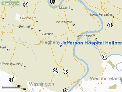
Jefferson Hospital Heliport |
Location & QuickFacts
| FAA Information Effective: | 2008-09-25 |
| Airport Identifier: | 60PN |
| Airport Status: | Operational |
| Longitude/Latitude: | 079-55-29.1800W/40-20-00.2500N
-79.924772/40.333403 (Estimated) |
| Elevation: | 1156 ft / 352.35 m (Estimated) |
| Land: | 0 acres |
| From nearest city: | 4 nautical miles NN of Large, PA |
| Location: | Allegheny County, PA |
| Magnetic Variation: | 08W (1985) |
Owner & Manager
| Ownership: | Privately owned |
| Owner: | South Hills Health System |
| Address: | Coal Valley Rd, Po Box 18119
Pittsburgh, PA 15236
EXTN 12. |
| Phone number: | 412-469-5941 |
| Manager: | Ralph L Travis |
| Address: | Coal Valley Rd, Po Box 18119
Pittsburgh, PA 15236 |
| Phone number: | 412-469-5941 |
Airport Operations and Facilities
| Airport Use: | Private
MEDICAL USE. |
| Wind indicator: | Yes |
| Segmented Circle: | Yes |
| Control Tower: | No |
| Landing fee charge: | No |
| Sectional chart: | Detroit |
| Region: | AEA - Eastern |
| Boundary ARTCC: | ZOB - Cleveland |
| Tie-in FSS: | AOO - Altoona |
| FSS on Airport: | No |
| FSS Toll Free: | 1-800-WX-BRIEF |
Runway Information
Helipad H1
| Dimension: | 70 x 70 ft / 21.3 x 21.3 m |
| Surface: | ASPH, |
| |
Runway H1 |
Runway |
| Traffic Pattern: | Left | Left |
|
Radio Navigation Aids
| ID |
Type |
Name |
Ch |
Freq |
Var |
Dist |
| MKP | NDB | Mc Keesport | | 287.00 | 07W | 6.7 nm |
| PNU | NDB | Washington County | | 255.00 | 08W | 15.7 nm |
| VV | NDB | Camor | | 299.00 | 08W | 28.3 nm |
| BHU | NDB | Benje | | 382.00 | 07W | 30.0 nm |
| INP | NDB | Indiana | | 242.00 | 08W | 43.2 nm |
| UCP | NDB | Castle | | 272.00 | 09W | 47.1 nm |
| SYS | NDB | Stoystown | | 209.00 | 08W | 48.6 nm |
| AGC | VOR/DME | Allegheny | 037X | 110.00 | 09W | 6.3 nm |
| HLG | VOR/DME | Wheeling | 059X | 112.20 | 07W | 29.8 nm |
| AIR | VOR/DME | Bellaire | 118X | 117.10 | 07W | 45.2 nm |
| MMJ | VORTAC | Montour | 057X | 112.00 | 08W | 15.4 nm |
| EWC | VORTAC | Ellwood City | 105X | 115.80 | 08W | 32.3 nm |
| IHD | VORTAC | Indian Head | 019X | 108.20 | 06W | 33.8 nm |
| MGW | VORTAC | Morgantown | 053X | 111.60 | 05W | 46.8 nm |
| JST | VORTAC | Johnstown | 077X | 113.00 | 06W | 50.0 nm |
Remarks
- PRVDD A WINDSOCK IS PSND NEAR THE HELI.
Images and information placed above are from
http://www.airport-data.com/airport/60PN/
We thank them for the data!
| General Info
|
| Country |
United States
|
| State |
PENNSYLVANIA
|
| FAA ID |
60PN
|
| Latitude |
40-20-00.250N
|
| Longitude |
079-55-29.180W
|
| Elevation |
1156 feet
|
| Near City |
LARGE
|
We don't guarantee the information is fresh and accurate. The data may
be wrong or outdated.
For more up-to-date information please refer to other sources.
|
|


