 |
|
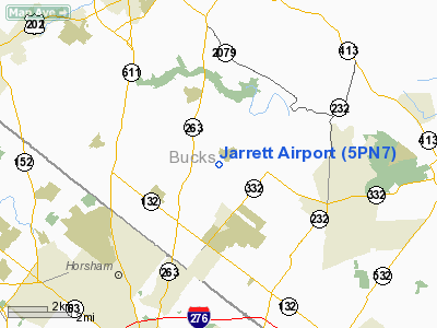
Location & QuickFacts
| FAA Information Effective: | 2008-09-25 |
| Airport Identifier: | 5PN7 |
| Airport Status: | Operational |
| Longitude/Latitude: | 075-04-30.0000W/40-14-00.0000N
-75.075000/40.233333 (Estimated) |
| Elevation: | 210 ft / 64.01 m () |
| Land: | 55 acres |
| From nearest city: | 2 nautical miles N of Ivyland, PA |
| Location: | Bucks County, PA |
| Magnetic Variation: | 12W (2000) |
Owner & Manager
| Ownership: | Privately owned |
| Owner: | Franklin Jarrett |
| Address: | 680 Creek Rd
Ivyland, PA 18974 |
| Phone number: | 215-672-8310 |
| Manager: | Franklin Jarrett |
| Address: | 690 Creek Rd
Ivyland, PA 18974 |
Airport Operations and Facilities
| Airport Use: | Private |
| Wind indicator: | Yes |
| Segmented Circle: | No |
| Control Tower: | No |
| Sectional chart: | New York |
| Region: | AEA - Eastern |
| Boundary ARTCC: | ZNY - New York |
| Tie-in FSS: | IPT - Williamsport |
| FSS Toll Free: | 1-800-WX-BRIEF |
Runway Information
Runway 12/30
| Dimension: | 1200 x 100 ft / 365.8 x 30.5 m |
| Surface: | TURF, |
| |
Runway 12 |
Runway 30 |
| Traffic Pattern: | Left | Left |
| Markings: | Basic, Good Condition | Basic, Good Condition |
| Displaced threshold: | 0.00 ft | 500.00 ft |
| Obstruction: | | 40 ft trees, 250.0 ft from runway |
|
Radio Navigation Aids
| ID |
Type |
Name |
Ch |
Freq |
Var |
Dist |
| EWR | FAN MARKER | Maryann | | | 11W | 49.4 nm |
| NXX | NDB | Willow Grove | | 388.00 | 12W | 4.2 nm |
| DYL | NDB | Doylestown | | 237.00 | 10W | 6.5 nm |
| ING | NDB | Ambler | | 275.00 | 11W | 11.6 nm |
| UKT | NDB | Quakertown | | 208.00 | 12W | 15.4 nm |
| NEL | NDB | Lakehurst | | 396.00 | 13W | 35.8 nm |
| CAT | NDB | Chatham | | 254.00 | 11W | 42.4 nm |
| LQX | NDB | Carbon | | 339.00 | 12W | 46.8 nm |
| RNB | NDB | Rainbow | | 363.00 | 11W | 49.1 nm |
| NXX | TACAN | Willow Grove | 061X | | 10W | 4.0 nm |
| NEL | TACAN | Lakehurst | 055X | | 11W | 35.2 nm |
| NEL | UHF/NDB | Lakehurst | | 274.80 | 13W | 35.8 nm |
| PNE | VOR | North Philadelphia | | 112.00 | 10W | 9.6 nm |
| ARD | VOR/DME | Yardley | 019X | 108.20 | 10W | 7.8 nm |
| CKZ | VOR/DME | Pennridge | 025Y | 108.85 | 12W | 13.6 nm |
| SBJ | VOR/DME | Solberg | 076X | 112.90 | 10W | 26.0 nm |
| ETX | VOR/DME | East Texas | 039X | 110.20 | 09W | 34.8 nm |
| BWZ | VOR/DME | Broadway | 089X | 114.20 | 11W | 35.9 nm |
| COL | VOR/DME | Colts Neck | 101X | 115.40 | 11W | 42.2 nm |
| STW | VOR/DME | Stillwater | 033X | 109.60 | 11W | 46.8 nm |
| PTW | VORTAC | Pottstown | 112X | 116.50 | 09W | 22.3 nm |
| GXU | VORTAC | Mc Guire | 043X | 110.60 | 11W | 25.8 nm |
| RBV | VORTAC | Robbinsville | 085X | 113.80 | 10W | 26.7 nm |
| MXE | VORTAC | Modena | 079X | 113.20 | 09W | 33.3 nm |
| FJC | VORTAC | Allentown | 122X | 117.50 | 10W | 34.4 nm |
| OOD | VORTAC | Woodstown | 075X | 112.80 | 10W | 37.4 nm |
| CYN | VORTAC | Coyle | 081X | 113.40 | 10W | 38.8 nm |
| DQO | VORTAC | Dupont | 087X | 114.00 | 10W | 41.4 nm |
| VCN | VORTAC | Cedar Lake | 099X | 115.20 | 10W | 42.1 nm |
| PHL | VOT | Philadelphia Intl | | 109.80 | | 23.2 nm |
Remarks
- PRVDD VFR ONLY, CLEAR 20:1 APCH/DEPT PATH, CLEAR PRIMARY SFC 125 FT EACH SIDE RY (TREES REVOVED IF NECESSARY), MINIMIZE NOISE OVER RESIDENCES & CHURCH.
Images and information placed above are from
http://www.airport-data.com/airport/5PN7/
We thank them for the data!
| General Info
|
| Country |
United States
|
| State |
PENNSYLVANIA
|
| FAA ID |
5PN7
|
| Latitude |
40-14-00.000N
|
| Longitude |
075-04-30.000W
|
| Elevation |
210 feet
|
| Near City |
IVYLAND
|
We don't guarantee the information is fresh and accurate. The data may
be wrong or outdated.
For more up-to-date information please refer to other sources.
|
|


