 |
|
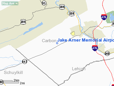
Jake Arner Memorial Airport |
Location & QuickFacts
| FAA Information Effective: | 2008-09-25 |
| Airport Identifier: | 22N |
| Airport Status: | Operational |
| Longitude/Latitude: | 075-45-41.3870W/40-48-34.2320N
-75.761496/40.809509 (Estimated) |
| Elevation: | 534 ft / 162.76 m (Surveyed) |
| Land: | 137 acres |
| From nearest city: | 3 nautical miles SW of Lehighton, PA |
| Location: | Carbon County, PA |
| Magnetic Variation: | 12W (2000) |
Owner & Manager
| Ownership: | Publicly owned |
| Owner: | Carbon County Airport Authority |
| Address: | 2321 Mahoning Dr East
Lehighton, PA 18235 |
| Phone number: | 570-386-5025 |
| Manager: | Paul Smith |
| Address: | 2321 Mahoning Drive East
Lehighton, PA 18235 |
| Phone number: | 570-778-4783 |
Airport Operations and Facilities
| Airport Use: | Open to public |
| Wind indicator: | Yes |
| Segmented Circle: | Yes |
| Control Tower: | No |
| Lighting Schedule: | DUSK-DAWN
ACTVT MIRL, REILS & VASI RY 08/26 -CTAF. |
| Beacon Color: | Clear-Green (lighted land airport) |
| Landing fee charge: | No |
| Sectional chart: | New York |
| Region: | AEA - Eastern |
| Boundary ARTCC: | ZNY - New York |
| Tie-in FSS: | IPT - Williamsport |
| FSS on Airport: | No |
| FSS Toll Free: | 1-800-WX-BRIEF |
| NOTAMs Facility: | IPT (NOTAM-d service avaliable) |
| Federal Agreements: | NGY |
Airport Communications
| CTAF: | 123.050 |
| Unicom: | 123.050 |
Airport Services
| Fuel available: | 100LLA |
| Airframe Repair: | MAJOR |
| Power Plant Repair: | MAJOR |
| Bottled Oxygen: | NONE |
| Bulk Oxygen: | NONE |
Runway Information
Runway 08/26
| Dimension: | 3000 x 60 ft / 914.4 x 18.3 m |
| Surface: | ASPH, Good Condition |
| Weight Limit: | Single wheel: 12500 lbs. |
| Edge Lights: | Medium |
| |
Runway 08 |
Runway 26 |
| Longitude: | 075-45-59.5630W | 075-45-23.1550W |
| Latitude: | 40-48-28.9370N | 40-48-39.5970N |
| Elevation: | 534.00 ft | 509.00 ft |
| Alignment: | 69 | 127 |
| Traffic Pattern: | Left | Left |
| Markings: | Non-precision instrument, Good Condition | Non-precision instrument, Good Condition |
| Crossing Height: | 40.00 ft | 40.00 ft |
| VASI: | 2-box on left side | 2-box on left side |
| Visual Glide Angle: | 3.00° | 3.00° |
| Runway End Identifier: | Yes | Yes |
| Obstruction: | 78 ft tree, 1580.0 ft from runway, 117 ft right of centerline, 17:1 slope to clear | 56 ft trees, 440.0 ft from runway, 237 ft left of centerline, 4:1 slope to clear
RY 26 HAS +26 FT TREES, 85 FT FM RY END, 192 FT L. |
|
Radio Navigation Aids
| ID |
Type |
Name |
Ch |
Freq |
Var |
Dist |
| LQX | NDB | Carbon | | 339.00 | 12W | 0.2 nm |
| HXM | NDB | Humbolt | | 366.00 | 10W | 15.2 nm |
| CYE | NDB | Crystal Lake | | 410.00 | 11W | 24.3 nm |
| UKT | NDB | Quakertown | | 208.00 | 12W | 31.4 nm |
| DYL | NDB | Doylestown | | 237.00 | 10W | 40.8 nm |
| BZJ | NDB | Bellgrove | | 328.00 | 10W | 42.5 nm |
| ING | NDB | Ambler | | 275.00 | 11W | 46.5 nm |
| NXX | NDB | Willow Grove | | 388.00 | 12W | 46.7 nm |
| NXX | TACAN | Willow Grove | 061X | | 10W | 46.4 nm |
| HZL | VOR | Hazleton | | 109.40 | 09W | 19.3 nm |
| ETX | VOR/DME | East Texas | 039X | 110.20 | 09W | 14.2 nm |
| CKZ | VOR/DME | Pennridge | 025Y | 108.85 | 12W | 33.1 nm |
| STW | VOR/DME | Stillwater | 033X | 109.60 | 11W | 42.1 nm |
| BWZ | VOR/DME | Broadway | 089X | 114.20 | 11W | 42.8 nm |
| SBJ | VOR/DME | Solberg | 076X | 112.90 | 10W | 48.4 nm |
| FJC | VORTAC | Allentown | 122X | 117.50 | 10W | 14.8 nm |
| LVZ | VORTAC | Wilkes-barre | 053X | 111.60 | 10W | 28.0 nm |
| PTW | VORTAC | Pottstown | 112X | 116.50 | 09W | 36.5 nm |
| RAV | VORTAC | Ravine | 093X | 114.60 | 11W | 41.2 nm |
| LHY | VORTAC | Lake Henry | 045X | 110.80 | 10W | 42.0 nm |
| MIP | VORTAC | Milton | 029X | 109.20 | 09W | 43.0 nm |
| LRP | VORTAC | Lancaster | 120X | 117.30 | 09W | 48.0 nm |
Remarks
- DEER ON AND IN VICINITY OF ARPT.
- NO OJECTION.
Images and information placed above are from
http://www.airport-data.com/airport/22N/
We thank them for the data!
| General Info
|
| Country |
United States
|
| State |
PENNSYLVANIA
|
| FAA ID |
22N
|
| Latitude |
40-48-34.232N
|
| Longitude |
075-45-41.387W
|
| Elevation |
534 feet
|
| Near City |
LEHIGHTON
|
We don't guarantee the information is fresh and accurate. The data may
be wrong or outdated.
For more up-to-date information please refer to other sources.
|
|


