 |
|
Location & QuickFacts
| FAA Information Effective: | 2008-09-25 |
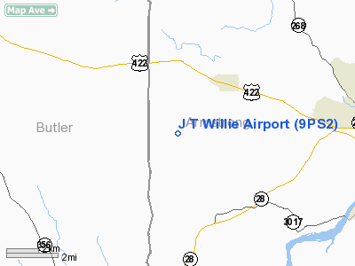
| Airport Identifier: | 9PS2 |
| Airport Status: | Operational |
| Longitude/Latitude: | 079-40-11.1750W/40-48-31.2310N
-79.669771/40.808675 (Estimated) |
| Elevation: | 1200 ft / 365.76 m (Estimated) |
| Land: | 25 acres |
| From nearest city: | 3 nautical miles SW of Worthington, PA |
| Location: | Armstrong County, PA |
| Magnetic Variation: | 08W (1985) |
Owner & Manager
| Ownership: | Privately owned |
| Owner: | J T Willie Inc |
| Address: | Rd 1 Box 300-d
Worthington, PA 16262 |
| Phone number: | 412-297-3690 |
| Manager: | W E Ritts |
| Address: | Rd 1 Box 300
Worthington, PA 16262 |
| Phone number: | 412-297-5775 |
Airport Operations and Facilities
| Airport Use: | Private |
| Wind indicator: | Yes |
| Segmented Circle: | No |
| Control Tower: | No |
| Sectional chart: | Detroit |
| Region: | AEA - Eastern |
| Boundary ARTCC: | ZOB - Cleveland |
| Tie-in FSS: | AOO - Altoona |
| FSS Toll Free: | 1-800-WX-BRIEF |
Airport Communications
Runway Information
Runway 18/36
| Dimension: | 2100 x 100 ft / 640.1 x 30.5 m |
| Surface: | TURF, |
| |
Runway 18 |
Runway 36 |
| Traffic Pattern: | Left | Left |
|
Radio Navigation Aids
| ID |
Type |
Name |
Ch |
Freq |
Var |
Dist |
| MKP | NDB | Mc Keesport | | 287.00 | 07W | 27.7 nm |
| INP | NDB | Indiana | | 242.00 | 08W | 29.5 nm |
| BHU | NDB | Benje | | 382.00 | 07W | 31.8 nm |
| UCP | NDB | Castle | | 272.00 | 09W | 36.3 nm |
| HBD | NDB | Hubbard | | 408.00 | 08W | 44.2 nm |
| PNU | NDB | Washington County | | 255.00 | 08W | 45.8 nm |
| FKL | VOR | Franklin | | 109.60 | 06W | 38.8 nm |
| CIP | VOR/DME | Clarion | 076X | 112.90 | 06W | 22.5 nm |
| AGC | VOR/DME | Allegheny | 037X | 110.00 | 09W | 36.1 nm |
| REC | VOR/DME | Revloc | 043X | 110.60 | 09W | 44.9 nm |
| EWC | VORTAC | Ellwood City | 105X | 115.80 | 08W | 24.7 nm |
| MMJ | VORTAC | Montour | 057X | 112.00 | 08W | 30.7 nm |
| JST | VORTAC | Johnstown | 077X | 113.00 | 06W | 48.3 nm |
Remarks
- PARACHUTING ACTIVITY
- PROVIDED OPS ARE LIMITED TO SINGLE ENGINE LAND ACFT
Images and information placed above are from
http://www.airport-data.com/airport/9PS2/
We thank them for the data!
| General Info
|
| Country |
United States
|
| State |
PENNSYLVANIA
|
| FAA ID |
9PS2
|
| Latitude |
40-48-31.231N
|
| Longitude |
079-40-11.175W
|
| Elevation |
1200 feet
|
| Near City |
WORTHINGTON
|
We don't guarantee the information is fresh and accurate. The data may
be wrong or outdated.
For more up-to-date information please refer to other sources.
|
|


