 |
|
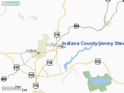
Indiana County/jimmy Stewart Fld/ Airport |
Coordinates: 40°37′56″N 079°06′20″W / 40.63222°N 79.10556°W / 40.63222; -79.10556
Indiana County-Jimmy Stewart Airport
Indiana County Airport (Jimmy Stewart Field) |
| IATA: IDI – ICAO: KIDI – FAA LID: IDI |
| Summary |
| Airport type |
Public |
| Owner |
Indiana County, Pennsylvania |
| Location |
Indiana, Pennsylvania |
| Elevation AMSL |
1,405 ft / 428 m |
| Website |
www.JimmyStewartAirport.com |
| Runways |
| Direction |
Length |
Surface |
| ft |
m |
| 10/28 |
4,001 |
1,220 |
Asphalt |
| Statistics (2007) |
| Aircraft operations |
26,100 |
| Based aircraft |
45 |
| Source: FAA and airport web site |
Indiana County-Jimmy Stewart Airport (IATA: IDI, ICAO: KIDI, FAA LID: IDI), also referred to as Indiana County Airport or Jimmy Stewart Field, is a county-owned public-use airport located two miles (3 km) east of the borough of Indiana, in Indiana County, Pennsylvania, United States. The airport is approximately 65 miles (105 km) northeast of Pittsburgh. It is classified as a business service airport by the Pennsylvania Bureau of Aviation.
Facilities and aircraft
Indiana County-Jimmy Stewart Airport covers an area of 276 acres (112 ha) and contains one asphalt paved runway designated 10/28 which measures 4,001 x 75 ft (1,220 x 23 m). The runway is outfitted with medium intensity runway lighting (MIRL). The airport is equipped with three nonprecision approaches (LOC RWY 28, GPS 10, GPS 28).
For the 12-month period ending March 31, 2007, the airport had 26,100 aircraft operations, an average of 71 per day: 95% general aviation, 3% military and 2% air taxi. There are 45 aircraft based at this airport: 89% single-engine, 9% multi-engine and 2% ultralight.
The above content comes from Wikipedia and is published under free licenses – click here to read more.
Location & QuickFacts
| FAA Information Effective: | 2008-09-25 |
| Airport Identifier: | IDI |
| Airport Status: | Operational |
| Longitude/Latitude: | 079-06-19.9000W/40-37-56.0000N
-79.105528/40.632222 (Estimated) |
| Elevation: | 1405 ft / 428.24 m (Surveyed) |
| Land: | 300 acres |
| From nearest city: | 2 nautical miles E of Indiana, PA |
| Location: | Indiana County, PA |
| Magnetic Variation: | 08W (1985) |
Owner & Manager
| Ownership: | Publicly owned |
| Owner: | County Of Indiana |
| Address: | 398 Airport Road
Indiana, PA 15701 |
| Phone number: | 724-463-3883 |
| Manager: | Todd Heming |
| Address: | 398 Airport Road
Indiana, PA 15701 |
| Phone number: | 724-463-3883 |
Airport Operations and Facilities
| Airport Use: | Open to public |
| Wind indicator: | Yes |
| Segmented Circle: | Yes |
| Control Tower: | No |
| Lighting Schedule: | DUSK-DAWN |
| Beacon Color: | Clear-Green (lighted land airport) |
| Landing fee charge: | No |
| Sectional chart: | Detroit |
| Region: | AEA - Eastern |
| Boundary ARTCC: | ZOB - Cleveland |
| Tie-in FSS: | AOO - Altoona |
| FSS on Airport: | No |
| FSS Toll Free: | 1-800-WX-BRIEF |
| NOTAMs Facility: | IDI (NOTAM-d service avaliable) |
| Federal Agreements: | NGY |
Airport Communications
| CTAF: | 122.800 |
| Unicom: | 122.800 |
Airport Services
| Fuel available: | 100LLA |
| Airframe Repair: | MINOR |
| Power Plant Repair: | MINOR |
| Bottled Oxygen: | NONE |
| Bulk Oxygen: | NONE |
Runway Information
Runway 10/28
| Dimension: | 4001 x 75 ft / 1219.5 x 22.9 m |
| Surface: | ASPH, Fair Condition |
| Weight Limit: | Single wheel: 18000 lbs. |
| Edge Lights: | Medium |
| |
Runway 10 |
Runway 28 |
| Longitude: | 079-06-45.6975W | 079-05-54.1264W |
| Latitude: | 40-37-58.1704N | 40-37-53.8441N |
| Elevation: | 1360.00 ft | 1405.00 ft |
| Alignment: | 96 | 127 |
| ILS Type: | | LOC/DME
|
| Traffic Pattern: | Left | Left |
| Markings: | Non-precision instrument, Fair Condition | Non-precision instrument, Fair Condition |
| Crossing Height: | 42.00 ft | 29.00 ft |
| VASI: | 2-box on left side | 2-box on left side |
| Visual Glide Angle: | 3.00° | 3.00° |
| Runway End Identifier: | Yes
RWY 10 REIL OTS INDEFLY. | Yes
RWY 28 REIL OTS INDEFLY. |
| Obstruction: | 59 ft trees, 677.0 ft from runway, 196 ft left of centerline, 8:1 slope to clear | 22 ft trees, 292.0 ft from runway, 184 ft left of centerline, 4:1 slope to clear |
|
Radio Navigation Aids
| ID |
Type |
Name |
Ch |
Freq |
Var |
Dist |
| INP | NDB | Indiana | | 242.00 | 08W | 1.8 nm |
| BHU | NDB | Benje | | 382.00 | 07W | 17.2 nm |
| SYS | NDB | Stoystown | | 209.00 | 08W | 34.0 nm |
| MKP | NDB | Mc Keesport | | 287.00 | 07W | 35.1 nm |
| AOO | VOR | Altoona | | 108.80 | 07W | 41.0 nm |
| REC | VOR/DME | Revloc | 043X | 110.60 | 09W | 17.2 nm |
| CIP | VOR/DME | Clarion | 076X | 112.90 | 06W | 34.8 nm |
| AGC | VOR/DME | Allegheny | 037X | 110.00 | 09W | 47.8 nm |
| JST | VORTAC | Johnstown | 077X | 113.00 | 06W | 22.7 nm |
| TON | VORTAC | Tyrone | 096X | 114.90 | 07W | 35.8 nm |
| IHD | VORTAC | Indian Head | 019X | 108.20 | 06W | 41.2 nm |
Remarks
- SNOW REMOVAL AVBL.
- BIRDS & DEER ON & INVOF ARPT.
Images and information placed above are from
http://www.airport-data.com/airport/IDI/
We thank them for the data!
| General Info
|
| Country |
United States
|
| State |
PENNSYLVANIA
|
| FAA ID |
IDI
|
| Latitude |
40-37-56.000N
|
| Longitude |
079-06-19.900W
|
| Elevation |
1405 feet
|
| Near City |
INDIANA
|
We don't guarantee the information is fresh and accurate. The data may
be wrong or outdated.
For more up-to-date information please refer to other sources.
|
|


