 |
|
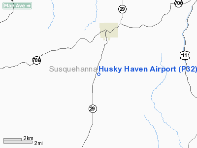
Location & QuickFacts
| FAA Information Effective: | 2008-09-25 |
| Airport Identifier: | P32 |
| Airport Status: | Operational |
| Longitude/Latitude: | 075-53-23.7030W/41-47-20.2740N
-75.889917/41.788965 (Estimated) |
| Elevation: | 1670 ft / 509.02 m (Estimated) |
| Land: | 34 acres |
| From nearest city: | 3 nautical miles S of Montrose, PA |
| Location: | Susquehanna County, PA |
| Magnetic Variation: | 12W (1985) |
Owner & Manager
| Ownership: | Privately owned |
| Owner: | Dalton Air Inc |
| Address: | Po Box 247
Blairstown, NJ 07825 |
| Phone number: | 516-790-9183 |
| Manager: | Kim Darst |
| Address: | Po Box 247
Blairstown, NJ 07825 |
| Phone number: | 516-790-9183 |
Airport Operations and Facilities
| Airport Use: | Open to public |
| Wind indicator: | Yes |
| Segmented Circle: | No |
| Control Tower: | No |
| Landing fee charge: | No |
| Sectional chart: | New York |
| Region: | AEA - Eastern |
| Boundary ARTCC: | ZNY - New York |
| Responsible ARTCC: | ZDC - Washington |
| Tie-in FSS: | IPT - Williamsport |
| FSS on Airport: | No |
| FSS Toll Free: | 1-800-WX-BRIEF |
| NOTAMs Facility: | IPT (NOTAM-d service avaliable) |
Airport Communications
Airport Services
| Airframe Repair: | NONE |
| Power Plant Repair: | NONE |
Runway Information
Runway 10/28
| Dimension: | 1900 x 100 ft / 579.1 x 30.5 m |
| Surface: | TURF, Good Condition |
| |
Runway 10 |
Runway 28 |
| Traffic Pattern: | Left | Left |
| Obstruction: | , 50:1 slope to clear | 10 ft trees, 100.0 ft from runway, 65 ft right of centerline, 10:1 slope to clear |
|
Radio Navigation Aids
| ID |
Type |
Name |
Ch |
Freq |
Var |
Dist |
| CYE | NDB | Crystal Lake | | 410.00 | 11W | 34.9 nm |
| MS | NDB | Monga | | 359.00 | 12W | 46.1 nm |
| ALP | NDB | Alpine | | 245.00 | 12W | 47.5 nm |
| PIX | NDB | Picture Rocks | | 344.00 | 09W | 48.1 nm |
| HXM | NDB | Humbolt | | 366.00 | 10W | 48.4 nm |
| HNK | VOR/DME | Hancock | 115X | 116.80 | 11W | 30.5 nm |
| DNY | VOR/DME | De Lancey | 058X | 112.10 | 11W | 47.8 nm |
| FQM | VOR/DME | Williamsport | 091X | 114.40 | 09W | 48.1 nm |
| ITH | VOR/DME | Ithaca | 055X | 111.80 | 10W | 49.5 nm |
| RKA | VOR/DME | Rockdale | 073X | 112.60 | 11W | 50.0 nm |
| CFB | VORTAC | Binghamton | 059X | 112.20 | 10W | 24.7 nm |
| LHY | VORTAC | Lake Henry | 045X | 110.80 | 10W | 26.3 nm |
| LVZ | VORTAC | Wilkes-barre | 053X | 111.60 | 10W | 32.3 nm |
Remarks
- ULTRALIGHTS ON & INVOF ARPT.
- RY 10/28 NOT PLOWED DURING WINTER MONTHS.
- VFR OPERATIONS ONLY.
Images and information placed above are from
http://www.airport-data.com/airport/P32/
We thank them for the data!
| General Info
|
| Country |
United States
|
| State |
ARIZONA
|
| FAA ID |
P32
|
| Latitude |
35-18-08.036N
|
| Longitude |
112-11-38.607W
|
| Elevation |
6680 feet
|
| Near City |
WILLIAMS
|
We don't guarantee the information is fresh and accurate. The data may
be wrong or outdated.
For more up-to-date information please refer to other sources.
|
|


