 |
|
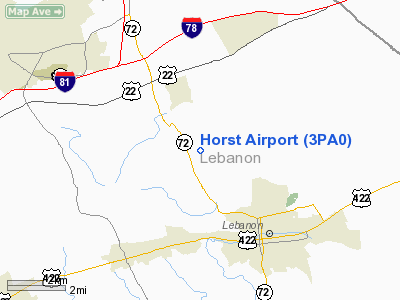
Location & QuickFacts
| FAA Information Effective: | 2008-09-25 |
| Airport Identifier: | 3PA0 |
| Airport Status: | Operational |
| Longitude/Latitude: | 076-27-58.8670W/40-23-00.3270N
-76.466352/40.383424 (Estimated) |
| Elevation: | 450 ft / 137.16 m (Estimated) |
| Land: | 0 acres |
| From nearest city: | 4 nautical miles NW of Lebanon, PA |
| Location: | Lebanon County, PA |
| Magnetic Variation: | 11W (1985) |
Owner & Manager
| Ownership: | Privately owned |
| Owner: | Ralph M. Horst |
| Address: | 1850 N 72
Lebanon, PA 17042 |
| Phone number: | 717-274-0762 |
| Address: |
|
Airport Operations and Facilities
| Airport Use: | Private |
| Wind indicator: | Yes |
| Segmented Circle: | No |
| Control Tower: | No |
| Landing fee charge: | No |
| Sectional chart: | New York |
| Region: | AEA - Eastern |
| Boundary ARTCC: | ZNY - New York |
| Tie-in FSS: | IPT - Williamsport |
| FSS on Airport: | No |
| FSS Toll Free: | 1-800-WX-BRIEF |
Airport Services
| Airframe Repair: | NONE |
| Power Plant Repair: | NONE |
Runway Information
Runway E/W
| Dimension: | 2000 x 100 ft / 609.6 x 30.5 m |
| Surface: | TURF, |
| |
Runway E |
Runway W |
| Traffic Pattern: | Left | Left |
|
Radio Navigation Aids
| ID |
Type |
Name |
Ch |
Freq |
Var |
Dist |
| BZJ | NDB | Bellgrove | | 328.00 | 10W | 5.1 nm |
| EUD | NDB | York | | 254.00 | 11W | 33.7 nm |
| LQX | NDB | Carbon | | 339.00 | 12W | 41.3 nm |
| HXM | NDB | Humbolt | | 366.00 | 10W | 42.2 nm |
| HZL | VOR | Hazleton | | 109.40 | 09W | 38.8 nm |
| ETX | VOR/DME | East Texas | 039X | 110.20 | 09W | 37.7 nm |
| RAV | VORTAC | Ravine | 093X | 114.60 | 11W | 11.9 nm |
| LRP | VORTAC | Lancaster | 120X | 117.30 | 09W | 17.8 nm |
| HAR | VORTAC | Harrisburg | 072X | 112.50 | 10W | 28.1 nm |
| SEG | VORTAC | Selinsgrove | 041X | 110.40 | 08W | 31.0 nm |
| MIP | VORTAC | Milton | 029X | 109.20 | 09W | 39.5 nm |
| PTW | VORTAC | Pottstown | 112X | 116.50 | 09W | 42.6 nm |
| MXE | VORTAC | Modena | 079X | 113.20 | 09W | 46.0 nm |
| MDT | VOT | Harrisburg International | | 110.00 | | 17.6 nm |
Images and information placed above are from
http://www.airport-data.com/airport/3PA0/
We thank them for the data!
| General Info
|
| Country |
United States
|
| State |
PENNSYLVANIA
|
| FAA ID |
3PA0
|
| Latitude |
40-23-00.327N
|
| Longitude |
076-27-58.867W
|
| Elevation |
450 feet
|
| Near City |
LEBANON
|
We don't guarantee the information is fresh and accurate. The data may
be wrong or outdated.
For more up-to-date information please refer to other sources.
|
|


