 |
|
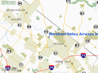
Horsham Valley Airways Inc Heliport |
Location & QuickFacts
| FAA Information Effective: | 2008-09-25 |
| Airport Identifier: | N48 |
| Airport Status: | Operational |
| Longitude/Latitude: | 075-10-41.6250W/40-12-07.3890N
-75.178229/40.202053 (Estimated) |
| Elevation: | 250 ft / 76.20 m (Estimated) |
| Land: | 8 acres |
| From nearest city: | 2 nautical miles NW of Horsham, PA |
| Location: | Montgomery County, PA |
| Magnetic Variation: | 12W (1985) |
Owner & Manager
| Ownership: | Privately owned |
| Owner: | Horsham Valley Airways Inc |
| Address: | 450 Caredean Drive
Horsham, PA 19044 |
| Phone number: | 215-674-2100 |
| Manager: | Hoyt Bangs |
| Address: | 450 Caredean Dr
Horsham, PA 19044 |
| Phone number: | 215-674-2100 |
Airport Operations and Facilities
| Airport Use: | Open to public |
| Wind indicator: | Yes |
| Segmented Circle: | No |
| Control Tower: | No |
| Lighting Schedule: | DUSK-DAWN |
| Landing fee charge: | No |
| Sectional chart: | New York |
| Region: | AEA - Eastern |
| Boundary ARTCC: | ZNY - New York |
| Tie-in FSS: | IPT - Williamsport |
| FSS on Airport: | No |
| FSS Toll Free: | 1-800-WX-BRIEF |
| NOTAMs Facility: | IPT (NOTAM-d service avaliable) |
Airport Communications
| CTAF: | 123.075 |
| Unicom: | 123.075 |
Airport Services
| Fuel available: | A |
| Airframe Repair: | MAJOR |
| Power Plant Repair: | MAJOR |
Runway Information
Helipad H1
| Dimension: | 65 x 65 ft / 19.8 x 19.8 m |
| Surface: | ASPH, Good Condition |
| |
Runway H1 |
Runway |
| Traffic Pattern: | Left | Left |
|
Radio Navigation Aids
| ID |
Type |
Name |
Ch |
Freq |
Var |
Dist |
| NXX | NDB | Willow Grove | | 388.00 | 12W | 1.7 nm |
| ING | NDB | Ambler | | 275.00 | 11W | 6.7 nm |
| DYL | NDB | Doylestown | | 237.00 | 10W | 8.4 nm |
| UKT | NDB | Quakertown | | 208.00 | 12W | 14.5 nm |
| NEL | NDB | Lakehurst | | 396.00 | 13W | 39.9 nm |
| LQX | NDB | Carbon | | 339.00 | 12W | 45.3 nm |
| CAT | NDB | Chatham | | 254.00 | 11W | 47.1 nm |
| RNB | NDB | Rainbow | | 363.00 | 11W | 47.2 nm |
| NXX | TACAN | Willow Grove | 061X | | 10W | 1.5 nm |
| NEL | TACAN | Lakehurst | 055X | | 11W | 39.2 nm |
| NEL | UHF/NDB | Lakehurst | | 274.80 | 13W | 39.9 nm |
| PNE | VOR | North Philadelphia | | 112.00 | 10W | 10.6 nm |
| CKZ | VOR/DME | Pennridge | 025Y | 108.85 | 12W | 12.4 nm |
| ARD | VOR/DME | Yardley | 019X | 108.20 | 10W | 12.8 nm |
| SBJ | VOR/DME | Solberg | 076X | 112.90 | 10W | 30.4 nm |
| ETX | VOR/DME | East Texas | 039X | 110.20 | 09W | 32.5 nm |
| BWZ | VOR/DME | Broadway | 089X | 114.20 | 11W | 39.4 nm |
| COL | VOR/DME | Colts Neck | 101X | 115.40 | 11W | 47.2 nm |
| STW | VOR/DME | Stillwater | 033X | 109.60 | 11W | 49.8 nm |
| PTW | VORTAC | Pottstown | 112X | 116.50 | 09W | 17.6 nm |
| MXE | VORTAC | Modena | 079X | 113.20 | 09W | 28.4 nm |
| GXU | VORTAC | Mc Guire | 043X | 110.60 | 11W | 29.1 nm |
| RBV | VORTAC | Robbinsville | 085X | 113.80 | 10W | 31.4 nm |
| FJC | VORTAC | Allentown | 122X | 117.50 | 10W | 34.0 nm |
| OOD | VORTAC | Woodstown | 075X | 112.80 | 10W | 34.5 nm |
| DQO | VORTAC | Dupont | 087X | 114.00 | 10W | 37.2 nm |
| VCN | VORTAC | Cedar Lake | 099X | 115.20 | 10W | 41.1 nm |
| CYN | VORTAC | Coyle | 081X | 113.40 | 10W | 41.4 nm |
| PHL | VOT | Philadelphia Intl | | 109.80 | | 20.2 nm |
Remarks
- AVOID OVERFLIGHT OF HOUSES EAST & WEST.
- AIRSPACE DTRMN PENDING.
Images and information placed above are from
http://www.airport-data.com/airport/N48/
We thank them for the data!
| General Info
|
| Country |
United States
|
| State |
PENNSYLVANIA
|
| FAA ID |
N48
|
| Latitude |
40-12-07.389N
|
| Longitude |
075-10-41.625W
|
| Elevation |
250 feet
|
| Near City |
HORSHAM
|
We don't guarantee the information is fresh and accurate. The data may
be wrong or outdated.
For more up-to-date information please refer to other sources.
|
|


