 |
|
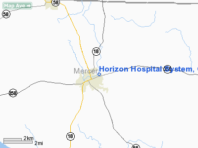
Horizon Hospital System, Greenville Heliport |
Location & QuickFacts
| FAA Information Effective: | 2008-09-25 |
| Airport Identifier: | PA46 |
| Airport Status: | Operational |
| Longitude/Latitude: | 080-22-22.0000W/41-24-42.1960N
-80.372778/41.411721 (Estimated) |
| Elevation: | 1047 ft / 319.13 m (Estimated) |
| Land: | 2 acres |
| From nearest city: | 0 nautical miles N of Greenville, PA |
| Location: | Mercer County, PA |
| Magnetic Variation: | 08W (1995) |
Owner & Manager
| Ownership: | Privately owned |
| Owner: | Horizon Hospital System |
| Address: | 110 N. Main St
Greenville, PA 16125 |
| Phone number: | 412-588-2100 |
| Manager: | David M Hazi |
| Address: | 110 N. Main St
Greenville, PA 16125 |
| Phone number: | 412-589-6266 |
Airport Operations and Facilities
| Airport Use: | Private
MEDICAL. |
| Wind indicator: | Yes |
| Segmented Circle: | No |
| Control Tower: | No |
| Lighting Schedule: | PHONE REQ
FOR PERIMETER LGTS CALL 412-588-2100. |
| Sectional chart: | Detroit |
| Region: | AEA - Eastern |
| Boundary ARTCC: | ZOB - Cleveland |
| Tie-in FSS: | AOO - Altoona |
| FSS Toll Free: | 1-800-WX-BRIEF |
Runway Information
Helipad H1
| Dimension: | 80 x 80 ft / 24.4 x 24.4 m |
| Surface: | ASPH-CONC, Good Condition |
| |
Runway H1 |
Runway |
| Traffic Pattern: | Left | Left |
| Markings: | Basic, Good Condition | , |
|
Radio Navigation Aids
| ID |
Type |
Name |
Ch |
Freq |
Var |
Dist |
| HBD | NDB | Hubbard | | 408.00 | 08W | 17.1 nm |
| UCP | NDB | Castle | | 272.00 | 09W | 23.4 nm |
| CQD | NDB | Cascade | | 372.00 | 08W | 44.2 nm |
| ORJ | NDB | Corry | | 258.00 | 09W | 44.3 nm |
| LQL | NDB | Lakeland | | 263.00 | 08W | 48.1 nm |
| FKL | VOR | Franklin | | 109.60 | 06W | 23.3 nm |
| JFN | VOR/DME | Jefferson | 099X | 115.20 | 05W | 26.9 nm |
| CXR | VOR/DME | Chardon | 074X | 112.70 | 05W | 36.2 nm |
| ACO | VOR/DME | Akron | 091X | 114.40 | 04W | 41.7 nm |
| CIP | VOR/DME | Clarion | 076X | 112.90 | 06W | 44.3 nm |
| LNN | VOR/DME | Lost Nation | 039X | 110.20 | 08W | 48.6 nm |
| YNG | VORTAC | Youngstown | 027X | 109.00 | 05W | 14.5 nm |
| EWC | VORTAC | Ellwood City | 105X | 115.80 | 08W | 36.0 nm |
| ERI | VORTAC | Erie | 031X | 109.40 | 06W | 36.6 nm |
| TDT | VORTAC | Tidioute | 123X | 117.60 | 09W | 46.6 nm |
Remarks
- PRVDD LARGEST ACFT WEIGHS LESS THAN 12500 LBS; CAUTION IS EXERCISED TO AVOID CONFLICT WITH TFC OPERATING TO & FM GREENVILLE ARPT; & TREE LIMBS & BRUSH TO NORTHERLY APCH/DEP REMOVED.
Images and information placed above are from
http://www.airport-data.com/airport/PA46/
We thank them for the data!
| General Info
|
| Country |
United States
|
| State |
PENNSYLVANIA
|
| FAA ID |
PA46
|
| Latitude |
41-24-42.196N
|
| Longitude |
080-22-22.000W
|
| Elevation |
1047 feet
|
| Near City |
GREENVILLE
|
We don't guarantee the information is fresh and accurate. The data may
be wrong or outdated.
For more up-to-date information please refer to other sources.
|
|


