 |
|
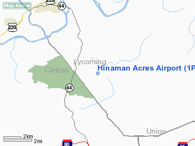
Location & QuickFacts
| FAA Information Effective: | 2008-09-25 |
| Airport Identifier: | 1PA0 |
| Airport Status: | Operational |
| Longitude/Latitude: | 077-11-58.8880W/41-08-00.2670N
-77.199691/41.133407 (Estimated) |
| Elevation: | 800 ft / 243.84 m (Estimated) |
| Land: | 0 acres |
| From nearest city: | 4 nautical miles SE of Jersey Shore, PA |
| Location: | Lycoming County, PA |
| Magnetic Variation: | 10W (1985) |
Owner & Manager
| Ownership: | Privately owned |
| Owner: | Margaret E. Hinaman |
| Address: | Rr 2, Box 529
Jersey Shore, PA 17740 |
| Phone number: | 717-745-7147 |
| Address: |
|
Airport Operations and Facilities
| Airport Use: | Private |
| Wind indicator: | Yes |
| Segmented Circle: | No |
| Control Tower: | No |
| Landing fee charge: | No |
| Sectional chart: | Detroit |
| Region: | AEA - Eastern |
| Boundary ARTCC: | ZNY - New York |
| Tie-in FSS: | IPT - Williamsport |
| FSS on Airport: | No |
| FSS Toll Free: | 1-800-WX-BRIEF |
Airport Services
| Airframe Repair: | NONE |
| Power Plant Repair: | NONE |
Runway Information
Runway 09/27
| Dimension: | 2300 x 100 ft / 701.0 x 30.5 m |
| Surface: | TURF, |
| |
Runway 09 |
Runway 27 |
| Traffic Pattern: | Left | Left |
|
Radio Navigation Aids
| ID |
Type |
Name |
Ch |
Freq |
Var |
Dist |
| PIX | NDB | Picture Rocks | | 344.00 | 09W | 23.8 nm |
| RV | NDB | Stroh | | 407.00 | 10W | 39.1 nm |
| HZL | VOR | Hazleton | | 109.40 | 09W | 49.6 nm |
| FQM | VOR/DME | Williamsport | 091X | 114.40 | 09W | 22.8 nm |
| SFK | VOR/DME | Stonyfork | 023X | 108.60 | 08W | 35.2 nm |
| SEG | VORTAC | Selinsgrove | 041X | 110.40 | 08W | 25.1 nm |
| MIP | VORTAC | Milton | 029X | 109.20 | 09W | 25.1 nm |
| PSB | VORTAC | Philipsburg | 102X | 115.50 | 10W | 38.3 nm |
| SLT | VORTAC | Slate Run | 086X | 113.90 | 08W | 41.6 nm |
| ETG | VORTAC | Keating | 107X | 116.00 | 10W | 42.9 nm |
| RAV | VORTAC | Ravine | 093X | 114.60 | 11W | 44.3 nm |
Remarks
Images and information placed above are from
http://www.airport-data.com/airport/1PA0/
We thank them for the data!
| General Info
|
| Country |
United States
|
| State |
PENNSYLVANIA
|
| FAA ID |
1PA0
|
| Latitude |
41-08-00.267N
|
| Longitude |
077-11-58.888W
|
| Elevation |
800 feet
|
| Near City |
JERSEY SHORE
|
We don't guarantee the information is fresh and accurate. The data may
be wrong or outdated.
For more up-to-date information please refer to other sources.
|
|


