 |
|
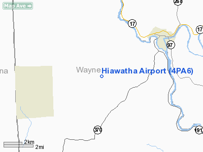
Location & QuickFacts
| FAA Information Effective: | 2008-09-25 |
| Airport Identifier: | 4PA6 |
| Airport Status: | Operational |
| Longitude/Latitude: | 075-21-52.0000W/41-54-54.3060N
-75.364444/41.915085 (Estimated) |
| Elevation: | 1670 ft / 509.02 m (Estimated) |
| Land: | 0 acres |
| From nearest city: | 2 nautical miles NE of Starlight, PA |
| Location: | Wayne County, PA |
| Magnetic Variation: | 13W (1995) |
Owner & Manager
| Ownership: | Privately owned |
| Owner: | Hiawatha Lake Corp. |
| Address: | P.o. Box 558
Bryn Athyn, PA 19009 |
| Phone number: | 215-947-0813 |
| Manager: | Daniel Schmucker |
| Address: | 1171 Country Lane
Huntingdon Valley, PA 19006 |
| Phone number: | 215-947-1917
ADDITIONAL PHONE 215-343-7950. |
Airport Operations and Facilities
| Airport Use: | Private |
| Wind indicator: | Yes |
| Segmented Circle: | No |
| Control Tower: | No |
| Sectional chart: | New York |
| Region: | AEA - Eastern |
| Boundary ARTCC: | ZNY - New York |
| Tie-in FSS: | IPT - Williamsport |
| FSS on Airport: | No |
| FSS Toll Free: | 1-800-WX-BRIEF |
Runway Information
Runway 03/21
| Dimension: | 3100 x 100 ft / 944.9 x 30.5 m |
| Surface: | TURF, |
| |
Runway 03 |
Runway 21 |
| Traffic Pattern: | Left | Left |
| Displaced threshold: | 1000.00 ft | 0.00 ft |
| Obstruction: | 60 ft trees, 200.0 ft from runway | |
|
Radio Navigation Aids
| ID |
Type |
Name |
Ch |
Freq |
Var |
Dist |
| MS | NDB | Monga | | 359.00 | 12W | 24.3 nm |
| CYE | NDB | Crystal Lake | | 410.00 | 11W | 47.3 nm |
| HNK | VOR/DME | Hancock | 115X | 116.80 | 11W | 9.2 nm |
| DNY | VOR/DME | De Lancey | 058X | 112.10 | 11W | 24.1 nm |
| RKA | VOR/DME | Rockdale | 073X | 112.60 | 11W | 33.6 nm |
| HUO | VOR/DME | Huguenot | 108X | 116.10 | 11W | 46.1 nm |
| LHY | VORTAC | Lake Henry | 045X | 110.80 | 10W | 26.9 nm |
| CFB | VORTAC | Binghamton | 059X | 112.20 | 10W | 37.4 nm |
| LVZ | VORTAC | Wilkes-barre | 053X | 111.60 | 10W | 41.3 nm |
Remarks
- PRVDD DALGT OPNS ONLY; LARGEST CLASS OF ACFT RECOMMENDED IS SNGL/MULT ENG (12500 LBS MGW); IFR OPNS ARE NOT CONDUCTED; RY 03 THLD DSPLCD AT LEAST 800 FT; COORDINATION IS ASSURED WITH OPR OF BODEN ARPT ON TFC PATS.
Images and information placed above are from
http://www.airport-data.com/airport/4PA6/
We thank them for the data!
| General Info
|
| Country |
United States
|
| State |
PENNSYLVANIA
|
| FAA ID |
4PA6
|
| Latitude |
41-54-54.306N
|
| Longitude |
075-21-52.000W
|
| Elevation |
1670 feet
|
| Near City |
STARLIGHT
|
We don't guarantee the information is fresh and accurate. The data may
be wrong or outdated.
For more up-to-date information please refer to other sources.
|
|


