 |
|
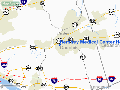
Hershey Medical Center Heliport |
Location & QuickFacts
| FAA Information Effective: | 2008-09-25 |
| Airport Identifier: | 64PN |
| Airport Status: | Operational |
| Longitude/Latitude: | 076-40-30.0000W/40-15-53.0000N
-76.675000/40.264722 (Estimated) |
| Elevation: | 438 ft / 133.50 m (Estimated) |
| Land: | 0 acres |
| From nearest city: | 2 nautical miles SW of Hershey, PA |
| Location: | Dauphin County, PA |
| Magnetic Variation: | 10W (1985) |
Owner & Manager
| Ownership: | Privately owned |
| Owner: | The Pa State University |
| Address: | 500 University Dr
Hershey, PA 17033 |
| Phone number: | 717-531-7365 |
| Manager: | Rick W. Jones, Dir Of Oper
COORDINATOR, FLIGHT SERVICES. |
| Address: | 500 University Dr
Hershey, PA 17033 |
| Phone number: | 717-243-8953 |
Airport Operations and Facilities
| Airport Use: | Private
MEDICAL USE. |
| Wind indicator: | Yes |
| Segmented Circle: | No |
| Control Tower: | No |
| Lighting Schedule: | PHONE REQ
FOR ROTG BCN & PERIMETER LGTS CALL 717-531-7777 OR CTC HOSPITAL ON FREQ 123.050. |
| Landing fee charge: | No |
| Sectional chart: | New York |
| Region: | AEA - Eastern |
| Boundary ARTCC: | ZNY - New York |
| Tie-in FSS: | IPT - Williamsport |
| FSS on Airport: | No |
| FSS Toll Free: | 1-800-WX-BRIEF |
Airport Communications
Runway Information
Helipad H1
| Dimension: | 60 x 60 ft / 18.3 x 18.3 m |
| Surface: | ASPH, |
| |
Runway H1 |
Runway |
| Traffic Pattern: | Left | Left |
|
Radio Navigation Aids
| ID |
Type |
Name |
Ch |
Freq |
Var |
Dist |
| BZJ | NDB | Bellgrove | | 328.00 | 10W | 11.7 nm |
| EUD | NDB | York | | 254.00 | 11W | 22.7 nm |
| HZL | VOR | Hazleton | | 109.40 | 09W | 49.5 nm |
| ETX | VOR/DME | East Texas | 039X | 110.20 | 09W | 49.2 nm |
| RAV | VORTAC | Ravine | 093X | 114.60 | 11W | 17.7 nm |
| HAR | VORTAC | Harrisburg | 072X | 112.50 | 10W | 18.2 nm |
| LRP | VORTAC | Lancaster | 120X | 117.30 | 09W | 19.6 nm |
| SEG | VORTAC | Selinsgrove | 041X | 110.40 | 08W | 33.0 nm |
| MIP | VORTAC | Milton | 029X | 109.20 | 09W | 45.6 nm |
| EMI | VORTAC | Westminster | 126X | 117.90 | 08W | 48.3 nm |
| MDT | VOT | Harrisburg International | | 110.00 | | 5.7 nm |
Images and information placed above are from
http://www.airport-data.com/airport/64PN/
We thank them for the data!
| General Info
|
| Country |
United States
|
| State |
PENNSYLVANIA
|
| FAA ID |
64PN
|
| Latitude |
40-15-53.326N
|
| Longitude |
076-40-27.890W
|
| Elevation |
438 feet
|
| Near City |
HERSHEY
|
We don't guarantee the information is fresh and accurate. The data may
be wrong or outdated.
For more up-to-date information please refer to other sources.
|
|


