 |
|
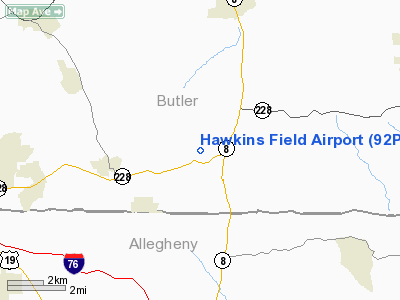
Location & QuickFacts
| FAA Information Effective: | 2008-09-25 |
| Airport Identifier: | 92PA |
| Airport Status: | Operational |
| Longitude/Latitude: | 079-57-07.2050W/40-42-15.2370N
-79.952001/40.704232 (Estimated) |
| Elevation: | 1150 ft / 350.52 m (Estimated) |
| Land: | 4 acres |
| From nearest city: | 1 nautical miles SW of Cooperstown, PA |
| Location: | Butler County, PA |
| Magnetic Variation: | 08W (1985) |
Owner & Manager
| Ownership: | Privately owned |
| Address: |
|
| Manager: | Bernard J. Turcovsky |
| Address: | 149 Forsythe Road
Valencia, PA 16059 |
| Phone number: | 412-898-2537 |
Airport Operations and Facilities
| Airport Use: | Private |
| Wind indicator: | Yes |
| Segmented Circle: | No |
| Control Tower: | No |
| Landing fee charge: | No |
| Sectional chart: | Detroit |
| Region: | AEA - Eastern |
| Boundary ARTCC: | ZOB - Cleveland |
| Tie-in FSS: | AOO - Altoona |
| FSS on Airport: | No |
| FSS Toll Free: | 1-800-WX-BRIEF |
Airport Services
| Airframe Repair: | NONE |
| Power Plant Repair: | NONE |
Runway Information
Runway 17/35
| Dimension: | 1285 x 100 ft / 391.7 x 30.5 m |
| Surface: | TURF, |
| |
Runway 17 |
Runway 35 |
| Traffic Pattern: | Left | Left |
|
Radio Navigation Aids
| ID |
Type |
Name |
Ch |
Freq |
Var |
Dist |
| MKP | NDB | Mc Keesport | | 287.00 | 07W | 22.4 nm |
| UCP | NDB | Castle | | 272.00 | 09W | 28.5 nm |
| PNU | NDB | Washington County | | 255.00 | 08W | 35.0 nm |
| BHU | NDB | Benje | | 382.00 | 07W | 36.8 nm |
| HBD | NDB | Hubbard | | 408.00 | 08W | 37.7 nm |
| INP | NDB | Indiana | | 242.00 | 08W | 40.6 nm |
| FKL | VOR | Franklin | | 109.60 | 06W | 44.4 nm |
| AGC | VOR/DME | Allegheny | 037X | 110.00 | 09W | 25.9 nm |
| CIP | VOR/DME | Clarion | 076X | 112.90 | 06W | 34.8 nm |
| HLG | VOR/DME | Wheeling | 059X | 112.20 | 07W | 38.8 nm |
| EWC | VORTAC | Ellwood City | 105X | 115.80 | 08W | 13.9 nm |
| MMJ | VORTAC | Montour | 057X | 112.00 | 08W | 17.0 nm |
| YNG | VORTAC | Youngstown | 027X | 109.00 | 05W | 49.9 nm |
Remarks
Images and information placed above are from
http://www.airport-data.com/airport/92PA/
We thank them for the data!
| General Info
|
| Country |
United States
|
| State |
PENNSYLVANIA
|
| FAA ID |
92PA
|
| Latitude |
40-42-15.237N
|
| Longitude |
079-57-07.205W
|
| Elevation |
1150 feet
|
| Near City |
COOPERSTOWN
|
We don't guarantee the information is fresh and accurate. The data may
be wrong or outdated.
For more up-to-date information please refer to other sources.
|
|


