 |
|
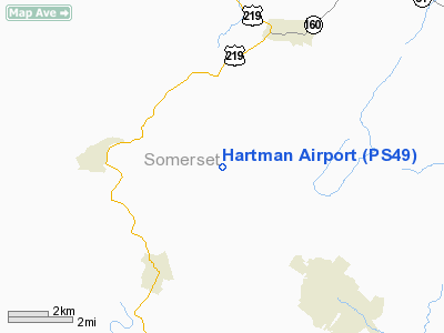
Location & QuickFacts
| FAA Information Effective: | 2008-09-25 |
| Airport Identifier: | PS49 |
| Airport Status: | Operational |
| Longitude/Latitude: | 078-59-19.0890W/39-51-37.2940N
-78.988636/39.860359 (Estimated) |
| Elevation: | 2350 ft / 716.28 m (Estimated) |
| Land: | 500 acres |
| From nearest city: | 3 nautical miles E of Garrett, PA |
| Location: | Somerset County, PA |
| Magnetic Variation: | 08W (1985) |
Owner & Manager
| Ownership: | Privately owned |
| Owner: | John H. Hartman |
| Address: | Rd 1
Garrett, PA 15542 |
| Phone number: | 814-267-3146 |
| Manager: | John H. Hartman |
| Address: | Rd 1
Garrett, PA 15542 |
| Phone number: | 814-267-3146 |
Airport Operations and Facilities
| Airport Use: | Private |
| Wind indicator: | Yes |
| Segmented Circle: | No |
| Control Tower: | No |
| Landing fee charge: | No |
| Sectional chart: | Cincinnati |
| Region: | AEA - Eastern |
| Boundary ARTCC: | ZOB - Cleveland |
| Tie-in FSS: | AOO - Altoona |
| FSS on Airport: | No |
| FSS Toll Free: | 1-800-WX-BRIEF |
Runway Information
Runway 03/21
| Dimension: | 2590 x 100 ft / 789.4 x 30.5 m |
| Surface: | TURF, |
| |
Runway 03 |
Runway 21 |
| Traffic Pattern: | Left | Left |
|
Radio Navigation Aids
| ID |
Type |
Name |
Ch |
Freq |
Var |
Dist |
| SYS | NDB | Stoystown | | 209.00 | 08W | 13.9 nm |
| CBE | NDB | Cumberland | | 317.00 | 07W | 16.9 nm |
| BHU | NDB | Benje | | 382.00 | 07W | 33.6 nm |
| VV | NDB | Camor | | 299.00 | 08W | 34.9 nm |
| INP | NDB | Indiana | | 242.00 | 08W | 46.5 nm |
| MKP | NDB | Mc Keesport | | 287.00 | 07W | 47.0 nm |
| AOO | VOR | Altoona | | 108.80 | 07W | 42.1 nm |
| GRV | VOR/DME | Grantsville | 070X | 112.30 | 06W | 13.8 nm |
| ESL | VOR/DME | Kessel | 045X | 110.80 | 06W | 38.2 nm |
| REC | VOR/DME | Revloc | 043X | 110.60 | 09W | 42.7 nm |
| IHD | VORTAC | Indian Head | 019X | 108.20 | 06W | 18.4 nm |
| JST | VORTAC | Johnstown | 077X | 113.00 | 06W | 28.3 nm |
| MGW | VORTAC | Morgantown | 053X | 111.60 | 05W | 44.3 nm |
| THS | VORTAC | St Thomas | 097X | 115.00 | 07W | 48.1 nm |
Remarks
Images and information placed above are from
http://www.airport-data.com/airport/PS49/
We thank them for the data!
| General Info
|
| Country |
United States
|
| State |
PENNSYLVANIA
|
| FAA ID |
PS49
|
| Latitude |
39-51-37.294N
|
| Longitude |
078-59-19.089W
|
| Elevation |
2350 feet
|
| Near City |
GARRETT
|
We don't guarantee the information is fresh and accurate. The data may
be wrong or outdated.
For more up-to-date information please refer to other sources.
|
|


