 |
|
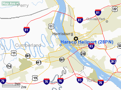
Location & QuickFacts
| FAA Information Effective: | 2008-09-25 |
| Airport Identifier: | 28PN |
| Airport Status: | Operational |
| Longitude/Latitude: | 076-54-34.9060W/40-15-35.3210N
-76.909696/40.259811 (Estimated) |
| Elevation: | 365 ft / 111.25 m (Estimated) |
| Land: | 0 acres |
| From nearest city: | 0 nautical miles N of Wormleysburg, PA |
| Location: | Cumberland County, PA |
| Magnetic Variation: | 10W (1985) |
Owner & Manager
| Ownership: | Privately owned |
| Owner: | Harsco Corporation |
| Address: | 350 Poplar Church Rd.
Camp Hill, PA 17011 |
| Phone number: | 717-763-7064 |
| Manager: | Bernard Redlawsk
AND JUDITH CONGREVE - 717-774-2242. |
| Address: | 350 Poplar Church Rd.
Camp Hill, PA 17011 |
| Phone number: | 717-774-2242 |
Airport Operations and Facilities
| Airport Use: | Private |
| Wind indicator: | No |
| Segmented Circle: | No |
| Control Tower: | No |
| Lighting Schedule: | DUSK-DAWN |
| Landing fee charge: | No |
| Sectional chart: | New York |
| Region: | AEA - Eastern |
| Boundary ARTCC: | ZNY - New York |
| Tie-in FSS: | IPT - Williamsport |
| FSS on Airport: | No |
| FSS Toll Free: | 1-800-WX-BRIEF |
Runway Information
Helipad H1
| Dimension: | 45 x 45 ft / 13.7 x 13.7 m
45 X 45' CONC TOUCHDOWN AREA WITHIN A 170' DIAMETER CIRCULAR LANDING/TAKEOFF AREA. |
| Surface: | CONC, |
| |
Runway H1 |
Runway |
| Traffic Pattern: | Left | Left |
|
Radio Navigation Aids
| ID |
Type |
Name |
Ch |
Freq |
Var |
Dist |
| BZJ | NDB | Bellgrove | | 328.00 | 10W | 19.5 nm |
| EUD | NDB | York | | 254.00 | 11W | 20.5 nm |
| RV | NDB | Stroh | | 407.00 | 10W | 42.7 nm |
| HAR | VORTAC | Harrisburg | 072X | 112.50 | 10W | 7.8 nm |
| RAV | VORTAC | Ravine | 093X | 114.60 | 11W | 22.7 nm |
| LRP | VORTAC | Lancaster | 120X | 117.30 | 09W | 29.6 nm |
| SEG | VORTAC | Selinsgrove | 041X | 110.40 | 08W | 31.9 nm |
| EMI | VORTAC | Westminster | 126X | 117.90 | 08W | 46.1 nm |
| MIP | VORTAC | Milton | 029X | 109.20 | 09W | 47.2 nm |
| MDT | VOT | Harrisburg International | | 110.00 | | 7.7 nm |
Remarks
- HELIPAD IN NOISE SENSITIVE AREA--PRIOR PERMISSION REQUIRED AS SPECIAL ROUTES ARE TO BE FLOWN.
Images and information placed above are from
http://www.airport-data.com/airport/28PN/
We thank them for the data!
| General Info
|
| Country |
United States
|
| State |
PENNSYLVANIA
|
| FAA ID |
28PN
|
| Latitude |
40-15-35.321N
|
| Longitude |
076-54-34.906W
|
| Elevation |
365 feet
|
| Near City |
WORMLEYSBURG
|
We don't guarantee the information is fresh and accurate. The data may
be wrong or outdated.
For more up-to-date information please refer to other sources.
|
|


