|
|
 |
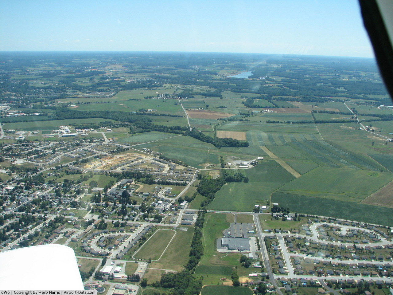
(Click on the photo to enlarge) |
 |
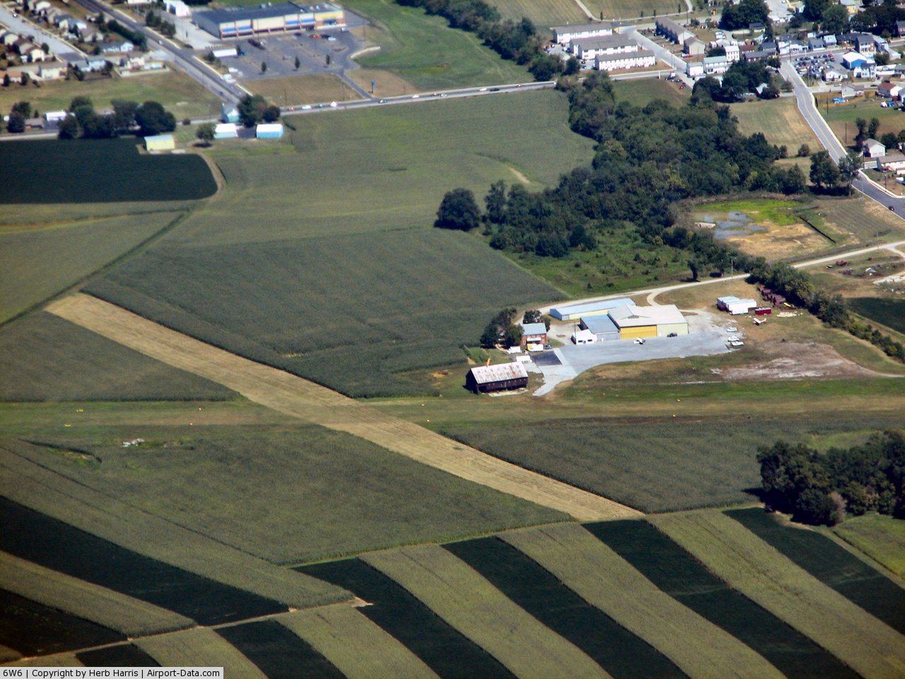
(Click on the photo to enlarge) |
Location & QuickFacts
| FAA Information Effective: | 2008-09-25 |
| Airport Identifier: | 6W6 |
| Airport Status: | Operational |
| Longitude/Latitude: | 077-01-28.9330W/39-47-33.3580N
-77.024704/39.792599 (Estimated) |
| Elevation: | 560 ft / 170.69 m (Estimated) |
| Land: | 105 acres |
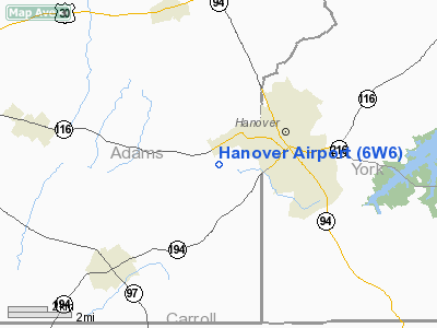
| From nearest city: | 1 nautical miles W of Hanover, PA |
| Location: | Adams County, PA |
| Magnetic Variation: | 10W (1985) |
Owner & Manager
| Ownership: | Privately owned |
| Owner: | Betty Gebhart |
| Address: | 180 Airport Rd
Hanover, PA 17331 |
| Phone number: | 717-637-3036 |
| Manager: | Dan Gebhart |
| Address: | 180 Airport Rd
Hanover, PA 17331 |
| Phone number: | 717-630-8046 |
Airport Operations and Facilities
| Airport Use: | Open to public |
| Wind indicator: | Yes |
| Segmented Circle: | No |
| Control Tower: | No |
| Landing fee charge: | No |
| Sectional chart: | Washington |
| Region: | AEA - Eastern |
| Boundary ARTCC: | ZNY - New York |
| Responsible ARTCC: | ZDC - Washington |
| Tie-in FSS: | IPT - Williamsport |
| FSS on Airport: | No |
| FSS Toll Free: | 1-800-WX-BRIEF |
| NOTAMs Facility: | IPT (NOTAM-d service avaliable) |
Airport Communications
Airport Services
| Airframe Repair: | MAJOR |
| Power Plant Repair: | NONE |
| Bottled Oxygen: | NONE |
| Bulk Oxygen: | NONE |
Runway Information
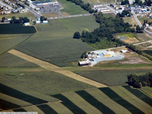
Runway 09/27
| Dimension: | 2550 x 100 ft / 777.2 x 30.5 m |
| Surface: | TURF, Good Condition |
| |
Runway 09 |
Runway 27 |
| Traffic Pattern: | Left | Left |
| Obstruction: | 59 ft tree, 1257.0 ft from runway, 82 ft left of centerline, 21:1 slope to clear | 15 ft road, 346.0 ft from runway, 23:1 slope to clear |
|
Radio Navigation Aids
| ID |
Type |
Name |
Ch |
Freq |
Var |
Dist |
| EUD | NDB | York | | 254.00 | 11W | 10.2 nm |
| FND | NDB | Ellicott | | 371.00 | 11W | 32.5 nm |
| IUB | NDB | Institute | | 404.00 | 08W | 35.6 nm |
| GAI | NDB | Gaithersburg | | 385.00 | 09W | 38.0 nm |
| MTN | NDB | Martin | | 342.00 | 11W | 42.1 nm |
| BUH | NDB | Anne Arundel | | 260.00 | 10W | 44.3 nm |
| BZJ | NDB | Bellgrove | | 328.00 | 10W | 44.3 nm |
| APG | NDB | Aberdeen | | 349.00 | 11W | 45.2 nm |
| MTN | TACAN | Martin | 068X | | 11W | 39.7 nm |
| FDK | VOR | Frederick | | 109.00 | 08W | 28.0 nm |
| HGR | VOR | Hagerstown | | 109.80 | 07W | 38.8 nm |
| PPM | VOR/DME | Phillips | 021X | 108.40 | 09W | 44.1 nm |
| EMI | VORTAC | Westminster | 126X | 117.90 | 08W | 18.0 nm |
| HAR | VORTAC | Harrisburg | 072X | 112.50 | 10W | 30.7 nm |
| LRP | VORTAC | Lancaster | 120X | 117.30 | 09W | 39.1 nm |
| BAL | VORTAC | Baltimore | 098X | 115.10 | 11W | 41.0 nm |
| THS | VORTAC | St Thomas | 097X | 115.00 | 07W | 43.6 nm |
| MRB | VORTAC | Martinsburg | 058X | 112.10 | 07W | 45.3 nm |
| RAV | VORTAC | Ravine | 093X | 114.60 | 11W | 49.7 nm |
| MDT | VOT | Harrisburg International | | 110.00 | | 27.2 nm |
Remarks
- RY 09/27 CLSD FOR TOUCH & GO LDGS.
Images and information placed above are from
http://www.airport-data.com/airport/6W6/
We thank them for the data!
| General Info
|
| Country |
United States
|
| State |
PENNSYLVANIA
|
| FAA ID |
6W6
|
| Latitude |
39-47-33.358N
|
| Longitude |
077-01-28.933W
|
| Elevation |
560 feet
|
| Near City |
HANOVER
|
We don't guarantee the information is fresh and accurate. The data may
be wrong or outdated.
For more up-to-date information please refer to other sources.
|
|