 |
|
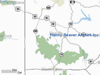
Hanny Beaver Airpark Inc Airport |
Location & QuickFacts
| FAA Information Effective: | 2008-09-25 |
| Airport Identifier: | 80PN |
| Airport Status: | Operational |
| Longitude/Latitude: | 080-27-09.2370W/40-32-30.2390N
-80.452566/40.541733 (Estimated) |
| Elevation: | 1220 ft / 371.86 m (Estimated) |
| Land: | 22 acres |
| From nearest city: | 5 nautical miles SE of Hookstown, PA |
| Location: | Beaver County, PA |
| Magnetic Variation: | 07W (1985) |
Owner & Manager
| Ownership: | Privately owned |
| Owner: | Hanny Beaver Airpark, Inc.
CORPORATION AIRPARK OWNED BY STOCKHOLDERS. |
| Address: | 476 Hanover-kendallroad
Hookstown, PA 15050 |
| Phone number: | 412-899-2726 |
| Manager: | William V. Jedinak |
| Address: | 476 Hanover-kendall Road
Hookstown, PA 15050 |
| Phone number: | 412-899-2726 |
Airport Operations and Facilities
| Airport Use: | Private |
| Wind indicator: | Yes |
| Segmented Circle: | No |
| Control Tower: | No |
| Lighting Schedule: | RDO-CTL |
| Landing fee charge: | No |
| Sectional chart: | Detroit |
| Region: | AEA - Eastern |
| Boundary ARTCC: | ZOB - Cleveland |
| Tie-in FSS: | AOO - Altoona |
| FSS on Airport: | No |
| FSS Toll Free: | 1-800-WX-BRIEF |
Airport Communications
Runway Information
Runway 13/31
| Dimension: | 2719 x 100 ft / 828.8 x 30.5 m |
| Surface: | ASPH-TURF,
20 FT WIDE ASPH STRIP DOWN CENTER OF RY. |
| Edge Lights: | Non-standard lighting system
NSTD LIRL. |
| |
Runway 13 |
Runway 31 |
| Traffic Pattern: | Left | Left |
|
Radio Navigation Aids
| ID |
Type |
Name |
Ch |
Freq |
Var |
Dist |
| PNU | NDB | Washington County | | 255.00 | 08W | 27.3 nm |
| TSO | NDB | Tolson | | 395.00 | 07W | 28.6 nm |
| UCP | NDB | Castle | | 272.00 | 09W | 29.0 nm |
| CFX | NDB | Cadiz | | 239.00 | 07W | 31.5 nm |
| MKP | NDB | Mc Keesport | | 287.00 | 07W | 32.7 nm |
| HBD | NDB | Hubbard | | 408.00 | 08W | 36.9 nm |
| HLG | VOR/DME | Wheeling | 059X | 112.20 | 07W | 17.8 nm |
| AGC | VOR/DME | Allegheny | 037X | 110.00 | 09W | 24.6 nm |
| AIR | VOR/DME | Bellaire | 118X | 117.10 | 07W | 35.7 nm |
| BSV | VOR/DME | Briggs | 071X | 112.40 | 04W | 46.3 nm |
| ACO | VOR/DME | Akron | 091X | 114.40 | 04W | 48.2 nm |
| MMJ | VORTAC | Montour | 057X | 112.00 | 08W | 12.3 nm |
| EWC | VORTAC | Ellwood City | 105X | 115.80 | 08W | 20.3 nm |
| YNG | VORTAC | Youngstown | 027X | 109.00 | 05W | 48.5 nm |
Remarks
- ULTRALIGHT ACTIVITY ON & INVOF ARPT.
- RESIDENTIAL AIRPARK.
- DETERMINATIN PENDING.
Images and information placed above are from
http://www.airport-data.com/airport/80PN/
We thank them for the data!
| General Info
|
| Country |
United States
|
| State |
PENNSYLVANIA
|
| FAA ID |
80PN
|
| Latitude |
40-32-30.239N
|
| Longitude |
080-27-09.237W
|
| Elevation |
1220 feet
|
| Near City |
HOOKSTOWN
|
We don't guarantee the information is fresh and accurate. The data may
be wrong or outdated.
For more up-to-date information please refer to other sources.
|
|


