 |
|
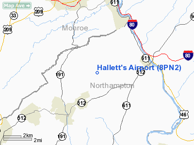
Location & QuickFacts
| FAA Information Effective: | 2008-09-25 |
| Airport Identifier: | 8PN2 |
| Airport Status: | Operational |
| Longitude/Latitude: | 075-09-54.4800W/40-54-37.9800N
-75.165133/40.910550 (Estimated) |
| Elevation: | 700 ft / 213.36 m (Estimated) |
| Land: | 27 acres |
| From nearest city: | 4 nautical miles NE of Bangor, PA |
| Location: | Northampton County, PA |
| Magnetic Variation: | () |
Owner & Manager
| Ownership: | Privately owned |
| Owner: | Larry Hallett |
| Address: | 221 East Shore Drive
Bangor, PA 18013 |
| Phone number: | 610-588-9543 |
| Manager: | Larry Hallett |
| Address: | 221 East Shore Drive
Bangor, PA 18013 |
| Phone number: | 610-588-9543 |
Airport Operations and Facilities
| Airport Use: | Private |
| Wind indicator: | Yes |
| Control Tower: | No |
| Sectional chart: | New York |
| Region: | AEA - Eastern |
| Boundary ARTCC: | ZNY - New York |
| Tie-in FSS: | IPT - Williamsport |
| FSS Toll Free: | 1-800-WX-BRIEF |
Runway Information
Runway 07/25
| Dimension: | 1600 x 50 ft / 487.7 x 15.2 m |
| Surface: | TURF, |
| |
Runway 07 |
Runway 25 |
| Traffic Pattern: | Left | Left |
| Obstruction: | 20 ft pline, 300.0 ft from runway | 20 ft pline, 305.0 ft from runway |
|
Radio Navigation Aids
| ID |
Type |
Name |
Ch |
Freq |
Var |
Dist |
| EWR | FAN MARKER | Maryann | | | 11W | 46.2 nm |
| LQX | NDB | Carbon | | 339.00 | 12W | 27.6 nm |
| UKT | NDB | Quakertown | | 208.00 | 12W | 29.8 nm |
| DYL | NDB | Doylestown | | 237.00 | 10W | 34.6 nm |
| CAT | NDB | Chatham | | 254.00 | 11W | 35.0 nm |
| CYE | NDB | Crystal Lake | | 410.00 | 11W | 35.2 nm |
| HXM | NDB | Humbolt | | 366.00 | 10W | 38.1 nm |
| NXX | NDB | Willow Grove | | 388.00 | 12W | 43.4 nm |
| PNJ | NDB | Paterson | | 347.00 | 12W | 46.1 nm |
| ING | NDB | Ambler | | 275.00 | 11W | 47.5 nm |
| NXX | TACAN | Willow Grove | 061X | | 10W | 43.0 nm |
| HZL | VOR | Hazleton | | 109.40 | 09W | 43.8 nm |
| STW | VOR/DME | Stillwater | 033X | 109.60 | 11W | 14.4 nm |
| BWZ | VOR/DME | Broadway | 089X | 114.20 | 11W | 17.0 nm |
| SBJ | VOR/DME | Solberg | 076X | 112.90 | 10W | 27.6 nm |
| ETX | VOR/DME | East Texas | 039X | 110.20 | 09W | 30.8 nm |
| CKZ | VOR/DME | Pennridge | 025Y | 108.85 | 12W | 31.7 nm |
| HUO | VOR/DME | Huguenot | 108X | 116.10 | 11W | 39.7 nm |
| ARD | VOR/DME | Yardley | 019X | 108.20 | 10W | 41.2 nm |
| FJC | VORTAC | Allentown | 122X | 117.50 | 10W | 17.2 nm |
| SAX | VORTAC | Sparta | 104X | 115.70 | 11W | 30.0 nm |
| LVZ | VORTAC | Wilkes-barre | 053X | 111.60 | 10W | 32.2 nm |
| LHY | VORTAC | Lake Henry | 045X | 110.80 | 10W | 36.9 nm |
| PTW | VORTAC | Pottstown | 112X | 116.50 | 09W | 45.1 nm |
Remarks
- PRVDD ARPT USED FOR DAYLGT OPNS; IF NGT TIME OPNS CONDUCTED, ARPT PROPERLY LGTD; MAINTAIN A CLEAR 20:1 APCH/DEP PATH FOR EACH RY; OPER IN A MANNER TO MINIMIZE NOISE; AND MAINTAIN "LOW FLYING ACFT"SIGN AT TWY ENTRANCE.
Images and information placed above are from
http://www.airport-data.com/airport/8PN2/
We thank them for the data!
|
|


