 |
|
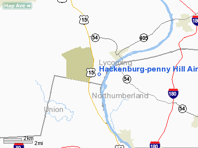
Hackenburg-penny Hill Airport |
Location & QuickFacts
| FAA Information Effective: | 2008-09-25 |
| Airport Identifier: | 6PA3 |
| Airport Status: | Operational |
| Longitude/Latitude: | 076-53-58.8700W/41-09-00.2930N
-76.899686/41.150081 (Estimated) |
| Elevation: | 1000 ft / 304.80 m (Estimated) |
| Land: | 0 acres |
| From nearest city: | 5 nautical miles SE of Montoursville, PA |
| Location: | Lycoming County, PA |
| Magnetic Variation: | 11W (1985) |
Owner & Manager
| Ownership: | Privately owned |
| Owner: | J. P. Hackenburg |
| Address: | 333 Mulberry St.
Montoursville, PA 17754 |
| Phone number: | 717-368-8849 |
| Manager: | Jess P. Hackenburg, Ii |
| Address: | Po Box 66
Montoursville, PA 17754 |
Airport Operations and Facilities
| Airport Use: | Private |
| Wind indicator: | Yes |
| Segmented Circle: | No |
| Control Tower: | No |
| Landing fee charge: | No |
| Sectional chart: | New York |
| Region: | AEA - Eastern |
| Boundary ARTCC: | ZNY - New York |
| Tie-in FSS: | IPT - Williamsport |
| FSS on Airport: | No |
| FSS Toll Free: | 1-800-WX-BRIEF |
Airport Services
| Fuel available: | 80 |
| Airframe Repair: | MAJOR |
| Power Plant Repair: | MAJOR |
Runway Information
Runway E/W
| Dimension: | 2273 x 140 ft / 692.8 x 42.7 m |
| Surface: | TURF, |
| |
Runway E |
Runway W |
| Traffic Pattern: | Left | Left |
| Runway End Identifier: | No | No |
| Centerline Lights: | No | No |
| Touchdown Lights: | No | No |
|
Radio Navigation Aids
| ID |
Type |
Name |
Ch |
Freq |
Var |
Dist |
| PIX | NDB | Picture Rocks | | 344.00 | 09W | 11.5 nm |
| HXM | NDB | Humbolt | | 366.00 | 10W | 42.0 nm |
| BZJ | NDB | Bellgrove | | 328.00 | 10W | 45.7 nm |
| CYE | NDB | Crystal Lake | | 410.00 | 11W | 48.4 nm |
| RV | NDB | Stroh | | 407.00 | 10W | 49.2 nm |
| HZL | VOR | Hazleton | | 109.40 | 09W | 36.6 nm |
| FQM | VOR/DME | Williamsport | 091X | 114.40 | 09W | 12.7 nm |
| SFK | VOR/DME | Stonyfork | 023X | 108.60 | 08W | 40.3 nm |
| MIP | VORTAC | Milton | 029X | 109.20 | 09W | 13.1 nm |
| SEG | VORTAC | Selinsgrove | 041X | 110.40 | 08W | 21.6 nm |
| RAV | VORTAC | Ravine | 093X | 114.60 | 11W | 38.4 nm |
Remarks
Images and information placed above are from
http://www.airport-data.com/airport/6PA3/
We thank them for the data!
| General Info
|
| Country |
United States
|
| State |
PENNSYLVANIA
|
| FAA ID |
6PA3
|
| Latitude |
41-09-00.293N
|
| Longitude |
076-53-58.870W
|
| Elevation |
1000 feet
|
| Near City |
MONTOURSVILLE
|
We don't guarantee the information is fresh and accurate. The data may
be wrong or outdated.
For more up-to-date information please refer to other sources.
|
|


