 |
|
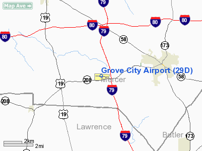
Location & QuickFacts
| FAA Information Effective: | 2008-09-25 |
| Airport Identifier: | 29D |
| Airport Status: | Operational |
| Longitude/Latitude: | 080-10-03.9000W/41-08-45.7000N
-80.167750/41.146028 (Estimated) |
| Elevation: | 1371 ft / 417.88 m (Estimated) |
| Land: | 150 acres |
| From nearest city: | 3 nautical miles W of Grove City, PA |
| Location: | Mercer County, PA |
| Magnetic Variation: | 09W (2010) |
Owner & Manager
| Ownership: | Publicly owned |
| Owner: | Borough Of Grove City |
| Address: | 123 W Main St. P.o. Box 110
Grove City, PA 16127 |
| Phone number: | 724-458-7060 |
| Manager: | Steve Rhule |
| Address: | 40 Oakley Kelly Drive
Mercer, PA 16137-8411 |
| Phone number: | 724-748-5530
MGR 24 HR CELL PHONE NR 724-992-1519 |
Airport Operations and Facilities
| Airport Use: | Open to public |
| Wind indicator: | Yes |
| Segmented Circle: | Yes |
| Control Tower: | No |
| Lighting Schedule: | DUSK-DAWN
ACTVT MIRL RY 10/28 - CTAF. |
| Beacon Color: | Clear-Green (lighted land airport) |
| Landing fee charge: | No |
| Sectional chart: | Detroit |
| Region: | AEA - Eastern |
| Boundary ARTCC: | ZOB - Cleveland |
| Tie-in FSS: | AOO - Altoona |
| FSS on Airport: | No |
| FSS Toll Free: | 1-800-WX-BRIEF |
| NOTAMs Facility: | AOO (NOTAM-d service avaliable) |
| Federal Agreements: | NGVY |
Airport Communications
| CTAF: | 122.700 |
| Unicom: | 122.700 |
Airport Services
| Fuel available: | 100LLA |
| Airframe Repair: | MINOR |
| Power Plant Repair: | MINOR |
| Bottled Oxygen: | NONE |
Runway Information
Runway 10/28
| Dimension: | 4500 x 75 ft / 1371.6 x 22.9 m |
| Surface: | ASPH, Fair Condition |
| Weight Limit: | Single wheel: 12500 lbs. |
| Edge Lights: | Medium |
| |
Runway 10 |
Runway 28 |
| Longitude: | 080-10-33.3160W | 080-09-34.5420W |
| Latitude: | 41-08-46.6050N | 41-08-44.8950N |
| Elevation: | 1349.00 ft | 1297.00 ft |
| Alignment: | 92 | 127 |
| Traffic Pattern: | Left | Left |
| Markings: | Basic, Poor Condition
RY MARKINGS ARE FADED. | Basic, Poor Condition
RY MARKINGS ARE FADED. |
| Displaced threshold: | 590.00 ft | 0.00 ft |
| VASI: | 2-light PAPI on left side
PAPI OTS INDEFLY. | 2-light PAPI on left side |
| Runway End Identifier: | Yes | Yes |
| Obstruction: | 20 ft trees, 266.0 ft from runway, 111 ft left of centerline, 3:1 slope to clear
RY 10 HAS +112 FT TREES; DIST 1875 FT; 334 FT RT; 16:1 BASED ON DSPLCD THLD. | 29 ft trees, 215.0 ft from runway, 230 ft left of centerline
RY 28 HAS +9 FT TREES, 8 FT FM RY END, 93 FT RIGHT. |
|
Radio Navigation Aids
| ID |
Type |
Name |
Ch |
Freq |
Var |
Dist |
| UCP | NDB | Castle | | 272.00 | 09W | 13.5 nm |
| HBD | NDB | Hubbard | | 408.00 | 08W | 16.5 nm |
| FKL | VOR | Franklin | | 109.60 | 06W | 22.5 nm |
| CIP | VOR/DME | Clarion | 076X | 112.90 | 06W | 32.1 nm |
| JFN | VOR/DME | Jefferson | 099X | 115.20 | 05W | 45.2 nm |
| ACO | VOR/DME | Akron | 091X | 114.40 | 04W | 46.9 nm |
| EWC | VORTAC | Ellwood City | 105X | 115.80 | 08W | 19.4 nm |
| YNG | VORTAC | Youngstown | 027X | 109.00 | 05W | 25.5 nm |
| MMJ | VORTAC | Montour | 057X | 112.00 | 08W | 39.6 nm |
| TDT | VORTAC | Tidioute | 123X | 117.60 | 09W | 48.0 nm |
Remarks
- DEER & GEESE ON AND INVOF ARPT.
- DRAINAGE RAVINE 15 FT DEEP LCTD IN SAFETY AREA NORTH OF RY 10.
- AVOID OVERFLYING FLD DURG DALGT VFR BECAUSE OF PARACHUTE JUMPING ACTIVITY NW CORNER OF FLD.
- GLIDER OPNS ON & INVOF ARPT APR-NOV.
Images and information placed above are from
http://www.airport-data.com/airport/29D/
We thank them for the data!
| General Info
|
| Country |
United States
|
| State |
PENNSYLVANIA
|
| FAA ID |
29D
|
| Latitude |
41-08-45.690N
|
| Longitude |
080-10-03.930W
|
| Elevation |
1371 feet
|
| Near City |
GROVE CITY
|
We don't guarantee the information is fresh and accurate. The data may
be wrong or outdated.
For more up-to-date information please refer to other sources.
|
|


