|
|
 |
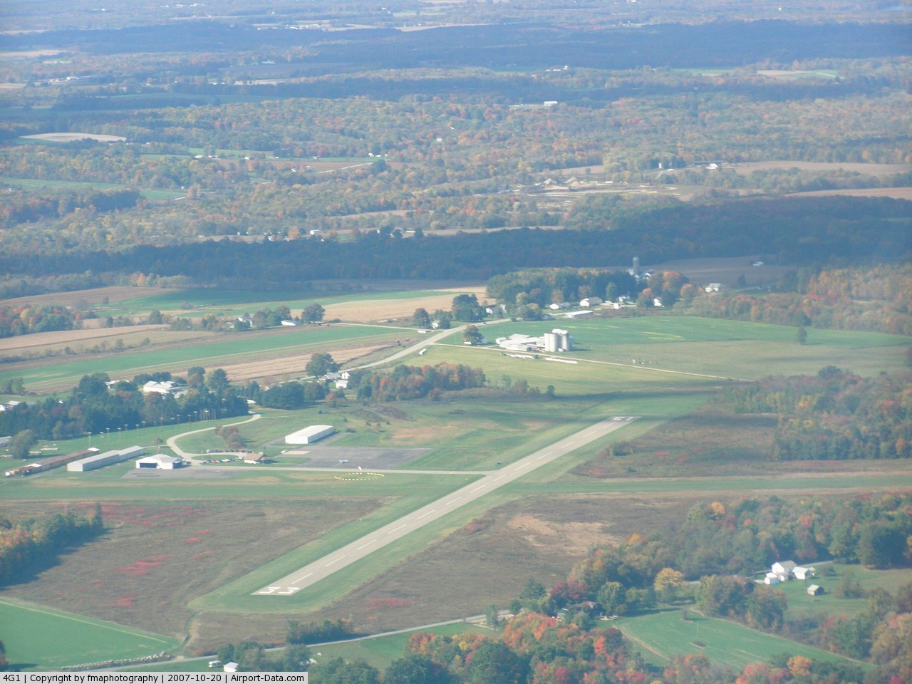
(Click on the photo to enlarge) |
 |
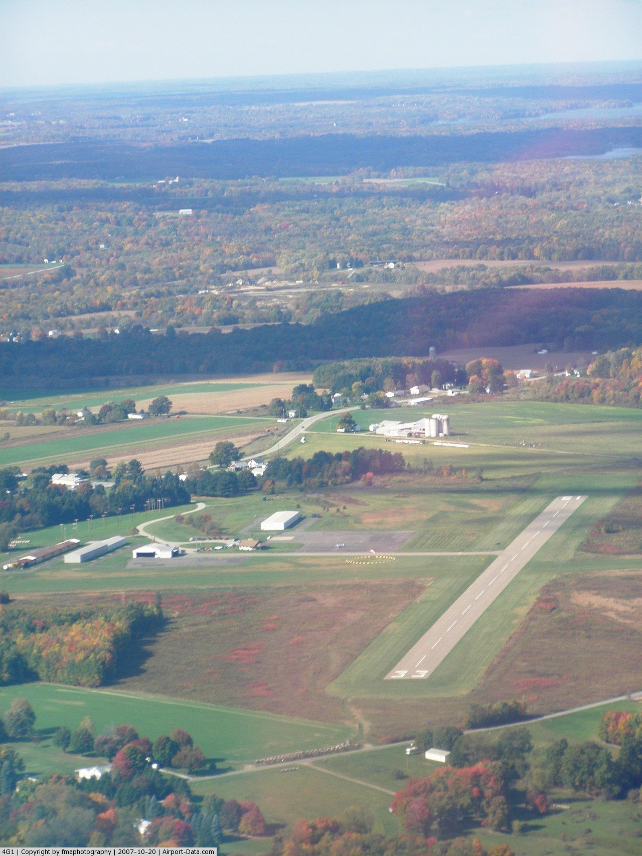
(Click on the photo to enlarge) |
Location & QuickFacts
| FAA Information Effective: | 2008-09-25 |
| Airport Identifier: | 4G1 |
| Airport Status: | Operational |
| Longitude/Latitude: | 080-23-28.5420W/41-26-48.5940N
-80.391262/41.446832 (Estimated) |
| Elevation: | 1202 ft / 366.37 m (Surveyed) |
| Land: | 54 acres |
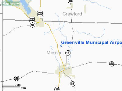
| From nearest city: | 3 nautical miles N of Greenville, PA |
| Location: | Mercer County, PA |
| Magnetic Variation: | 05W (1965) |
Owner & Manager
| Ownership: | Publicly owned |
| Owner: | Borough Of Greenville |
| Address: | Municipal Bldg
Greenville, PA 16125 |
| Phone number: | 724-588-4193 |
| Manager: | Rod Paul |
| Address: | 511 E Jamestown Rd
Greenville, PA 16125 |
| Phone number: | 724-588-1665
ALSO 724-662-5565. 24 HR MGR PHONE 724-967-1503. |
Airport Operations and Facilities
| Airport Use: | Open to public |
| Wind indicator: | Yes |
| Segmented Circle: | Yes |
| Control Tower: | No |
| Lighting Schedule: | DUSK-DAWN
ACTIVATE MIRL RY 15-33 - CTAF. |
| Beacon Color: | Clear-Green (lighted land airport) |
| Landing fee charge: | No |
| Sectional chart: | Detroit |
| Region: | AEA - Eastern |
| Boundary ARTCC: | ZOB - Cleveland |
| Tie-in FSS: | AOO - Altoona |
| FSS on Airport: | No |
| FSS Toll Free: | 1-800-WX-BRIEF |
| NOTAMs Facility: | AOO (NOTAM-d service avaliable) |
| Federal Agreements: | NGY |
Airport Communications
| CTAF: | 122.800 |
| Unicom: | 122.800 |
Airport Services
| Fuel available: | 100LL |
| Airframe Repair: | MINOR |
| Power Plant Repair: | MINOR |
| Bottled Oxygen: | NONE |
| Bulk Oxygen: | NONE |
Runway Information
Runway 05/23
| Dimension: | 2551 x 118 ft / 777.5 x 36.0 m |
| Surface: | TURF, Good Condition |
| |
Runway 05 |
Runway 23 |
| Longitude: | 080-23-39.2420W | 080-23-17.2410W |
| Latitude: | 41-26-39.1940N | 41-26-58.1940N |
| Alignment: | 41 | 127 |
| Traffic Pattern: | Left | Left |
| Displaced threshold: | 984.00 ft | 0.00 ft |
| Obstruction: | 58 ft trees, 402.0 ft from runway, 99 ft right of centerline, 6:1 slope to clear
RY 05 21:1 TO DSPLCD THLD. | 25 ft brush, 226.0 ft from runway, 30 ft right of centerline, 9:1 slope to clear |
|
Runway 15/33
| Dimension: | 2703 x 75 ft / 823.9 x 22.9 m |
| Surface: | ASPH, Good Condition |
| Weight Limit: | Single wheel: 12500 lbs. |
| Edge Lights: | Medium |
| |
Runway 15 |
Runway 33 |
| Longitude: | 080-23-40.0740W | 080-23-17.5050W |
| Latitude: | 41-26-58.7720N | 41-26-38.1660N |
| Elevation: | 1162.00 ft | 1202.00 ft |
| Alignment: | 127 | 127 |
| Traffic Pattern: | Left | Left |
| Markings: | Basic, Good Condition
RY 15/33 MKGS FADED. | Basic, Good Condition |
| Crossing Height: | 35.00 ft | 31.00 ft |
| VASI: | 2-light PAPI on left side | 2-light PAPI on left side
PAPI RY 33 OTS INDEFLY. |
| Visual Glide Angle: | 3.00° | 3.40° |
| Runway End Identifier: | Yes
RY 15 REIL OTS INDEFLY. | Yes
RY 33 REIL OTS INDEFLY. |
| Obstruction: | 8 ft brush, 330.0 ft from runway, 119 ft left of centerline, 16:1 slope to clear | 30 ft trees, 583.0 ft from runway, 153 ft right of centerline, 12:1 slope to clear |
|
Radio Navigation Aids
| ID |
Type |
Name |
Ch |
Freq |
Var |
Dist |
| HBD | NDB | Hubbard | | 408.00 | 08W | 18.8 nm |
| UCP | NDB | Castle | | 272.00 | 09W | 25.5 nm |
| CQD | NDB | Cascade | | 372.00 | 08W | 42.4 nm |
| ORJ | NDB | Corry | | 258.00 | 09W | 43.5 nm |
| LQL | NDB | Lakeland | | 263.00 | 08W | 46.6 nm |
| FKL | VOR | Franklin | | 109.60 | 06W | 24.1 nm |
| JFN | VOR/DME | Jefferson | 099X | 115.20 | 05W | 24.7 nm |
| CXR | VOR/DME | Chardon | 074X | 112.70 | 05W | 35.0 nm |
| ACO | VOR/DME | Akron | 091X | 114.40 | 04W | 41.9 nm |
| CIP | VOR/DME | Clarion | 076X | 112.90 | 06W | 45.9 nm |
| LNN | VOR/DME | Lost Nation | 039X | 110.20 | 08W | 47.1 nm |
| YNG | VORTAC | Youngstown | 027X | 109.00 | 05W | 14.6 nm |
| ERI | VORTAC | Erie | 031X | 109.40 | 06W | 34.6 nm |
| EWC | VORTAC | Ellwood City | 105X | 115.80 | 08W | 38.2 nm |
| TDT | VORTAC | Tidioute | 123X | 117.60 | 09W | 46.6 nm |
Remarks
- RY 05/23 SOFT & WET DURING SPRING THAW.
- DEER & BIRDS ON & INVOF ARPT.
- VFR USE ONLY
Images and information placed above are from
http://www.airport-data.com/airport/4G1/
We thank them for the data!
| General Info
|
| Country |
United States
|
| State |
PENNSYLVANIA
|
| FAA ID |
4G1
|
| Latitude |
41-26-48.594N
|
| Longitude |
080-23-28.542W
|
| Elevation |
1202 feet
|
| Near City |
GREENVILLE
|
We don't guarantee the information is fresh and accurate. The data may
be wrong or outdated.
For more up-to-date information please refer to other sources.
|
|