 |
|
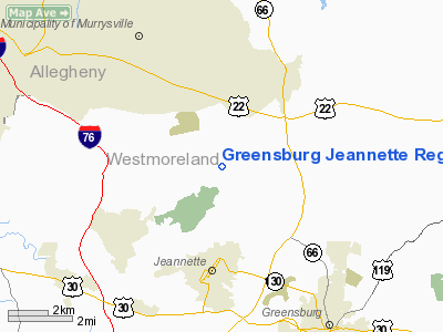
Greensburg Jeannette Rgnl Airport |
Location & QuickFacts
| FAA Information Effective: | 2008-09-25 |
| Airport Identifier: | 5G8 |
| Airport Status: | Operational |
| Longitude/Latitude: | 079-36-30.1530W/40-22-35.2460N
-79.608376/40.376457 (Estimated) |
| Elevation: | 1188 ft / 362.10 m (Estimated) |
| Land: | 121 acres |
| From nearest city: | 3 nautical miles N of Jeannette, PA |
| Location: | Westmoreland County, PA |
| Magnetic Variation: | 08W (1985) |
Owner & Manager
| Ownership: | Privately owned |
| Owner: | Richard H King |
| Address: | Airport Road
Jeannette, PA 15644 |
| Phone number: | 724-744-2900 |
| Manager: | Frank Mahkowic |
| Address: | Airport Road
Jeannette, PA 15644 |
| Phone number: | 724-744-2900 |
Airport Operations and Facilities
| Airport Use: | Open to public |
| Wind indicator: | Yes |
| Segmented Circle: | Yes |
| Control Tower: | No |
| Lighting Schedule: | DUSK-0000
AFTER 0000 ROTG BCN BY PRIOR REQUEST 724-744-2900. |
| Beacon Color: | Clear-Green (lighted land airport) |
| Landing fee charge: | No |
| Sectional chart: | Detroit |
| Region: | AEA - Eastern |
| Traffic Pattern Alt: | 800 ft |
| Boundary ARTCC: | ZOB - Cleveland |
| Tie-in FSS: | AOO - Altoona |
| FSS on Airport: | No |
| FSS Toll Free: | 1-800-WX-BRIEF |
| NOTAMs Facility: | AOO (NOTAM-d service avaliable) |
| Federal Agreements: | N |
Airport Communications
Airport Services
| Bottled Oxygen: | NONE |
| Bulk Oxygen: | NONE |
Runway Information
Runway 02/20
| Dimension: | 2605 x 50 ft / 794.0 x 15.2 m |
| Surface: | ASPH, Good Condition |
| Edge Lights: | Medium
RY 02/20 NO TWY LGTS. NON-STANDARD RY LIGHT SPACING. |
| |
Runway 02 |
Runway 20 |
| Traffic Pattern: | Right | Left |
| Markings: | Basic, Fair Condition | Basic, Fair Condition |
| Obstruction: | 233 ft hill, 4745.0 ft from runway, 227 ft right of centerline, 19:1 slope to clear
RY 02 HAS +1 FT TREES 108 FT FM THLD, 91 FT R AND +7 FT TREES, 105 FT FM THLD, 85 FT L. | 4 ft tree, 256.0 ft from runway, 96 ft left of centerline, 14:1 slope to clear |
|
Radio Navigation Aids
| ID |
Type |
Name |
Ch |
Freq |
Var |
Dist |
| MKP | NDB | Mc Keesport | | 287.00 | 07W | 8.0 nm |
| BHU | NDB | Benje | | 382.00 | 07W | 15.4 nm |
| PNU | NDB | Washington County | | 255.00 | 08W | 29.0 nm |
| INP | NDB | Indiana | | 242.00 | 08W | 29.2 nm |
| VV | NDB | Camor | | 299.00 | 08W | 30.3 nm |
| SYS | NDB | Stoystown | | 209.00 | 08W | 36.2 nm |
| AGC | VOR/DME | Allegheny | 037X | 110.00 | 09W | 20.7 nm |
| REC | VOR/DME | Revloc | 043X | 110.60 | 09W | 40.7 nm |
| HLG | VOR/DME | Wheeling | 059X | 112.20 | 07W | 44.6 nm |
| CIP | VOR/DME | Clarion | 076X | 112.90 | 06W | 46.8 nm |
| IHD | VORTAC | Indian Head | 019X | 108.20 | 06W | 26.8 nm |
| MMJ | VORTAC | Montour | 057X | 112.00 | 08W | 27.6 nm |
| JST | VORTAC | Johnstown | 077X | 113.00 | 06W | 35.6 nm |
| EWC | VORTAC | Ellwood City | 105X | 115.80 | 08W | 38.5 nm |
Remarks
- TRRN DROPS OFF RAPIDLY ON BOTH ENDS OF RY.
- DEER & BIRDS ON & INVOF ARPT WITH OCCASIONAL RY INCURSIONS.
- VFR OPNS ONLY.
Images and information placed above are from
http://www.airport-data.com/airport/5G8/
We thank them for the data!
| General Info
|
| Country |
United States
|
| State |
PENNSYLVANIA
|
| FAA ID |
5G8
|
| Latitude |
40-22-35.246N
|
| Longitude |
079-36-30.153W
|
| Elevation |
1188 feet
|
| Near City |
JEANNETTE
|
We don't guarantee the information is fresh and accurate. The data may
be wrong or outdated.
For more up-to-date information please refer to other sources.
|
|


