 |
|
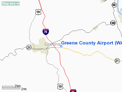
Location & QuickFacts
| FAA Information Effective: | 2008-09-25 |
| Airport Identifier: | WAY |
| Airport Status: | Operational |
| Longitude/Latitude: | 080-07-50.5000W/39-54-04.1000N
-80.130694/39.901139 (Estimated) |
| Elevation: | 1069 ft / 325.83 m (Surveyed) |
| Land: | 89 acres |
| From nearest city: | 2 nautical miles E of Waynesburg, PA |
| Location: | Greene County, PA |
| Magnetic Variation: | 09W (2010) |
Owner & Manager
| Ownership: | Publicly owned |
| Owner: | Greene County |
| Address: | County Office Bldg
Waynesburg, PA 15370 |
| Phone number: | 724-852-5323 |
| Manager: | Jake Blaker |
| Address: | 417 E Roy E. Furman Highway, Ste 20
Waynesburg, PA 15370 |
| Phone number: | 724-627-8029 |
Airport Operations and Facilities
| Airport Use: | Open to public |
| Wind indicator: | Yes |
| Segmented Circle: | Yes |
| Control Tower: | No |
| Lighting Schedule: | DUSK-DAWN |
| Beacon Color: | Clear-Green (lighted land airport) |
| Landing fee charge: | No |
| Sectional chart: | Cincinnati |
| Region: | AEA - Eastern |
| Boundary ARTCC: | ZOB - Cleveland |
| Tie-in FSS: | AOO - Altoona |
| FSS on Airport: | No |
| FSS Toll Free: | 1-800-WX-BRIEF |
| NOTAMs Facility: | AOO (NOTAM-d service avaliable) |
| Federal Agreements: | NGY |
Airport Communications
| CTAF: | 122.800 |
| Unicom: | 122.800 |
Airport Services
| Fuel available: | 100LL |
| Airframe Repair: | MAJOR |
| Power Plant Repair: | MAJOR |
| Bottled Oxygen: | NONE |
Runway Information
Runway 09/27
| Dimension: | 3500 x 75 ft / 1066.8 x 22.9 m |
| Surface: | ASPH, Fair Condition |
| Weight Limit: | Single wheel: 12000 lbs. |
| Edge Lights: | Medium |
| |
Runway 09 |
Runway 27 |
| Longitude: | 080-08-12.5500W | 080-07-28.5000W |
| Latitude: | 39-54-00.7900N | 39-54-07.4800N |
| Elevation: | 1065.00 ft | 1062.00 ft |
| Traffic Pattern: | Left | Left |
| Markings: | Basic, Fair Condition | Basic, Fair Condition |
| Crossing Height: | 0.00 ft | 28.00 ft |
| VASI: | | 4-box on right side |
| Visual Glide Angle: | 0.00° | 4.00° |
| Obstruction: | 5 ft trees, 317.0 ft from runway, 52 ft right of centerline, 25:1 slope to clear | 15 ft trees, 267.0 ft from runway, 55 ft right of centerline, 4:1 slope to clear
RY 27 HAS +5 FT TREES 152 FT FM THLD 47 FT L; +5 FT BRUSH 100 FT FM THLD 103 FT L. |
|
Radio Navigation Aids
| ID |
Type |
Name |
Ch |
Freq |
Var |
Dist |
| PNU | NDB | Washington County | | 255.00 | 08W | 14.7 nm |
| VV | NDB | Camor | | 299.00 | 08W | 17.8 nm |
| MKP | NDB | Mc Keesport | | 287.00 | 07W | 31.7 nm |
| CFX | NDB | Cadiz | | 239.00 | 07W | 45.3 nm |
| BHU | NDB | Benje | | 382.00 | 07W | 48.7 nm |
| AGC | VOR/DME | Allegheny | 037X | 110.00 | 09W | 23.1 nm |
| HLG | VOR/DME | Wheeling | 059X | 112.20 | 07W | 29.5 nm |
| AIR | VOR/DME | Bellaire | 118X | 117.10 | 07W | 32.4 nm |
| CKB | VOR/DME | Clarksburg | 073X | 112.60 | 04W | 39.5 nm |
| MGW | VORTAC | Morgantown | 053X | 111.60 | 05W | 24.2 nm |
| MMJ | VORTAC | Montour | 057X | 112.00 | 08W | 35.4 nm |
| IHD | VORTAC | Indian Head | 019X | 108.20 | 06W | 35.9 nm |
Remarks
- GROUND DROPS OFF SHARPLY EAST END RY 09/27.
- DEER AND BIRDS ON & INVOF RY.
- ESTAB PRIOR TO 1959.
Images and information placed above are from
http://www.airport-data.com/airport/WAY/
We thank them for the data!
| General Info
|
| Country |
United States
|
| State |
PENNSYLVANIA
|
| FAA ID |
WAY
|
| Latitude |
39-54-00.270N
|
| Longitude |
080-07-59.220W
|
| Elevation |
1065 feet
|
| Near City |
WAYNESBURG
|
We don't guarantee the information is fresh and accurate. The data may
be wrong or outdated.
For more up-to-date information please refer to other sources.
|
|


