 |
|
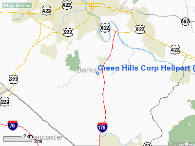
Green Hills Corp Heliport |
Location & QuickFacts
| FAA Information Effective: | 2008-09-25 |
| Airport Identifier: | 1PN2 |
| Airport Status: | Operational |
| Longitude/Latitude: | 075-55-20.0000W/40-15-50.0000N
-75.922222/40.263889 (Estimated) |
| Elevation: | 440 ft / 134.11 m (Estimated) |
| Land: | 1 acres |
| From nearest city: | 3 nautical miles SE of Reading, PA |
| Location: | Berks County, PA |
| Magnetic Variation: | 12W (1995) |
Owner & Manager
| Ownership: | Privately owned |
| Owner: | Brandywine Realty Trust |
| Address: | 2675 Morgantown Rd
Reading, PA 19607 |
| Phone number: | 610-856-5400 |
| Manager: | Terry Hafer |
| Address: | 2675 Morgantown Rd
Reading, PA 19607 |
| Phone number: | 610-856-5469 |
Airport Operations and Facilities
| Airport Use: | Private |
| Wind indicator: | Yes |
| Segmented Circle: | Yes |
| Control Tower: | No |
| Lighting Schedule: | DUSK-DAWN |
| Sectional chart: | New York |
| Region: | AEA - Eastern |
| Boundary ARTCC: | ZNY - New York |
| Tie-in FSS: | IPT - Williamsport |
| FSS Toll Free: | 1-800-WX-BRIEF |
Runway Information
Helipad H1
| Dimension: | 60 x 60 ft / 18.3 x 18.3 m |
| Surface: | ASPH, Good Condition |
| |
Runway H1 |
Runway |
| Traffic Pattern: | Left | Left |
| Markings: | Basic, | , |
|
Radio Navigation Aids
| ID |
Type |
Name |
Ch |
Freq |
Var |
Dist |
| UKT | NDB | Quakertown | | 208.00 | 12W | 30.2 nm |
| ING | NDB | Ambler | | 275.00 | 11W | 30.4 nm |
| BZJ | NDB | Bellgrove | | 328.00 | 10W | 30.7 nm |
| LQX | NDB | Carbon | | 339.00 | 12W | 33.8 nm |
| NXX | NDB | Willow Grove | | 388.00 | 12W | 35.9 nm |
| DYL | NDB | Doylestown | | 237.00 | 10W | 36.9 nm |
| HXM | NDB | Humbolt | | 366.00 | 10W | 43.7 nm |
| APG | NDB | Aberdeen | | 349.00 | 11W | 44.6 nm |
| EUD | NDB | York | | 254.00 | 11W | 48.5 nm |
| NXX | TACAN | Willow Grove | 061X | | 10W | 35.8 nm |
| PNE | VOR | North Philadelphia | | 112.00 | 10W | 43.3 nm |
| HZL | VOR | Hazleton | | 109.40 | 09W | 43.7 nm |
| ETX | VOR/DME | East Texas | 039X | 110.20 | 09W | 22.0 nm |
| CKZ | VOR/DME | Pennridge | 025Y | 108.85 | 12W | 30.0 nm |
| ARD | VOR/DME | Yardley | 019X | 108.20 | 10W | 46.5 nm |
| PPM | VOR/DME | Phillips | 021X | 108.40 | 09W | 49.3 nm |
| PTW | VORTAC | Pottstown | 112X | 116.50 | 09W | 16.8 nm |
| LRP | VORTAC | Lancaster | 120X | 117.30 | 09W | 19.0 nm |
| MXE | VORTAC | Modena | 079X | 113.20 | 09W | 23.8 nm |
| FJC | VORTAC | Allentown | 122X | 117.50 | 10W | 35.1 nm |
| RAV | VORTAC | Ravine | 093X | 114.60 | 11W | 35.5 nm |
| DQO | VORTAC | Dupont | 087X | 114.00 | 10W | 38.1 nm |
| OOD | VORTAC | Woodstown | 075X | 112.80 | 10W | 47.3 nm |
| MDT | VOT | Harrisburg International | | 110.00 | | 38.8 nm |
| PHL | VOT | Philadelphia Intl | | 109.80 | | 39.1 nm |
Remarks
- PRVDD VFR ONLY, CLEAR 8:1 INGRESS/EGRESS, VEHICULAR TFC AROUND SITE CONTROLLED, PAK MKD WITH INGRESS/EGRESS MKGS, WINDSOCK INSTALLED.
Images and information placed above are from
http://www.airport-data.com/airport/1PN2/
We thank them for the data!
| General Info
|
| Country |
United States
|
| State |
PENNSYLVANIA
|
| FAA ID |
1PN2
|
| Latitude |
40-15-50.000N
|
| Longitude |
075-55-20.000W
|
| Elevation |
440 feet
|
| Near City |
READING
|
We don't guarantee the information is fresh and accurate. The data may
be wrong or outdated.
For more up-to-date information please refer to other sources.
|
|


