 |
|
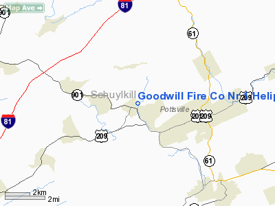
Goodwill Fire Co Nr 1 Heliport |
Location & QuickFacts
| FAA Information Effective: | 2008-09-25 |
| Airport Identifier: | PN86 |
| Airport Status: | Operational |
| Longitude/Latitude: | 076-15-22.0000W/40-41-38.0000N
-76.256111/40.693889 (Estimated) |
| Elevation: | 710 ft / 216.41 m (Estimated) |
| Land: | 1 acres |
| From nearest city: | 0 nautical miles N of Minersville, PA |
| Location: | Schuylkill County, PA |
| Magnetic Variation: | () |
Owner & Manager
| Ownership: | Privately owned |
| Owner: | Goodwill Fire Co No. 1 |
| Address: | 25 North Street
Minersville, PA 17954 |
| Phone number: | 570-544-6099 |
| Manager: | Allen Reber |
| Address: | 25 North Street
Minersville, PA 17954 |
| Phone number: | 570-544-6099 |
Airport Operations and Facilities
| Airport Use: | Private |
| Wind indicator: | Yes |
| Control Tower: | No |
| Lighting Schedule: | RDO-CTL
ACTVT RTG BCN AND PERIMETER LGTS H1- 123.05. |
| Beacon Color: | Clear-Green-Yellow (heliport) |
| Sectional chart: | Washington |
| Region: | AEA - Eastern |
| Boundary ARTCC: | ZNY - New York |
| Tie-in FSS: | IPT - Williamsport |
| FSS Toll Free: | 1-800-WX-BRIEF |
Runway Information
Helipad H1
| Dimension: | 40 x 40 ft / 12.2 x 12.2 m |
| Surface: | ASPH, |
| |
Runway H1 |
Runway |
| Traffic Pattern: | Left | Left |
|
Radio Navigation Aids
| ID |
Type |
Name |
Ch |
Freq |
Var |
Dist |
| BZJ | NDB | Bellgrove | | 328.00 | 10W | 20.6 nm |
| HXM | NDB | Humbolt | | 366.00 | 10W | 21.3 nm |
| LQX | NDB | Carbon | | 339.00 | 12W | 23.7 nm |
| CYE | NDB | Crystal Lake | | 410.00 | 11W | 36.5 nm |
| PIX | NDB | Picture Rocks | | 344.00 | 09W | 40.6 nm |
| UKT | NDB | Quakertown | | 208.00 | 12W | 46.7 nm |
| HZL | VOR | Hazleton | | 109.40 | 09W | 17.9 nm |
| ETX | VOR/DME | East Texas | 039X | 110.20 | 09W | 27.0 nm |
| FQM | VOR/DME | Williamsport | 091X | 114.40 | 09W | 45.3 nm |
| CKZ | VOR/DME | Pennridge | 025Y | 108.85 | 12W | 47.8 nm |
| RAV | VORTAC | Ravine | 093X | 114.60 | 11W | 17.8 nm |
| MIP | VORTAC | Milton | 029X | 109.20 | 09W | 27.2 nm |
| SEG | VORTAC | Selinsgrove | 041X | 110.40 | 08W | 29.2 nm |
| LRP | VORTAC | Lancaster | 120X | 117.30 | 09W | 34.5 nm |
| FJC | VORTAC | Allentown | 122X | 117.50 | 10W | 36.6 nm |
| PTW | VORTAC | Pottstown | 112X | 116.50 | 09W | 42.6 nm |
| LVZ | VORTAC | Wilkes-barre | 053X | 111.60 | 10W | 43.3 nm |
| HAR | VORTAC | Harrisburg | 072X | 112.50 | 10W | 44.0 nm |
| MDT | VOT | Harrisburg International | | 110.00 | | 37.8 nm |
Remarks
- PRVDD CLR 8:1 INGRESS/EGRESS; OPERATE IN SAFE MANNER TO MINIMIZE NOISE; VEHICULAR TFC AROUND SITE CONTROLLED; IF NIGHTTIME OPNS LGTD WINDSOCK TO BE USED; AND PERIMETER LGTS INSTALLED.
Images and information placed above are from
http://www.airport-data.com/airport/PN86/
We thank them for the data!
| General Info
|
| Country |
United States
|
| State |
PENNSYLVANIA
|
| FAA ID |
PN86
|
| Latitude |
41-07-00.210N
|
| Longitude |
080-24-59.242W
|
| Elevation |
1050 feet
|
| Near City |
PULASKI
|
We don't guarantee the information is fresh and accurate. The data may
be wrong or outdated.
For more up-to-date information please refer to other sources.
|
|


