 |
|
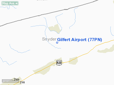
Location & QuickFacts
| FAA Information Effective: | 2008-09-25 |
| Airport Identifier: | 77PN |
| Airport Status: | Operational |
| Longitude/Latitude: | 077-12-23.9420W/40-47-02.2820N
-77.206651/40.783967 (Estimated) |
| Elevation: | 630 ft / 192.02 m (Estimated) |
| Land: | 0 acres |
| From nearest city: | 0 nautical miles N of Benfer, PA |
| Location: | Snyder County, PA |
| Magnetic Variation: | 10W (1985) |
Owner & Manager
| Ownership: | Privately owned |
| Owner: | Larry Y. Gilfert |
| Address: | Rd 1
Beaver Springs, PA 17812 |
| Phone number: | 717-658-3663 |
| Address: |
|
Airport Operations and Facilities
| Airport Use: | Private |
| Wind indicator: | Yes |
| Segmented Circle: | No |
| Control Tower: | No |
| Landing fee charge: | No |
| Sectional chart: | Detroit |
| Region: | AEA - Eastern |
| Boundary ARTCC: | ZNY - New York |
| Tie-in FSS: | IPT - Williamsport |
| FSS on Airport: | No |
| FSS Toll Free: | 1-800-WX-BRIEF |
Runway Information
Runway 10/28
| Dimension: | 1930 x 80 ft / 588.3 x 24.4 m |
| Surface: | TURF, |
| |
Runway 10 |
Runway 28 |
| Traffic Pattern: | Left | Right |
|
Radio Navigation Aids
| ID |
Type |
Name |
Ch |
Freq |
Var |
Dist |
| RV | NDB | Stroh | | 407.00 | 10W | 25.4 nm |
| BZJ | NDB | Bellgrove | | 328.00 | 10W | 36.4 nm |
| PIX | NDB | Picture Rocks | | 344.00 | 09W | 37.2 nm |
| FQM | VOR/DME | Williamsport | 091X | 114.40 | 09W | 38.7 nm |
| SEG | VORTAC | Selinsgrove | 041X | 110.40 | 08W | 14.7 nm |
| MIP | VORTAC | Milton | 029X | 109.20 | 09W | 28.5 nm |
| HAR | VORTAC | Harrisburg | 072X | 112.50 | 10W | 29.6 nm |
| RAV | VORTAC | Ravine | 093X | 114.60 | 11W | 31.0 nm |
| PSB | VORTAC | Philipsburg | 102X | 115.50 | 10W | 36.6 nm |
| ETG | VORTAC | Keating | 107X | 116.00 | 10W | 49.7 nm |
| MDT | VOT | Harrisburg International | | 110.00 | | 40.7 nm |
Remarks
- AIRPORT RESTRICTED TO PERSONAL USE; APPROPRIATE TRAFFIC PATTERNS ARE ESTABLISHED TO PROVIDE SEPARATION FROM CAMERON AIRPORT.
Images and information placed above are from
http://www.airport-data.com/airport/77PN/
We thank them for the data!
| General Info
|
| Country |
United States
|
| State |
PENNSYLVANIA
|
| FAA ID |
77PN
|
| Latitude |
40-47-02.282N
|
| Longitude |
077-12-23.942W
|
| Elevation |
630 feet
|
| Near City |
BENFER
|
We don't guarantee the information is fresh and accurate. The data may
be wrong or outdated.
For more up-to-date information please refer to other sources.
|
|


