|
|
| Gettysburg Regional Airport |
| IATA: GTY – ICAO: none – FAA LID: W05 |
| Summary |
| Airport type |
Public |
| Owner |
Susquehanna Area Regional Airport Authority |
| Location |
Gettysburg, Pennsylvania |
| Elevation AMSL |
590 ft / 180 m |
| Coordinates |
39°50′27″N 77°16′27″W / 39.84083°N 77.27417°W / 39.84083; -77.27417 |
| Runways |
| Direction |
Length |
Surface |
| ft |
m |
| 6/24 |
3,100 |
945 |
Asphalt |
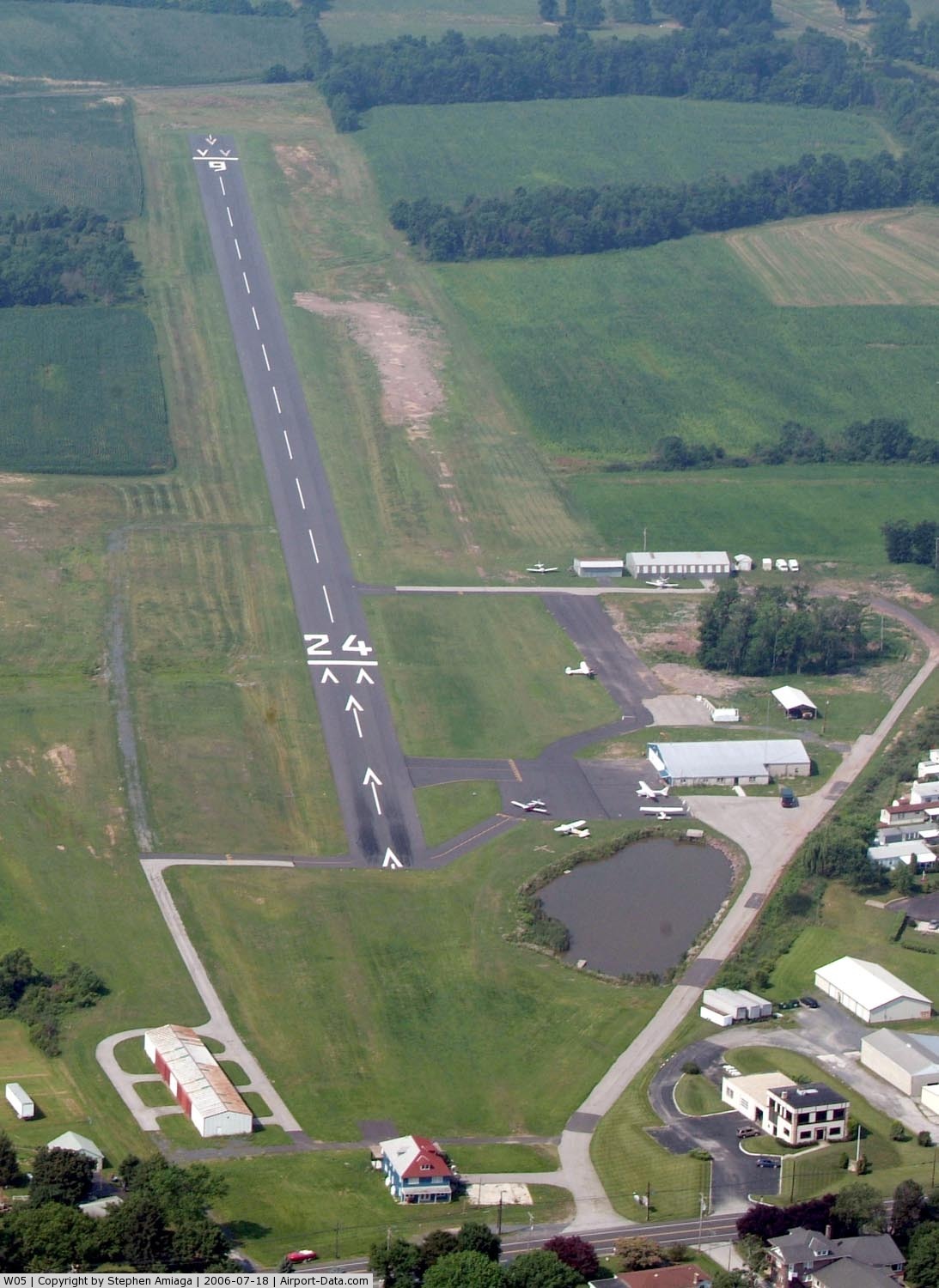
Gettysburg Regional Airport (IATA: GTY, FAA LID: W05), formerly known as the Gettysburg Airport and Travel Center, is a general aviation airport located two miles (4 km) west of the Gettysburg, in Adams County, Pennsylvania, USA. The airport is situated approximately 38 miles (61 km) south of Harrisburg.
The airport opened in 1926 and had been a privately operated general aviation service airport. It is located on roughly 47 acres (190,000 m) in Cumberland Township, Pennsylvania. On August 25, 2006, the Susquehanna Area Regional Airport Authority acquired the airport and changed its official name. Facilities
Gettysburg Regional Airport has one runway:
- Runway 6/24: 3,100 x 60 ft (945 x 18 m), Surface: Asphalt
- Partial taxiway on either side of the runway provides access to the hangar areas and fuel farm.
- Landside facilities include four hangar units, 18,682 (sq ft) of hangar space.
Statistics
- 9,600 total aircraft operations for 2005
The above content comes from Wikipedia and is published under free licenses – click here to read more.
 |
(Click on the photo to enlarge) |
Location & QuickFacts
| FAA Information Effective: | 2008-09-25 |
| Airport Identifier: | W05 |
| Airport Status: | Operational |
| Longitude/Latitude: | 077-16-28.7400W/39-50-28.7100N
-77.274650/39.841308 (Estimated) |
| Elevation: | 590 ft / 179.83 m (Estimated) |
| Land: | 59 acres |
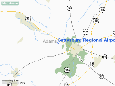
| From nearest city: | 2 nautical miles W of Gettysburg, PA |
| Location: | Adams County, PA |
| Magnetic Variation: | 10W (1985) |
Owner & Manager
| Ownership: | Publicly owned |
| Owner: | Sarra
SUSQUEHANNA REGIONAL AIRPORT AUTHORITY |
| Address: | One Terminal Drive, Suite 300
Middletown, PA 17057 |
| Phone number: | 717-948-3900 |
| Manager: | Fred Testa |
| Address: | One Terminal Drive, Suite 300
Middletown, PA 17057 |
| Phone number: | 717-948-3900 |
Airport Operations and Facilities
| Airport Use: | Open to public |
| Wind indicator: | Yes |
| Segmented Circle: | No |
| Control Tower: | No |
| Lighting Schedule: | RDO-CTL
ACTVT MIRL RY 06/24 - CTAF - 122.8. |
| Landing fee charge: | No |
| Sectional chart: | Washington |
| Region: | AEA - Eastern |
| Boundary ARTCC: | ZNY - New York |
| Responsible ARTCC: | ZDC - Washington |
| Tie-in FSS: | IPT - Williamsport |
| FSS on Airport: | No |
| FSS Toll Free: | 1-800-WX-BRIEF |
| NOTAMs Facility: | IPT (NOTAM-d service avaliable) |
| Federal Agreements: | N |
Airport Communications
| CTAF: | 122.800 |
| Unicom: | 122.800 |
Airport Services
| Fuel available: | 100LL
NO FUEL AVBL FOR TSNT ACFT. |
| Airframe Repair: | NONE |
| Power Plant Repair: | NONE |
Runway Information
Runway 06/24
| Dimension: | 3100 x 60 ft / 944.9 x 18.3 m |
| Surface: | ASPH, Good Condition |
| Edge Lights: | Medium |
| |
Runway 06 |
Runway 24 |
| Longitude: | 077-16-43.8710W | 077-16-13.6150W |
| Latitude: | 39-50-18.7720N | 39-50-38.6590N |
| Elevation: | 540.00 ft | 552.00 ft |
| Traffic Pattern: | Left | Left |
| Markings: | Basic, Good Condition | Basic, Good Condition |
| Displaced threshold: | 167.00 ft | 542.00 ft |
| Obstruction: | 20 ft road, 350.0 ft from runway, 7:1 slope to clear
RY 06 APCH RATIO 25:1 TO DSPLCD THLD. | 66 ft trees, 827.0 ft from runway, 29 ft left of centerline, 9:1 slope to clear
RY 24 APCH RATIO 20:1 TO DSPLCD THLD. |
|
Radio Navigation Aids
| ID |
Type |
Name |
Ch |
Freq |
Var |
Dist |
| EUD | NDB | York | | 254.00 | 11W | 18.9 nm |
| FND | NDB | Ellicott | | 371.00 | 11W | 40.5 nm |
| GAI | NDB | Gaithersburg | | 385.00 | 09W | 40.7 nm |
| IUB | NDB | Institute | | 404.00 | 08W | 44.9 nm |
| BZJ | NDB | Bellgrove | | 328.00 | 10W | 48.8 nm |
| FDK | VOR | Frederick | | 109.00 | 08W | 26.2 nm |
| HGR | VOR | Hagerstown | | 109.80 | 07W | 28.2 nm |
| EMI | VORTAC | Westminster | 126X | 117.90 | 08W | 24.9 nm |
| HAR | VORTAC | Harrisburg | 072X | 112.50 | 10W | 29.3 nm |
| THS | VORTAC | St Thomas | 097X | 115.00 | 07W | 31.7 nm |
| MRB | VORTAC | Martinsburg | 058X | 112.10 | 07W | 38.2 nm |
| LRP | VORTAC | Lancaster | 120X | 117.30 | 09W | 48.3 nm |
| BAL | VORTAC | Baltimore | 098X | 115.10 | 11W | 49.3 nm |
| MDT | VOT | Harrisburg International | | 110.00 | | 31.8 nm |
Images and information placed above are from
http://www.airport-data.com/airport/W05/
We thank them for the data!
| General Info
|
| Country |
United States
|
| State |
PENNSYLVANIA
|
| FAA ID |
W05
|
| Latitude |
39-50-27.342N
|
| Longitude |
077-16-26.945W
|
| Elevation |
590 feet
|
| Near City |
GETTYSBURG
|
We don't guarantee the information is fresh and accurate. The data may
be wrong or outdated.
For more up-to-date information please refer to other sources.
|
|