 |
|
| Gardner Airport |
| IATA: none – ICAO: none – FAA LID: 29PA |
| Summary |
| Airport type |
Private |
| Owner/Operator |
William Gardner |
| Location |
Breinigsville, Pennsylvania |
| Elevation AMSL |
500 ft / 152 m |
| Coordinates |
40°33′24″N 075°38′36″W / 40.55667°N 75.64333°W / 40.55667; -75.64333 |
| Runways |
| Direction |
Length |
Surface |
| ft |
m |
| 8/26 |
2,240 |
683 |
Turf |
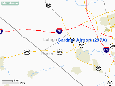
Gardner Airport (FAA LID: 29PA) is a privately owned airport located 12 miles west of Breinigsville, Pennsylvania, United States.
The above content comes from Wikipedia and is published under free licenses – click here to read more.
Location & QuickFacts
| FAA Information Effective: | 2008-09-25 |
| Airport Identifier: | 29PA |
| Airport Status: | Operational |
| Longitude/Latitude: | 075-38-35.6790W/40-33-24.3440N
-75.643244/40.556762 (Estimated) |
| Elevation: | 500 ft / 152.40 m (Estimated) |
| Land: | 100 acres |
| From nearest city: | 3 nautical miles N of Breinigsville, PA |
| Location: | Lehigh County, PA |
| Magnetic Variation: | 12W (1990) |
Owner & Manager
| Ownership: | Privately owned |
| Owner: | William Gardner |
| Address: | 9020 Schantz Rd, Rd 2 Box 991
Breinigsville, PA 18031 |
| Phone number: | 215-395-5409 |
| Manager: | William Gardner |
| Address: | 9020 Schantz Rd, Rd 2 Box 991
Breinigsville, PA 18031 |
| Phone number: | 215-395-5409 |
Airport Operations and Facilities
| Airport Use: | Private |
| Wind indicator: | Yes |
| Segmented Circle: | No |
| Control Tower: | No |
| Sectional chart: | New York |
| Region: | AEA - Eastern |
| Boundary ARTCC: | ZNY - New York |
| Tie-in FSS: | IPT - Williamsport |
| FSS on Airport: | No |
| FSS Toll Free: | 1-800-WX-BRIEF |
Runway Information
Runway 08/26
| Dimension: | 2240 x 100 ft / 682.8 x 30.5 m |
| Surface: | TURF, |
| |
Runway 08 |
Runway 26 |
| Traffic Pattern: | Left | Left |
| Obstruction: | 20 ft trees | 25 ft plines, 75.0 ft from runway |
|
Radio Navigation Aids
| ID |
Type |
Name |
Ch |
Freq |
Var |
Dist |
| LQX | NDB | Carbon | | 339.00 | 12W | 16.2 nm |
| UKT | NDB | Quakertown | | 208.00 | 12W | 17.7 nm |
| DYL | NDB | Doylestown | | 237.00 | 10W | 27.3 nm |
| HXM | NDB | Humbolt | | 366.00 | 10W | 30.5 nm |
| ING | NDB | Ambler | | 275.00 | 11W | 30.7 nm |
| NXX | NDB | Willow Grove | | 388.00 | 12W | 31.7 nm |
| CYE | NDB | Crystal Lake | | 410.00 | 11W | 40.2 nm |
| BZJ | NDB | Bellgrove | | 328.00 | 10W | 42.2 nm |
| NXX | TACAN | Willow Grove | 061X | | 10W | 31.5 nm |
| HZL | VOR | Hazleton | | 109.40 | 09W | 33.4 nm |
| PNE | VOR | North Philadelphia | | 112.00 | 10W | 40.7 nm |
| ETX | VOR/DME | East Texas | 039X | 110.20 | 09W | 2.4 nm |
| CKZ | VOR/DME | Pennridge | 025Y | 108.85 | 12W | 19.0 nm |
| ARD | VOR/DME | Yardley | 019X | 108.20 | 10W | 38.3 nm |
| BWZ | VOR/DME | Broadway | 089X | 114.20 | 11W | 40.2 nm |
| SBJ | VOR/DME | Solberg | 076X | 112.90 | 10W | 41.2 nm |
| STW | VOR/DME | Stillwater | 033X | 109.60 | 11W | 44.0 nm |
| FJC | VORTAC | Allentown | 122X | 117.50 | 10W | 13.4 nm |
| PTW | VORTAC | Pottstown | 112X | 116.50 | 09W | 20.5 nm |
| MXE | VORTAC | Modena | 079X | 113.20 | 09W | 38.4 nm |
| LRP | VORTAC | Lancaster | 120X | 117.30 | 09W | 39.6 nm |
| LVZ | VORTAC | Wilkes-barre | 053X | 111.60 | 10W | 43.1 nm |
| RAV | VORTAC | Ravine | 093X | 114.60 | 11W | 43.7 nm |
| PHL | VOT | Philadelphia Intl | | 109.80 | | 45.1 nm |
Remarks
- PRVDD ARPT OPERATES IN VFR, DALGT CONDITIONS; APPROPRIATE OBSTN CLEARANCES ARE ACHIEVED & MAINTAINED, & OPNS RESTRICTED TO LGT GENERAL AVIATION CLASS ACFT.
Images and information placed above are from
http://www.airport-data.com/airport/29PA/
We thank them for the data!
| General Info
|
| Country |
United States
|
| State |
PENNSYLVANIA
|
| FAA ID |
29PA
|
| Latitude |
40-33-24.344N
|
| Longitude |
075-38-35.679W
|
| Elevation |
500 feet
|
| Near City |
BREINIGSVILLE
|
We don't guarantee the information is fresh and accurate. The data may
be wrong or outdated.
For more up-to-date information please refer to other sources.
|
|


