 |
|
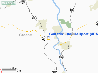
Location & QuickFacts
| FAA Information Effective: | 2008-09-25 |
| Airport Identifier: | 4PN3 |
| Airport Status: | Operational |
| Longitude/Latitude: | 079-57-02.1970W/39-51-59.2740N
-79.950610/39.866465 (Estimated) |
| Elevation: | 980 ft / 298.70 m (Estimated) |
| Land: | 0 acres |
| From nearest city: | 2 nautical miles NW of Masontown, PA |
| Location: | Greene County, PA |
| Magnetic Variation: | 07W (1985) |
Owner & Manager
| Ownership: | Privately owned |
| Owner: | Gallatin Fuel, Inc. |
| Address: | 250 W Main
Uniontown, PA 15401 |
| Phone number: | 412-966-7546 |
| Manager: | John H. Baily |
| Address: | Po Box 355
Carmichaels, PA 15320 |
| Phone number: | 412-966-5435 |
Airport Operations and Facilities
| Airport Use: | Private |
| Wind indicator: | Yes |
| Segmented Circle: | No |
| Control Tower: | No |
| Landing fee charge: | No |
| Sectional chart: | Cincinnati |
| Region: | AEA - Eastern |
| Boundary ARTCC: | ZOB - Cleveland |
| Tie-in FSS: | AOO - Altoona |
| FSS on Airport: | No |
| FSS Toll Free: | 1-800-WX-BRIEF |
Airport Services
| Airframe Repair: | NONE |
| Power Plant Repair: | NONE |
| Bottled Oxygen: | NONE |
| Bulk Oxygen: | NONE |
Runway Information
Helipad H1
| Dimension: | 60 x 50 ft / 18.3 x 15.2 m |
| Surface: | ASPH, |
| |
Runway H1 |
Runway |
| Traffic Pattern: | Left | Left |
| Runway End Identifier: | No | |
| Centerline Lights: | No | |
| Touchdown Lights: | No | |
|
Radio Navigation Aids
| ID |
Type |
Name |
Ch |
Freq |
Var |
Dist |
| VV | NDB | Camor | | 299.00 | 08W | 9.5 nm |
| PNU | NDB | Washington County | | 255.00 | 08W | 19.4 nm |
| MKP | NDB | Mc Keesport | | 287.00 | 07W | 30.4 nm |
| BHU | NDB | Benje | | 382.00 | 07W | 43.7 nm |
| SYS | NDB | Stoystown | | 209.00 | 08W | 49.4 nm |
| AGC | VOR/DME | Allegheny | 037X | 110.00 | 09W | 25.1 nm |
| HLG | VOR/DME | Wheeling | 059X | 112.20 | 07W | 37.0 nm |
| CKB | VOR/DME | Clarksburg | 073X | 112.60 | 04W | 39.7 nm |
| AIR | VOR/DME | Bellaire | 118X | 117.10 | 07W | 41.0 nm |
| GRV | VOR/DME | Grantsville | 070X | 112.30 | 06W | 43.9 nm |
| MGW | VORTAC | Morgantown | 053X | 111.60 | 05W | 19.1 nm |
| IHD | VORTAC | Indian Head | 019X | 108.20 | 06W | 28.1 nm |
| MMJ | VORTAC | Montour | 057X | 112.00 | 08W | 39.0 nm |
Images and information placed above are from
http://www.airport-data.com/airport/4PN3/
We thank them for the data!
| General Info
|
| Country |
United States
|
| State |
PENNSYLVANIA
|
| FAA ID |
4PN3
|
| Latitude |
39-51-59.274N
|
| Longitude |
079-57-02.197W
|
| Elevation |
980 feet
|
| Near City |
MASONTOWN
|
We don't guarantee the information is fresh and accurate. The data may
be wrong or outdated.
For more up-to-date information please refer to other sources.
|
|


