 |
|
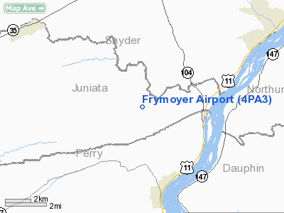
Location & QuickFacts
| FAA Information Effective: | 2008-09-25 |
| Airport Identifier: | 4PA3 |
| Airport Status: | Operational |
| Longitude/Latitude: | 077-00-36.9290W/40-37-50.3040N
-77.010258/40.630640 (Estimated) |
| Elevation: | 520 ft / 158.50 m (Estimated) |
| Land: | 0 acres |
| From nearest city: | 0 nautical miles NW of Liverpool, PA |
| Location: | Juniata County, PA |
| Magnetic Variation: | 10W (1985) |
Owner & Manager
| Ownership: | Privately owned |
| Owner: | Carson Frymoyer |
| Address: | Rd 1, Box 117c
Liverpool, PA 17045 |
| Phone number: | 717-444-2130 |
| Address: |
|
Airport Operations and Facilities
| Airport Use: | Private |
| Wind indicator: | Yes |
| Segmented Circle: | No |
| Control Tower: | No |
| Landing fee charge: | No |
| Sectional chart: | Detroit |
| Region: | AEA - Eastern |
| Boundary ARTCC: | ZNY - New York |
| Tie-in FSS: | IPT - Williamsport |
| FSS on Airport: | No |
| FSS Toll Free: | 1-800-WX-BRIEF |
Airport Services
| Airframe Repair: | NONE |
| Power Plant Repair: | NONE |
Runway Information
Runway 07/25
| Dimension: | 2040 x 100 ft / 621.8 x 30.5 m |
| Surface: | TURF, |
| |
Runway 07 |
Runway 25 |
| Traffic Pattern: | Left | Right |
| Displaced threshold: | 240.00 ft | 0.00 ft |
|
Radio Navigation Aids
| ID |
Type |
Name |
Ch |
Freq |
Var |
Dist |
| BZJ | NDB | Bellgrove | | 328.00 | 10W | 23.9 nm |
| RV | NDB | Stroh | | 407.00 | 10W | 32.3 nm |
| PIX | NDB | Picture Rocks | | 344.00 | 09W | 41.2 nm |
| EUD | NDB | York | | 254.00 | 11W | 43.1 nm |
| HZL | VOR | Hazleton | | 109.40 | 09W | 45.3 nm |
| FQM | VOR/DME | Williamsport | 091X | 114.40 | 09W | 43.9 nm |
| SEG | VORTAC | Selinsgrove | 041X | 110.40 | 08W | 11.2 nm |
| RAV | VORTAC | Ravine | 093X | 114.60 | 11W | 19.3 nm |
| HAR | VORTAC | Harrisburg | 072X | 112.50 | 10W | 19.9 nm |
| MIP | VORTAC | Milton | 029X | 109.20 | 09W | 28.3 nm |
| LRP | VORTAC | Lancaster | 120X | 117.30 | 09W | 45.0 nm |
| PSB | VORTAC | Philipsburg | 102X | 115.50 | 10W | 47.9 nm |
| MDT | VOT | Harrisburg International | | 110.00 | | 28.4 nm |
Images and information placed above are from
http://www.airport-data.com/airport/4PA3/
We thank them for the data!
| General Info
|
| Country |
United States
|
| State |
PENNSYLVANIA
|
| FAA ID |
4PA3
|
| Latitude |
40-37-50.304N
|
| Longitude |
077-00-36.929W
|
| Elevation |
520 feet
|
| Near City |
LIVERPOOL
|
We don't guarantee the information is fresh and accurate. The data may
be wrong or outdated.
For more up-to-date information please refer to other sources.
|
|


