 |
|
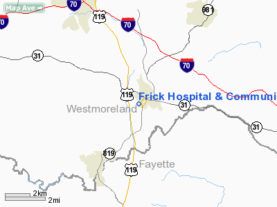
Frick Hospital & Community Health Center Heliport |
Location & QuickFacts
| FAA Information Effective: | 2008-09-25 |
| Airport Identifier: | PA29 |
| Airport Status: | Operational |
| Longitude/Latitude: | 079-33-02.1390W/40-08-43.2580N
-79.550594/40.145349 (Estimated) |
| Elevation: | 1240 ft / 377.95 m (Estimated) |
| Land: | 0 acres |
| From nearest city: | 0 nautical miles SW of Mount Pleasant, PA |
| Location: | Westmoreland County, PA |
| Magnetic Variation: | 09W (2000) |
Owner & Manager
| Ownership: | Privately owned |
| Owner: | Frick Hosp & Comm Health Ctr |
| Address: | 508 South Church St
Mt Pleasant, PA 15666 |
| Phone number: | 412-547-1000 |
| Manager: | Rodney L Gunderson |
| Address: | 508 South Church St
Mt Pleasant, PA 15666 |
| Phone number: | 412-547-1000 |
Airport Operations and Facilities
| Airport Use: | Private
MEDICAL USE. |
| Wind indicator: | Yes |
| Segmented Circle: | No |
| Control Tower: | No |
| Sectional chart: | Detroit |
| Region: | AEA - Eastern |
| Boundary ARTCC: | ZOB - Cleveland |
| Tie-in FSS: | AOO - Altoona |
| FSS Toll Free: | 1-800-WX-BRIEF |
Runway Information
Helipad H1
| Dimension: | 65 x 65 ft / 19.8 x 19.8 m |
| Surface: | ASPH, |
| |
Runway H1 |
Runway |
| Traffic Pattern: | Left | Left |
|
Radio Navigation Aids
| ID |
Type |
Name |
Ch |
Freq |
Var |
Dist |
| MKP | NDB | Mc Keesport | | 287.00 | 07W | 16.5 nm |
| VV | NDB | Camor | | 299.00 | 08W | 18.1 nm |
| BHU | NDB | Benje | | 382.00 | 07W | 18.8 nm |
| PNU | NDB | Washington County | | 255.00 | 08W | 28.1 nm |
| SYS | NDB | Stoystown | | 209.00 | 08W | 29.4 nm |
| INP | NDB | Indiana | | 242.00 | 08W | 36.7 nm |
| CBE | NDB | Cumberland | | 317.00 | 07W | 47.6 nm |
| AGC | VOR/DME | Allegheny | 037X | 110.00 | 09W | 23.9 nm |
| GRV | VOR/DME | Grantsville | 070X | 112.30 | 06W | 38.4 nm |
| REC | VOR/DME | Revloc | 043X | 110.60 | 09W | 44.0 nm |
| HLG | VOR/DME | Wheeling | 059X | 112.20 | 07W | 47.2 nm |
| IHD | VORTAC | Indian Head | 019X | 108.20 | 06W | 13.6 nm |
| JST | VORTAC | Johnstown | 077X | 113.00 | 06W | 34.5 nm |
| MMJ | VORTAC | Montour | 057X | 112.00 | 08W | 36.0 nm |
| MGW | VORTAC | Morgantown | 053X | 111.60 | 05W | 38.2 nm |
Remarks
- OBST REMOVED TO COMPLY PART 77; BLDGS LGTD; ACFT LMTD UNDER 12,500 POUNDS.
Images and information placed above are from
http://www.airport-data.com/airport/PA29/
We thank them for the data!
| General Info
|
| Country |
United States
|
| State |
PENNSYLVANIA
|
| FAA ID |
PA29
|
| Latitude |
40-08-43.258N
|
| Longitude |
079-33-02.139W
|
| Elevation |
1240 feet
|
| Near City |
MOUNT PLEASANT
|
We don't guarantee the information is fresh and accurate. The data may
be wrong or outdated.
For more up-to-date information please refer to other sources.
|
|


