 |
|
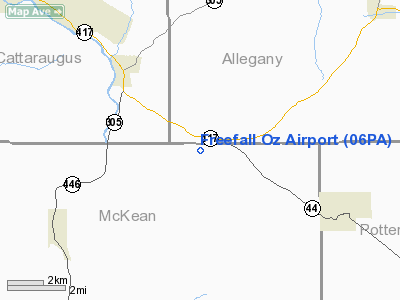
Location & QuickFacts
| FAA Information Effective: | 2008-09-25 |
| Airport Identifier: | 06PA |
| Airport Status: | Operational |
| Longitude/Latitude: | 078-17-11.4000W/41-59-45.6000N
-78.286500/41.996000 (Estimated) |
| Elevation: | 1440 ft / 438.91 m (Estimated) |
| Land: | 0 acres |
| From nearest city: | 1 nautical miles W of Ceres, PA |
| Location: | Mc Kean County, PA |
| Magnetic Variation: | 10W (1985) |
Owner & Manager
| Ownership: | Privately owned |
| Owner: | Ashley & Celene Easdon-smith |
| Address: | 296 Faulkner Road
Shinglehouse, PA 16748 |
| Phone number: | 814-697-7218 |
| Manager: | Ashley & Celene Easdon-smith |
| Address: | 296 Faulkner Road
Shinglehouse, PA 16748 |
| Phone number: | 814-697-7218 |
Airport Operations and Facilities
| Airport Use: | Private |
| Wind indicator: | Yes |
| Segmented Circle: | No |
| Control Tower: | No |
| Landing fee charge: | No |
| Sectional chart: | Detroit |
| Region: | AEA - Eastern |
| Boundary ARTCC: | ZOB - Cleveland |
| Tie-in FSS: | AOO - Altoona |
| FSS on Airport: | No |
| FSS Toll Free: | 1-800-WX-BRIEF |
Airport Services
| Airframe Repair: | NONE |
| Power Plant Repair: | NONE |
Runway Information
Runway 08/26
| Dimension: | 2965 x 100 ft / 903.7 x 30.5 m |
| Surface: | TURF, Good Condition |
| |
Runway 08 |
Runway 26 |
| Traffic Pattern: | Left | Left |
| Markings: | Nonstandard,
RY 08/26 NSTD MKGS; RY EDGES MKD WITH 6 FT SECTIONS OF CONVEYOR BELT PAINTED WHITE. RY THLDS MKD WITH SIX FT SECTIONS OF CONVEYOR BELT PAINTED RED. | Nonstandard, |
|
Radio Navigation Aids
| ID |
Type |
Name |
Ch |
Freq |
Var |
Dist |
| LYS | NDB | Olean | | 360.00 | 09W | 17.4 nm |
| EL | NDB | Halos | | 269.00 | 09W | 17.9 nm |
| BFD | VOR/DME | Bradford | 113X | 116.60 | 07W | 19.5 nm |
| JHW | VOR/DME | Jamestown | 094X | 114.70 | 07W | 39.0 nm |
| SFK | VOR/DME | Stonyfork | 023X | 108.60 | 08W | 42.8 nm |
| ELZ | VORTAC | Wellsville | 051X | 111.40 | 09W | 14.0 nm |
| SLT | VORTAC | Slate Run | 086X | 113.90 | 08W | 32.3 nm |
| ETG | VORTAC | Keating | 107X | 116.00 | 10W | 47.4 nm |
Remarks
- 800 FT MTN 1NM WSW. 100 FT PLINE 1NM W.
Images and information placed above are from
http://www.airport-data.com/airport/06PA/
We thank them for the data!
| General Info
|
| Country |
United States
|
| State |
PENNSYLVANIA
|
| FAA ID |
06PA
|
| Latitude |
42-00-30.236N
|
| Longitude |
078-15-29.047W
|
| Elevation |
1440 feet
|
| Near City |
CERES
|
We don't guarantee the information is fresh and accurate. The data may
be wrong or outdated.
For more up-to-date information please refer to other sources.
|
|


