 |
|
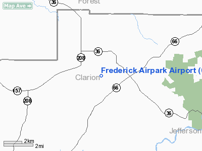
Frederick Airpark Airport |
Location & QuickFacts
| FAA Information Effective: | 2008-09-25 |
| Airport Identifier: | 0PS0 |
| Airport Status: | Operational |
| Longitude/Latitude: | 079-20-30.1580W/41-22-15.2250N
-79.341711/41.370896 (Estimated) |
| Elevation: | 1560 ft / 475.49 m (Estimated) |
| Land: | 10 acres |
| From nearest city: | 2 nautical miles W of Tylersburg, PA |
| Location: | Clarion County, PA |
| Magnetic Variation: | 09W (1985) |
Owner & Manager
| Ownership: | Privately owned |
| Owner: | Haf Aviation |
| Address: | Po Box 22
Tylersburg, PA 16361 |
| Phone number: | 814-744-8001 |
| Manager: | Joseph R. Hall, Jr. |
| Address: | Po Box 22
Tylersburg, PA 16361 |
| Phone number: | 814-744-8838 |
Airport Operations and Facilities
| Airport Use: | Private |
| Wind indicator: | Yes |
| Segmented Circle: | No |
| Control Tower: | No |
| Landing fee charge: | No |
| Sectional chart: | Detroit |
| Region: | AEA - Eastern |
| Boundary ARTCC: | ZOB - Cleveland |
| Tie-in FSS: | AOO - Altoona |
| FSS on Airport: | No |
| FSS Toll Free: | 1-800-WX-BRIEF |
Airport Communications
Runway Information
Runway 01/19
| Dimension: | 2200 x 100 ft / 670.6 x 30.5 m |
| Surface: | TURF, |
| |
Runway 01 |
Runway 19 |
| Traffic Pattern: | Left | Left |
| Displaced threshold: | 400.00 ft | 400.00 ft |
| Obstruction: | 30 ft trees, 500.0 ft from runway | 30 ft trees, 500.0 ft from runway |
|
Radio Navigation Aids
| ID |
Type |
Name |
Ch |
Freq |
Var |
Dist |
| ORJ | NDB | Corry | | 258.00 | 09W | 35.4 nm |
| INP | NDB | Indiana | | 242.00 | 08W | 46.1 nm |
| FKL | VOR | Franklin | | 109.60 | 06W | 23.6 nm |
| CIP | VOR/DME | Clarion | 076X | 112.90 | 06W | 14.5 nm |
| BFD | VOR/DME | Bradford | 113X | 116.60 | 07W | 41.0 nm |
| TDT | VORTAC | Tidioute | 123X | 117.60 | 09W | 20.8 nm |
Images and information placed above are from
http://www.airport-data.com/airport/0PS0/
We thank them for the data!
| General Info
|
| Country |
United States
|
| State |
PENNSYLVANIA
|
| FAA ID |
0PS0
|
| Latitude |
41-22-15.225N
|
| Longitude |
079-20-30.158W
|
| Elevation |
1560 feet
|
| Near City |
TYLERSBURG
|
We don't guarantee the information is fresh and accurate. The data may
be wrong or outdated.
For more up-to-date information please refer to other sources.
|
|


