 |
|
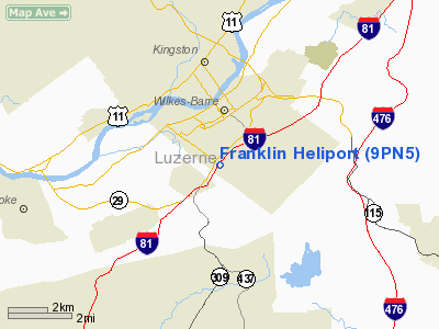
Location & QuickFacts
| FAA Information Effective: | 2008-09-25 |
| Airport Identifier: | 9PN5 |
| Airport Status: | Operational |
| Longitude/Latitude: | 075-52-51.7070W/41-13-11.2940N
-75.881030/41.219804 (Estimated) |
| Elevation: | 710 ft / 216.41 m (Estimated) |
| Land: | 0 acres |
| From nearest city: | 2 nautical miles S of Wilkes Barre, PA |
| Location: | Luzerne County, PA |
| Magnetic Variation: | 11W (1985) |
Owner & Manager
| Ownership: | Privately owned |
| Owner: | No 1 Cont Corp |
| Address: | 800 Exeter Ave West
Pittston, PA 18643 |
| Phone number: | 717-654-3355 |
| Manager: | A.j. Roman |
| Address: | 800 Exeter Ave West
Pittston, PA 18643 |
| Phone number: | 717-654-3355 |
Airport Operations and Facilities
| Airport Use: | Private |
| Wind indicator: | No |
| Segmented Circle: | No |
| Control Tower: | No |
| Landing fee charge: | No |
| Sectional chart: | New York |
| Region: | AEA - Eastern |
| Boundary ARTCC: | ZNY - New York |
| Tie-in FSS: | IPT - Williamsport |
| FSS on Airport: | No |
| FSS Toll Free: | 1-800-WX-BRIEF |
Runway Information
Helipad H1
| Dimension: | 140 x 90 ft / 42.7 x 27.4 m |
| Surface: | GRAVEL, |
| |
Runway H1 |
Runway |
| Traffic Pattern: | Left | Left |
|
Radio Navigation Aids
| ID |
Type |
Name |
Ch |
Freq |
Var |
Dist |
| CYE | NDB | Crystal Lake | | 410.00 | 11W | 2.3 nm |
| HXM | NDB | Humbolt | | 366.00 | 10W | 14.9 nm |
| LQX | NDB | Carbon | | 339.00 | 12W | 25.1 nm |
| PIX | NDB | Picture Rocks | | 344.00 | 09W | 37.6 nm |
| HZL | VOR | Hazleton | | 109.40 | 09W | 18.4 nm |
| ETX | VOR/DME | East Texas | 039X | 110.20 | 09W | 39.4 nm |
| FQM | VOR/DME | Williamsport | 091X | 114.40 | 09W | 41.0 nm |
| STW | VOR/DME | Stillwater | 033X | 109.60 | 11W | 47.8 nm |
| LVZ | VORTAC | Wilkes-barre | 053X | 111.60 | 10W | 9.2 nm |
| LHY | VORTAC | Lake Henry | 045X | 110.80 | 10W | 23.7 nm |
| FJC | VORTAC | Allentown | 122X | 117.50 | 10W | 35.4 nm |
| MIP | VORTAC | Milton | 029X | 109.20 | 09W | 37.4 nm |
Images and information placed above are from
http://www.airport-data.com/airport/9PN5/
We thank them for the data!
| General Info
|
| Country |
United States
|
| State |
PENNSYLVANIA
|
| FAA ID |
9PN5
|
| Latitude |
41-13-11.294N
|
| Longitude |
075-52-51.707W
|
| Elevation |
710 feet
|
| Near City |
WILKES BARRE
|
We don't guarantee the information is fresh and accurate. The data may
be wrong or outdated.
For more up-to-date information please refer to other sources.
|
|


