|
|
Franklin County Rgnl Airport |
| Franklin County Regional Airport |
| IATA: none – ICAO: none – FAA LID: N68 |
| Summary |
| Airport type |
Public |
| Owner |
Susquehanna Area Regional Airport Authority |
| Location |
Chambersburg, Pennsylvania |
| Elevation AMSL |
697 ft / 212.4 m |
| Coordinates |
39°58′19.6″N 77°38′35.7″W / 39.972111°N 77.64325°W / 39.972111; -77.64325 |
| Runways |
| Direction |
Length |
Surface |
| ft |
m |
| 6/24 |
3,300 |
1,006 |
Asphalt |
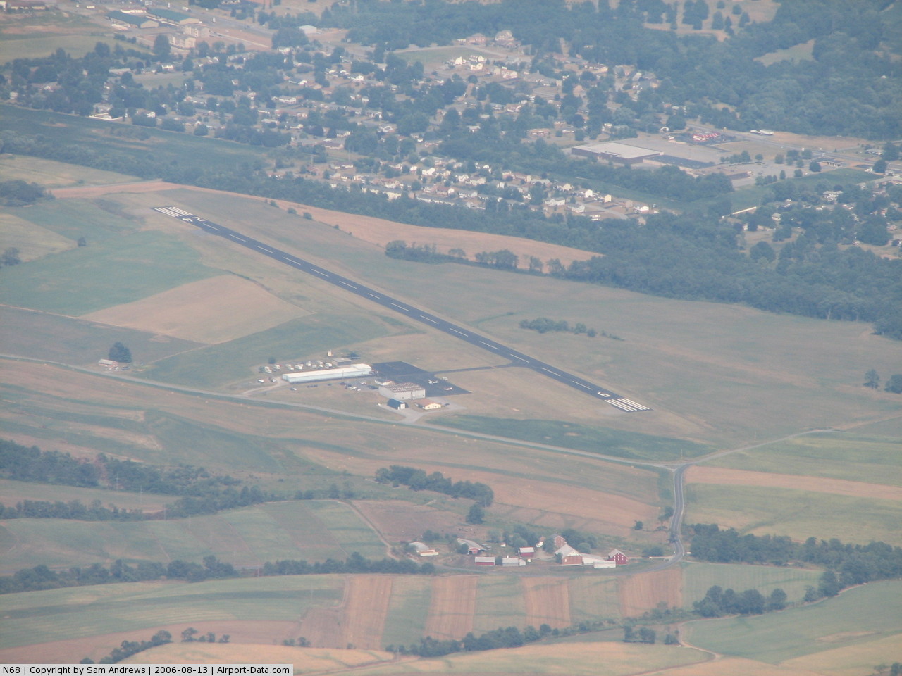
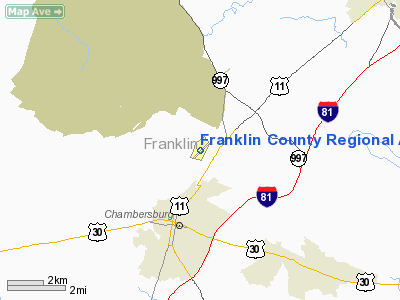
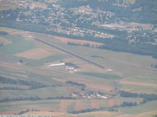
Franklin County Regional Airport (FAA LID: N68), formerly known as Chambersburg Municipal Airport, is a general aviation airport located three miles (5 km) north of the Borough of Chambersburg, in Franklin County, Pennsylvania, USA. The airport is situated approximately 45 miles southwest of Harrisburg.
In 2004, the Susquehanna Area Regional Airport Authority (SARAA) bought Franklin County Regional Airport and formed a Study Advisory Group (SAG) to develop a list of recommended improvements at the airport. Those improvements include: rehabilitation of the runway, taxiway, ramp area and other landside faculties, additional parking, signage, hangars, an automated weather observation station (AWOS) and a fueling service. The improvements will be made on a priority basis and as grant monies become available. Facilities
Franklin County Regional Airport has one runway:
- Runway 8/26: 3,300 x 75 ft. (1,006 x 23 m), Surface: Asphalt
Statistics
- 13,500 total aircraft operations in 2004
The above content comes from Wikipedia and is published under free licenses – click here to read more.
 |
(Click on the photo to enlarge) |
Location & QuickFacts
| FAA Information Effective: | 2008-09-25 |
| Airport Identifier: | N68 |
| Airport Status: | Operational |
| Longitude/Latitude: | 077-38-35.7640W/39-58-22.6260N
-77.643268/39.972952 (Estimated) |
| Elevation: | 697 ft / 212.45 m (Surveyed) |
| Land: | 95 acres |
| From nearest city: | 3 nautical miles N of Chambersburg, PA |
| Location: | Franklin County, PA |
| Magnetic Variation: | 11W (2000) |
Owner & Manager
| Ownership: | Publicly owned |
| Owner: | Susquehanna Area Regional Airport A |
| Address: | One Terminal Drive, Suite 300
Middletown, PA 17057 |
| Phone number: | 717-948-3900 |
| Manager: | Tim Edwards |
| Address: | One Terminal Drive, Suite 300, 208 Airport Drive
Middletown, PA 17057 |
| Phone number: | 717-948-3900 |
Airport Operations and Facilities
| Airport Use: | Open to public |
| Wind indicator: | Yes |
| Segmented Circle: | Yes |
| Control Tower: | No |
| Lighting Schedule: | DUSK-DAWN
ACTVT LIRL RY 06/24 & VASI RY 24 - CTAF. |
| Beacon Color: | Clear-Green (lighted land airport) |
| Landing fee charge: | No |
| Sectional chart: | Washington |
| Region: | AEA - Eastern |
| Traffic Pattern Alt: | 800 ft |
| Boundary ARTCC: | ZNY - New York |
| Tie-in FSS: | IPT - Williamsport |
| FSS on Airport: | No |
| FSS Toll Free: | 1-800-WX-BRIEF
|
| NOTAMs Facility: | IPT (NOTAM-d service avaliable) |
| Federal Agreements: | NGY |
Airport Communications
| CTAF: | 122.800 |
| Unicom: | 122.800 |
Airport Services
| Airframe Repair: | MINOR |
| Power Plant Repair: | MINOR |
| Bulk Oxygen: | NONE |
Runway Information
Runway 06/24
| Dimension: | 3300 x 75 ft / 1005.8 x 22.9 m |
| Surface: | ASPH, Fair Condition |
| Weight Limit: | Single wheel: 12500 lbs. |
| Edge Lights: | Low |
| |
Runway 06 |
Runway 24 |
| Longitude: | 077-38-51.5260W | 077-38-19.9480W |
| Latitude: | 39-58-11.7810N | 39-58-33.5380N |
| Elevation: | 683.00 ft | 683.00 ft |
| Alignment: | 48 | 127 |
| Traffic Pattern: | Left | Right |
| Markings: | Non-precision instrument, Good Condition | Non-precision instrument, Good Condition |
| Crossing Height: | 0.00 ft | 40.00 ft |
| VASI: | | 2-box on left side |
| Visual Glide Angle: | 0.00° | 3.00° |
| Obstruction: | 25 ft pole, 672.0 ft from runway, 202 ft left of centerline, 18:1 slope to clear | 36 ft trees, 369.0 ft from runway, 214 ft left of centerline, 5:1 slope to clear |
|
Radio Navigation Aids
| ID |
Type |
Name |
Ch |
Freq |
Var |
Dist |
| EUD | NDB | York | | 254.00 | 11W | 35.4 nm |
| RV | NDB | Stroh | | 407.00 | 10W | 38.7 nm |
| HGR | VOR | Hagerstown | | 109.80 | 07W | 19.2 nm |
| FDK | VOR | Frederick | | 109.00 | 08W | 35.9 nm |
| AOO | VOR | Altoona | | 108.80 | 07W | 37.0 nm |
| THS | VORTAC | St Thomas | 097X | 115.00 | 07W | 14.4 nm |
| HAR | VORTAC | Harrisburg | 072X | 112.50 | 10W | 33.0 nm |
| MRB | VORTAC | Martinsburg | 058X | 112.10 | 07W | 36.6 nm |
| EMI | VORTAC | Westminster | 126X | 117.90 | 08W | 42.1 nm |
| MDT | VOT | Harrisburg International | | 110.00 | | 42.7 nm |
Remarks
Images and information placed above are from
http://www.airport-data.com/airport/N68/
We thank them for the data!
| General Info
|
| Country |
United States
|
| State |
PENNSYLVANIA
|
| FAA ID |
N68
|
| Latitude |
39-58-22.626N
|
| Longitude |
077-38-35.764W
|
| Elevation |
697 feet
|
| Near City |
CHAMBERSBURG
|
We don't guarantee the information is fresh and accurate. The data may
be wrong or outdated.
For more up-to-date information please refer to other sources.
|
|