 |
|
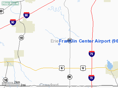
Location & QuickFacts
| FAA Information Effective: | 2008-09-25 |
| Airport Identifier: | 96PA |
| Airport Status: | Operational |
| Longitude/Latitude: | 080-14-59.2180W/41-55-15.2000N
-80.249783/41.920889 (Estimated) |
| Elevation: | 1225 ft / 373.38 m (Surveyed) |
| Land: | 25 acres |
| From nearest city: | 4 nautical miles NE of Cranesville, PA |
| Location: | Erie County, PA |
| Magnetic Variation: | 08W (1985) |
Owner & Manager
| Ownership: | Privately owned |
| Owner: | Stephen Chivari, Jr. |
| Address: | Rd 1,box 219
Cranesville, PA 16410 |
| Phone number: | 814-734-1960 |
| Manager: | Stephen Chivari |
| Address: | Rd 1, Box 219
Cranesville, PA 16410 |
| Phone number: | 814-734-1960 |
Airport Operations and Facilities
| Airport Use: | Private |
| Wind indicator: | Yes |
| Segmented Circle: | No |
| Control Tower: | No |
| Landing fee charge: | No |
| Sectional chart: | Detroit |
| Region: | AEA - Eastern |
| Boundary ARTCC: | ZOB - Cleveland |
| Tie-in FSS: | AOO - Altoona |
| FSS on Airport: | No |
| FSS Toll Free: | 1-800-WX-BRIEF |
Airport Services
| Airframe Repair: | NONE |
| Power Plant Repair: | NONE |
Runway Information
Runway E/W
| Dimension: | 2000 x 150 ft / 609.6 x 45.7 m |
| Surface: | TURF, |
| |
Runway E |
Runway W |
| Traffic Pattern: | Left | Left |
|
Runway NE/SW
| Dimension: | 2600 x 200 ft / 792.5 x 61.0 m |
| Surface: | TURF, |
| |
Runway NE |
Runway SW |
| Traffic Pattern: | Left | Left |
|
Radio Navigation Aids
| ID |
Type |
Name |
Ch |
Freq |
Var |
Dist |
| CQD | NDB | Cascade | | 372.00 | 08W | 13.6 nm |
| ORJ | NDB | Corry | | 258.00 | 09W | 26.9 nm |
| HBD | NDB | Hubbard | | 408.00 | 08W | 47.9 nm |
| FKL | VOR | Franklin | | 109.60 | 06W | 33.9 nm |
| JFN | VOR/DME | Jefferson | 099X | 115.20 | 05W | 24.3 nm |
| CXR | VOR/DME | Chardon | 074X | 112.70 | 05W | 47.6 nm |
| ERI | VORTAC | Erie | 031X | 109.40 | 06W | 6.1 nm |
| TDT | VORTAC | Tidioute | 123X | 117.60 | 09W | 39.3 nm |
| YNG | VORTAC | Youngstown | 027X | 109.00 | 05W | 40.3 nm |
Remarks
- LDG AREA SOFT WHEN WET IN FALL AND SPRING
- BUILT BEFORE 1959.
Images and information placed above are from
http://www.airport-data.com/airport/96PA/
We thank them for the data!
| General Info
|
| Country |
United States
|
| State |
PENNSYLVANIA
|
| FAA ID |
96PA
|
| Latitude |
41-55-15.200N
|
| Longitude |
080-14-59.218W
|
| Elevation |
1225 feet
|
| Near City |
CRANESVILLE
|
We don't guarantee the information is fresh and accurate. The data may
be wrong or outdated.
For more up-to-date information please refer to other sources.
|
|


