 |
|
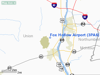
Location & QuickFacts
| FAA Information Effective: | 2008-09-25 |
| Airport Identifier: | 3PA6 |
| Airport Status: | Operational |
| Longitude/Latitude: | 076-54-00.8730W/40-59-36.3050N
-76.900243/40.993418 (Estimated) |
| Elevation: | 540 ft / 164.59 m (Estimated) |
| Land: | 0 acres |
| From nearest city: | 2 nautical miles S of Lewisburg, PA |
| Location: | Union County, PA |
| Magnetic Variation: | 11W (1990) |
Owner & Manager
| Ownership: | Privately owned |
| Owner: | Melvin E Reed |
| Address: | 413 Hospital Dr
Lewisburg, PA 17837 |
| Phone number: | 717-524-4393 |
| Manager: | Melvin E Reed |
| Address: | 413 Hospital Dr
Lewisburg, PA 17837 |
| Phone number: | 717-524-4393 |
Airport Operations and Facilities
| Airport Use: | Private |
| Wind indicator: | Yes |
| Segmented Circle: | No |
| Control Tower: | No |
| Sectional chart: | New York |
| Region: | AEA - Eastern |
| Boundary ARTCC: | ZNY - New York |
| Tie-in FSS: | IPT - Williamsport |
| FSS on Airport: | No |
| FSS Toll Free: | 1-800-WX-BRIEF |
Runway Information
Runway 09/27
| Dimension: | 1200 x 100 ft / 365.8 x 30.5 m |
| Surface: | TURF, |
| |
Runway 09 |
Runway 27 |
| Traffic Pattern: | Left | Left |
| Displaced threshold: | 0.00 ft | 580.00 ft |
| Obstruction: | | 30 ft plines |
|
Radio Navigation Aids
| ID |
Type |
Name |
Ch |
Freq |
Var |
Dist |
| PIX | NDB | Picture Rocks | | 344.00 | 09W | 19.1 nm |
| BZJ | NDB | Bellgrove | | 328.00 | 10W | 37.1 nm |
| HXM | NDB | Humbolt | | 366.00 | 10W | 41.0 nm |
| RV | NDB | Stroh | | 407.00 | 10W | 43.6 nm |
| HZL | VOR | Hazleton | | 109.40 | 09W | 35.2 nm |
| FQM | VOR/DME | Williamsport | 091X | 114.40 | 09W | 21.5 nm |
| SFK | VOR/DME | Stonyfork | 023X | 108.60 | 08W | 48.3 nm |
| MIP | VORTAC | Milton | 029X | 109.20 | 09W | 10.8 nm |
| SEG | VORTAC | Selinsgrove | 041X | 110.40 | 08W | 12.2 nm |
| RAV | VORTAC | Ravine | 093X | 114.60 | 11W | 29.8 nm |
| HAR | VORTAC | Harrisburg | 072X | 112.50 | 10W | 42.3 nm |
| PSB | VORTAC | Philipsburg | 102X | 115.50 | 10W | 49.8 nm |
| MDT | VOT | Harrisburg International | | 110.00 | | 48.2 nm |
Remarks
- OWNER DESIRES ARPT NOT TO BE CHARTED.
- SEE AIRSPACE LTR DTD JUNE 22, 1992. NOTE: THIS FACILITY HAS NO OBJECTION AS AN ULTRALIGHT FLIGHT PARK.
Images and information placed above are from
http://www.airport-data.com/airport/3PA6/
We thank them for the data!
| General Info
|
| Country |
United States
|
| State |
PENNSYLVANIA
|
| FAA ID |
3PA6
|
| Latitude |
40-59-36.305N
|
| Longitude |
076-54-00.873W
|
| Elevation |
540 feet
|
| Near City |
LEWISBURG
|
We don't guarantee the information is fresh and accurate. The data may
be wrong or outdated.
For more up-to-date information please refer to other sources.
|
|


