 |
|
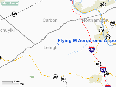
Flying M Aerodrome Airport |
Location & QuickFacts
| FAA Information Effective: | 2008-09-25 |
| Airport Identifier: | P91 |
| Airport Status: | Operational |
| Longitude/Latitude: | 075-42-18.6790W/40-44-14.3410N
-75.705189/40.737317 (Estimated) |
| Elevation: | 735 ft / 224.03 m (Estimated) |
| Land: | 50 acres |
| From nearest city: | 2 nautical miles N of Germansville, PA |
| Location: | Lehigh County, PA |
| Magnetic Variation: | 11W (1985) |
Owner & Manager
| Ownership: | Privately owned |
| Owner: | Lehigh Land Leasing Ltd |
| Address: | 5363 Mountain Rd, Po Box 65
Germansville, PA 18053 |
| Phone number: | 610-767-4133 |
| Manager: | Peter Maniscalco |
| Address: | P.o. Box 883
Lake Hopatcong, NJ 07849-0883 |
| Phone number: | 610-248-8190 |
Airport Operations and Facilities
| Airport Use: | Open to public |
| Wind indicator: | Yes |
| Segmented Circle: | No |
| Control Tower: | No |
| Landing fee charge: | No |
| Sectional chart: | New York |
| Region: | AEA - Eastern |
| Boundary ARTCC: | ZNY - New York |
| Tie-in FSS: | IPT - Williamsport |
| FSS on Airport: | No |
| FSS Toll Free: | 1-800-WX-BRIEF |
| NOTAMs Facility: | IPT (NOTAM-d service avaliable) |
Airport Communications
| CTAF: | 122.725 |
| Unicom: | 122.725 |
Airport Services
| Airframe Repair: | MINOR |
| Power Plant Repair: | MINOR |
Runway Information
Runway 08/26
| Dimension: | 2370 x 100 ft / 722.4 x 30.5 m |
| Surface: | TURF, Good Condition |
| |
Runway 08 |
Runway 26 |
| Traffic Pattern: | Left | Left |
| Displaced threshold: | 0.00 ft | 300.00 ft
DSPLCD THR MARKED WITH CONES & THREE LIGHTS EACH SIDE. |
| Obstruction: | 24 ft pline, 945.0 ft from runway, 15 ft left of centerline, 38:1 slope to clear | 66 ft trees, 691.0 ft from runway, 122 ft left of centerline, 10:1 slope to clear
APCH RATIO 20:1 BASED ON DSPLCD THLD. |
|
Radio Navigation Aids
| ID |
Type |
Name |
Ch |
Freq |
Var |
Dist |
| LQX | NDB | Carbon | | 339.00 | 12W | 5.1 nm |
| HXM | NDB | Humbolt | | 366.00 | 10W | 20.1 nm |
| UKT | NDB | Quakertown | | 208.00 | 12W | 26.4 nm |
| CYE | NDB | Crystal Lake | | 410.00 | 11W | 29.0 nm |
| DYL | NDB | Doylestown | | 237.00 | 10W | 35.9 nm |
| ING | NDB | Ambler | | 275.00 | 11W | 41.5 nm |
| NXX | NDB | Willow Grove | | 388.00 | 12W | 41.7 nm |
| BZJ | NDB | Bellgrove | | 328.00 | 10W | 42.7 nm |
| NXX | TACAN | Willow Grove | 061X | | 10W | 41.4 nm |
| HZL | VOR | Hazleton | | 109.40 | 09W | 23.9 nm |
| ETX | VOR/DME | East Texas | 039X | 110.20 | 09W | 9.4 nm |
| CKZ | VOR/DME | Pennridge | 025Y | 108.85 | 12W | 28.2 nm |
| BWZ | VOR/DME | Broadway | 089X | 114.20 | 11W | 40.4 nm |
| STW | VOR/DME | Stillwater | 033X | 109.60 | 11W | 41.1 nm |
| SBJ | VOR/DME | Solberg | 076X | 112.90 | 10W | 44.9 nm |
| ARD | VOR/DME | Yardley | 019X | 108.20 | 10W | 46.6 nm |
| FJC | VORTAC | Allentown | 122X | 117.50 | 10W | 11.4 nm |
| PTW | VORTAC | Pottstown | 112X | 116.50 | 09W | 31.7 nm |
| LVZ | VORTAC | Wilkes-barre | 053X | 111.60 | 10W | 32.2 nm |
| RAV | VORTAC | Ravine | 093X | 114.60 | 11W | 42.3 nm |
| LHY | VORTAC | Lake Henry | 045X | 110.80 | 10W | 45.5 nm |
| LRP | VORTAC | Lancaster | 120X | 117.30 | 09W | 45.8 nm |
| MIP | VORTAC | Milton | 029X | 109.20 | 09W | 46.9 nm |
| MXE | VORTAC | Modena | 079X | 113.20 | 09W | 49.3 nm |
Images and information placed above are from
http://www.airport-data.com/airport/P91/
We thank them for the data!
| General Info
|
| Country |
United States
|
| State |
PENNSYLVANIA
|
| FAA ID |
P91
|
| Latitude |
40-44-14.341N
|
| Longitude |
075-42-18.679W
|
| Elevation |
710 feet
|
| Near City |
GERMANSVILLE
|
We don't guarantee the information is fresh and accurate. The data may
be wrong or outdated.
For more up-to-date information please refer to other sources.
|
|


