 |
|
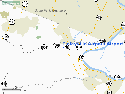
Finleyville Airpark Airport |
Location & QuickFacts
| FAA Information Effective: | 2008-09-25 |
| Airport Identifier: | G05 |
| Airport Status: | Operational |
| Longitude/Latitude: | 080-00-44.1860W/40-14-45.2520N
-80.012274/40.245903 (Estimated) |
| Elevation: | 1240 ft / 377.95 m (Estimated) |
| Land: | 66 acres |
| From nearest city: | 1 nautical miles SW of Finleyville, PA |
| Location: | Washington County, PA |
| Magnetic Variation: | 07W (1985) |
Owner & Manager
| Ownership: | Privately owned |
| Owner: | Finleyville Airport, Inc |
| Address: | P.o. Box 231
Finleyville, PA 15332 |
| Phone number: | 724-348-7202 |
| Manager: | Charles Wilhelm |
| Address: | Po Box 231
Finleyville, PA 15332 |
| Phone number: | 724-348-6902 |
Airport Operations and Facilities
| Airport Use: | Open to public |
| Wind indicator: | Yes |
| Segmented Circle: | No |
| Control Tower: | No |
| Lighting Schedule: | DUSK-0000
AFTER 0000 ACTVT LIRL & ROTG BCN - CTAF. |
| Beacon Color: | Clear-Green (lighted land airport) |
| Landing fee charge: | No |
| Sectional chart: | Detroit |
| Region: | AEA - Eastern |
| Boundary ARTCC: | ZOB - Cleveland |
| Tie-in FSS: | AOO - Altoona |
| FSS on Airport: | No |
| FSS Toll Free: | 1-800-WX-BRIEF |
| NOTAMs Facility: | AOO (NOTAM-d service avaliable) |
Airport Communications
| CTAF: | 123.000 |
| Unicom: | 123.000 |
Airport Services
| Fuel available: | 100LL |
| Bottled Oxygen: | NONE |
| Bulk Oxygen: | NONE |
Runway Information
Runway 14/32
| Dimension: | 2505 x 50 ft / 763.5 x 15.2 m |
| Surface: | ASPH, Fair Condition |
| Edge Lights: | Low |
| |
Runway 14 |
Runway 32 |
| Traffic Pattern: | Left | Left |
| Markings: | Basic, Fair Condition | Basic, Good Condition |
| Obstruction: | , 50:1 slope to clear | 67 ft trees, 650.0 ft from runway, 69 ft right of centerline, 6:1 slope to clear
RY 32 HAS +24 FT TREES, 16 FT FM THLD, 92 FT RIGHT. RY 32 HAS +2 FT BRUSH, 171 FT FM THLD, 95 FT LEFT. |
|
Radio Navigation Aids
| ID |
Type |
Name |
Ch |
Freq |
Var |
Dist |
| PNU | NDB | Washington County | | 255.00 | 08W | 9.2 nm |
| MKP | NDB | Mc Keesport | | 287.00 | 07W | 12.5 nm |
| VV | NDB | Camor | | 299.00 | 08W | 25.1 nm |
| BHU | NDB | Benje | | 382.00 | 07W | 34.8 nm |
| CFX | NDB | Cadiz | | 239.00 | 07W | 45.9 nm |
| INP | NDB | Indiana | | 242.00 | 08W | 49.1 nm |
| AGC | VOR/DME | Allegheny | 037X | 110.00 | 09W | 2.4 nm |
| HLG | VOR/DME | Wheeling | 059X | 112.20 | 07W | 25.5 nm |
| AIR | VOR/DME | Bellaire | 118X | 117.10 | 07W | 39.5 nm |
| MMJ | VORTAC | Montour | 057X | 112.00 | 08W | 16.8 nm |
| IHD | VORTAC | Indian Head | 019X | 108.20 | 06W | 34.2 nm |
| EWC | VORTAC | Ellwood City | 105X | 115.80 | 08W | 36.0 nm |
| MGW | VORTAC | Morgantown | 053X | 111.60 | 05W | 42.0 nm |
Remarks
- TRRN FALLS OFF RAPIDLY OFF AER 14; TRRN RISES OFF AER 32.
- TRANSIENT PILOTS ADVISED TO CHECK RY COND PRIOR TO USE DURG WINTER MONTHS.
- DEER ON & INVOF RY.
- ULTRALIGHTS AVOID OVERFLYING HOUSES NORTHEAST OF ARPT.
- HELICOPTERS FOLLOW FIXED WING TRAFFIC PATTERN.
- VFR OPNS ONLY
Images and information placed above are from
http://www.airport-data.com/airport/G05/
We thank them for the data!
| General Info
|
| Country |
United States
|
| State |
PENNSYLVANIA
|
| FAA ID |
G05
|
| Latitude |
40-14-45.252N
|
| Longitude |
080-00-44.186W
|
| Elevation |
1240 feet
|
| Near City |
FINLEYVILLE
|
We don't guarantee the information is fresh and accurate. The data may
be wrong or outdated.
For more up-to-date information please refer to other sources.
|
|


