 |
|
Erie Intl/tom Ridge Field Airport |
Erie International Airport
Tom Ridge Field |
 |
| IATA: ERI – ICAO: KERI |
| Summary |
| Airport type |
Public |
| Owner |
Erie Municipal Airport Authority |
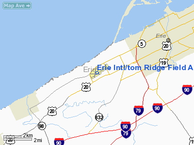
| Location |
Erie, Pennsylvania |
| Elevation AMSL |
733 ft / 223.4 m |
| Coordinates |
42°04′55″N 80°10′34″W / 42.08194°N 80.17611°W / 42.08194; -80.17611 |
| Website |
www.erieairport.org |
| Runways |
| Direction |
Length |
Surface |
| ft |
m |
| 6/24 |
6,500 |
1,981 |
Asphalt/Concrete |
| 2/20 |
3,507 |
1,069 |
Asphalt |
| Statistics |
| Passengers (2007) |
142,785 ▼ 11% |
Erie International Airport / Tom Ridge Field (IATA: ERI, ICAO: KERI) is a public airport serving northwestern Pennsylvania and is located five miles (8 km) southwest of the central business district (CBD) of Erie, a city in Erie County. It features commercial service by regional airlines, connecting passengers to hubs in the northeast, midwest, and southeast. The airport faces stiff competition from the Pittsburgh, Cleveland and Buffalo airports, all of which are within two hours of Erie via ground transport. The airport was recognized in 2004 as the third fastest growing airport in the United States, and the fastest growing airport in Pennsylvania. History
Prior to the events of September 11, 2001, the airport was at its height with US Airways mainline jets offering service to Pittsburgh and international service to Toronto. After 9/11, US Airways transitioned from 737s and DC-9s to regional jet service. As air service rebounded in the mid 2000's, the airport offered service on US Airways Express to Pittsburgh, Philadelphia, and Charlotte; Northwest Airlink to Detroit; Continental Connection to Cleveland; and Delta Connection to Cincinnati and Atlanta. The airport is reportedly looking to expand service to New York, Chicago, and many other cities. The airport has been served by many airlines over the years. US Airways discontinued Charlotte service in 2006. Delta Air Lines discontinued service to Atlanta on 6 September 2007. In early 2008, US Airways discontinued Erie-Pittsburgh service. As of January 2010, US Airways Express service has been reduced to three flights a day to Philadelphia; Delta Connection offers five flights a day to Detroit; and Continental Connection offers four flights a day to Cleveland. As is the case across the country, the high cost of fuel is causing airlines to reduce regional flying and cut routes to smaller airports such as Erie.
Current News
Erie International is in the process of a major expansion program. The plan includes expanding runway 6/24, establishing a relationship with an airport in Germany to create a major cargo bridge, and attracting new airlines offering service to more destinations. The terminal is very navigable and has virtually no wait at the security check-point. About 200,000 people used the airport in 2006, and that is down 14% due to airlines cutting back on seats.
Facilities
Erie International/Tom Ridge Field covers 450 acres (182 ha) and has two runways:
- Runway 2/20: 3,507 x 150 ft (1,069 x 46 m), Surface: Asphalt
- Runway 6/24: 6,500 x 150 ft (1,981 x 46 m), Surface: Asphalt/Concrete
Airlines and destinations
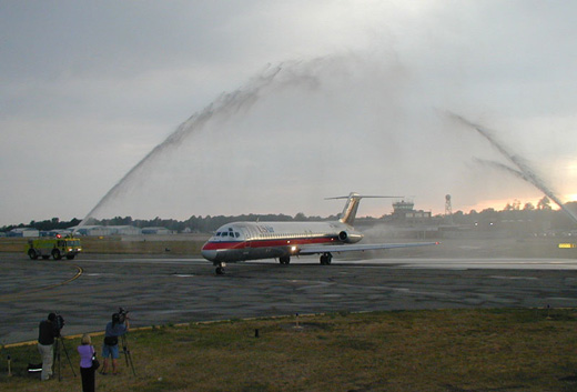 | |
The last DC-9 to fly for US Air arriving at Erie International Airport. |
| Airlines |
Destinations |
| Continental Connection operated by CommutAir |
Cleveland |
| Delta Connection operated by Mesaba Airlines |
Detroit |
| Delta Connection operated by Pinnacle Airlines |
Detroit |
| US Airways Express operated by Air Wisconsin |
Philadelphia |
| US Airways Express operated by Piedmont Airlines |
Philadelphia |
Accidents/Incidents
- In 1986 USAir Flight 499, a DC-9, from Toronto Pearson landed on snow covered runway 24, and slid off the runway to rest over Asbury Road on the western perimeter of the airport.
- In 1984, a USAir chartered flight, an MD-80 carrying a football team, landed in snowy conditions on a soft patch of land next to the runway.
The above content comes from Wikipedia and is published under free licenses – click here to read more.
Location & QuickFacts
| FAA Information Effective: | 2008-09-25 |
| Airport Identifier: | ERI |
| Airport Status: | Operational |
| Longitude/Latitude: | 080-10-34.3760W/42-04-55.2770N
-80.176216/42.082021 (Estimated) |
| Elevation: | 733 ft / 223.42 m (Surveyed) |
| Land: | 450 acres |
| From nearest city: | 5 nautical miles SW of Erie, PA |
| Location: | Erie County, PA |
| Magnetic Variation: | 08W (1985) |
Owner & Manager
| Ownership: | Publicly owned |
| Owner: | Erie Regional Arpt Authority |
| Address: | 4411 W 12th St
Erie, PA 16505 |
| Phone number: | 814-833-4258 |
| Manager: | Christopher L Rodgers |
| Address: | 4411 W 12th St
Erie, PA 16505 |
| Phone number: | 814-833-4258 |
Airport Operations and Facilities
| Airport Use: | Open to public |
| Wind indicator: | Yes |
| Segmented Circle: | No |
| Control Tower: | Yes |
| Lighting Schedule: | DUSK-DAWN
WHEN ATCT CLSD ACTVT HIRL RWY 06/24; MALSR RWY 06 & 24 & TWY LGTS - CTAF. MIRL RWY 02/20, TWYS B & C UNAVBL. |
| Beacon Color: | Clear-Green (lighted land airport) |
| Landing fee charge: | Yes
FEE FOR MULTI ENG ACFT. |
| Sectional chart: | Detroit |
| Region: | AEA - Eastern |
| Boundary ARTCC: | ZOB - Cleveland |
| Tie-in FSS: | AOO - Altoona |
| FSS on Airport: | No |
| FSS Toll Free: | 1-800-WX-BRIEF |
| NOTAMs Facility: | ERI (NOTAM-d service avaliable) |
| Certification type/date: | I B S 05/1973 |
| Federal Agreements: | NGY3 |
Airport Communications
| CTAF: | 118.100 |
| Unicom: | 122.950 |
Airport Services
| Fuel available: | 100 A |
| Airframe Repair: | MINOR |
| Power Plant Repair: | MINOR |
| Bottled Oxygen: | HIGH/LOW |
| Bulk Oxygen: | NONE |
Runway Information
Runway 02/20
| Dimension: | 3507 x 150 ft / 1068.9 x 45.7 m |
| Surface: | ASPH, Good Condition |
| Weight Limit: | Single wheel: 50000 lbs.
Dual wheel: 60000 lbs.
Dual tandem wheel: 150000 lbs. |
| Edge Lights: | Medium |
| |
Runway 02 |
Runway 20 |
| Longitude: | 080-10-48.8560W | 080-10-40.6880W |
| Latitude: | 42-04-39.4990N | 42-05-13.6080N |
| Elevation: | 732.00 ft | 728.00 ft |
| Alignment: | 10 | 127 |
| Traffic Pattern: | Left | Left |
| Markings: | Non-precision instrument, Good Condition | Non-precision instrument, Good Condition |
| Crossing Height: | 0.00 ft | 72.00 ft |
| Displaced threshold: | 816.00 ft | 306.00 ft |
| VASI: | | 4-box on left side
VASI OTS INDEF. |
| Visual Glide Angle: | 0.00° | 4.00° |
| Obstruction: | 62 ft tree, 400.0 ft from runway, 400 ft right of centerline, 3:1 slope to clear
RY 02 APCH RATIO 19:1 TO DSPLCD THLD.
+31 FT RR 0-125 FT FM RY END ON BOTH SIDES OF CNTRLN. | 17 ft road, 200.0 ft from runway, 36 ft right of centerline
RWY 20 APCH RATIO 12:1 TO DSPLCD THLD.
+15 FT ROAD AT AER 225 FT R. |
| Decleard distances: | Take off run available 3507.00 ft
Take off distance available 3507.00 ft
Actual stop distance available 3507.00 ft
Landing distance available 2691.00 ft
| Take off run available 3507.00 ft
Take off distance available 3507.00 ft
Actual stop distance available 3507.00 ft
Landing distance available 3201.00 ft
|
|
Runway 06/24
| Dimension: | 6500 x 150 ft / 1981.2 x 45.7 m |
| Surface: | ASPH, Good Condition |
| Surface Treatment: | Saw-cut or plastic Grooved |
| Weight Limit: | Single wheel: 65000 lbs.
Dual wheel: 98000 lbs.
Dual tandem wheel: 180000 lbs. |
| Edge Lights: | High |
| |
Runway 06 |
Runway 24 |
| Longitude: | 080-11-03.8400W | 080-09-53.6870W |
| Latitude: | 42-04-35.9440N | 42-05-13.2430N |
| Elevation: | 732.00 ft | 730.00 ft |
| Alignment: | 54 | 127 |
| ILS Type: | ILS
| ILS
|
| Traffic Pattern: | Left | Left |
| Markings: | Precision instrument, Good Condition | Precision instrument, Good Condition |
| Displaced threshold: | 0.00 ft | 490.00 ft |
| RVR Equipment: | touchdown | |
| Approach lights: | MALSR
MALSR UNMON. | MALSR
MALSR UNMON. |
| Obstruction: | 33 ft rr, 202.0 ft from runway, 380 ft right of centerline
+46 FT RR SIGNAL 100 FT FM AER, 490 FT R; +15 FT OBST MKD BLDG 150 FT FM AER, 462 FT L; +21 FT OBST LGTD POLE AT AER 360 FT R. | 15 ft road, 220.0 ft from runway, 471 ft right of centerline
RWY 24 APCH RATIO 46:1 TO DSPLCD THLD.
+6 FT FENCE 250 FT L OF RY END. |
| Decleard distances: | Take off run available 6500.00 ft
Take off distance available 6500.00 ft
Actual stop distance available 6500.00 ft
Landing distance available 6500.00 ft
| Take off run available 6500.00 ft
Take off distance available 6500.00 ft
Actual stop distance available 6500.00 ft
Landing distance available 6010.00 ft
|
|
Radio Navigation Aids
| ID |
Type |
Name |
Ch |
Freq |
Var |
Dist |
| CQD | NDB | Cascade | | 372.00 | 08W | 3.9 nm |
| ORJ | NDB | Corry | | 258.00 | 09W | 25.7 nm |
| FKL | VOR | Franklin | | 109.60 | 06W | 41.2 nm |
| JFN | VOR/DME | Jefferson | 099X | 115.20 | 05W | 32.1 nm |
| JHW | VOR/DME | Jamestown | 094X | 114.70 | 07W | 47.5 nm |
| YQO | VOR/DME | Aylmer | 089X | 114.20 | 08W | 49.1 nm |
| ERI | VORTAC | Erie | 031X | 109.40 | 06W | 6.5 nm |
| TDT | VORTAC | Tidioute | 123X | 117.60 | 09W | 40.6 nm |
| DKK | VORTAC | Dunkirk | 109X | 116.20 | 07W | 47.0 nm |
Remarks
- BIRDS ON & INVOF ARPT.
- EXTENSIVE NON-RADIO & ULTRALGT ACFT OPR 3.5-5 NM SOUTHWEST OF ARPT AT OR BLO 700 FT AGL MAY 1-OCT 31 ANNUALLY SR-SS.
- FLIGHT NOTIFICATION SERVICE (ADCUS) AVAILABLE; PRIOR RESERVATION REQUIRED; PHONE 814-833-1355.
- RW 02/20 NOT AVAILABLE FOR AIR CARRIER OPERATIONS
- RY 20 CLSD TO NIGHT LANDINGS.
- RY 02/20 CLSD WHEN ATCT CLOSES EXCEPT FOR TAXIING OPERATIONS.
Images and information placed above are from
http://www.airport-data.com/airport/ERI/
We thank them for the data!
| General Info
|
| Country |
United States
|
| State |
PENNSYLVANIA
|
| FAA ID |
ERI
|
| Latitude |
42-04-55.277N
|
| Longitude |
080-10-34.376W
|
| Elevation |
733 feet
|
| Near City |
ERIE
|
We don't guarantee the information is fresh and accurate. The data may
be wrong or outdated.
For more up-to-date information please refer to other sources.
|
|


