 |
|
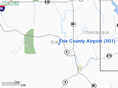
Location & QuickFacts
| FAA Information Effective: | 2008-09-25 |
| Airport Identifier: | 3G1 |
| Airport Status: | Operational |
| Longitude/Latitude: | 079-51-14.1840W/42-02-40.1970N
-79.853940/42.044499 (Estimated) |
| Elevation: | 1450 ft / 441.96 m (Surveyed) |
| Land: | 400 acres |
| From nearest city: | 3 nautical miles NW of Wattsburg, PA |
| Location: | Erie County, PA |
| Magnetic Variation: | 08W (1985) |
Owner & Manager
| Ownership: | Privately owned |
| Owner: | Thomas L. Mountain |
| Address: | Rd 1
Wattsburg, PA 16442 |
| Phone number: | 814-739-2456 |
| Manager: | Thomas L. Mountain |
| Address: | Rd 1
Wattsburg, PA 16442 |
| Phone number: | 814-739-2456 |
Airport Operations and Facilities
| Airport Use: | Open to public |
| Wind indicator: | Yes |
| Segmented Circle: | No |
| Control Tower: | No |
| Landing fee charge: | No |
| Sectional chart: | Detroit |
| Region: | AEA - Eastern |
| Boundary ARTCC: | ZOB - Cleveland |
| Tie-in FSS: | AOO - Altoona |
| FSS on Airport: | No |
| FSS Toll Free: | 1-800-WX-BRIEF |
| NOTAMs Facility: | AOO (NOTAM-d service avaliable) |
Airport Communications
Airport Services
| Airframe Repair: | NONE |
| Power Plant Repair: | NONE |
| Bottled Oxygen: | NONE |
| Bulk Oxygen: | NONE |
Runway Information
Runway 09/27
| Dimension: | 3030 x 60 ft / 923.5 x 18.3 m |
| Surface: | ASPH, Fair Condition |
| Weight Limit: | Single wheel: 12500 lbs. |
| |
Runway 09 |
Runway 27 |
| Traffic Pattern: | Left | Left |
| Markings: | Basic, Fair Condition | Basic, Fair Condition |
| Obstruction: | 42 ft trees, 778.0 ft from runway, 149 ft left of centerline, 13:1 slope to clear | , 50:1 slope to clear |
|
Radio Navigation Aids
| ID |
Type |
Name |
Ch |
Freq |
Var |
Dist |
| CQD | NDB | Cascade | | 372.00 | 08W | 12.0 nm |
| ORJ | NDB | Corry | | 258.00 | 09W | 12.1 nm |
| FKL | VOR | Franklin | | 109.60 | 06W | 36.4 nm |
| JHW | VOR/DME | Jamestown | 094X | 114.70 | 07W | 33.8 nm |
| JFN | VOR/DME | Jefferson | 099X | 115.20 | 05W | 43.5 nm |
| ERI | VORTAC | Erie | 031X | 109.40 | 06W | 19.7 nm |
| TDT | VORTAC | Tidioute | 123X | 117.60 | 09W | 27.9 nm |
| DKK | VORTAC | Dunkirk | 109X | 116.20 | 07W | 37.2 nm |
Remarks
- FOR ARPT CONDS DEC 25-MAR 31 CTC AMGR 814-739-2456.
- SMALL BIRDS & DEER ON & INVOF RY.
- ARPT UNATTENDED. GROUNDSKEEPER ON STATION. NO SVCS.
- VFR ONLY
Images and information placed above are from
http://www.airport-data.com/airport/3G1/
We thank them for the data!
| General Info
|
| Country |
United States
|
| State |
PENNSYLVANIA
|
| FAA ID |
3G1
|
| Latitude |
42-02-40.197N
|
| Longitude |
079-51-14.184W
|
| Elevation |
1450 feet
|
| Near City |
WATTSBURG
|
We don't guarantee the information is fresh and accurate. The data may
be wrong or outdated.
For more up-to-date information please refer to other sources.
|
|


