 |
|
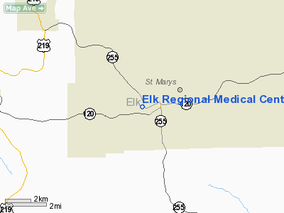
Elk Rgnl Medical Center Heliport |
Location & QuickFacts
| FAA Information Effective: | 2008-09-25 |
| Airport Identifier: | 7PS9 |
| Airport Status: | Operational |
| Longitude/Latitude: | 078-34-43.0820W/41-25-34.2210N
-78.578634/41.426172 (Estimated) |
| Elevation: | 1735 ft / 528.83 m (Estimated) |
| Land: | 0 acres |
| From nearest city: | 1 nautical miles NE of St Mary's, PA |
| Location: | Elk County, PA |
| Magnetic Variation: | 09W (1985) |
Owner & Manager
| Ownership: | Privately owned |
| Owner: | Andrew Kaul Memorial Hospital |
| Address: | Johnsonburg Road
St. Mary's, PA 15857 |
| Phone number: | 814-781-7500 |
| Manager: | John N Christenson |
| Address: | Johnsonburg Road
St. Mary's, PA 15857 |
| Phone number: | 814-781-7500 |
Airport Operations and Facilities
| Airport Use: | Private
MEDICAL USE. |
| Segmented Circle: | No |
| Control Tower: | No |
| Sectional chart: | Washington |
| Region: | AEA - Eastern |
| Boundary ARTCC: | ZOB - Cleveland |
| Tie-in FSS: | AOO - Altoona |
| FSS Toll Free: | 1-800-WX-BRIEF |
Runway Information
Helipad H1
| Dimension: | 40 x 40 ft / 12.2 x 12.2 m |
| Surface: | CONC, |
| |
Runway H1 |
Runway |
| Traffic Pattern: | Left | Left |
|
Radio Navigation Aids
| ID |
Type |
Name |
Ch |
Freq |
Var |
Dist |
| BFD | VOR/DME | Bradford | 113X | 116.60 | 07W | 21.7 nm |
| CIP | VOR/DME | Clarion | 076X | 112.90 | 06W | 43.1 nm |
| ETG | VORTAC | Keating | 107X | 116.00 | 10W | 23.4 nm |
| SLT | VORTAC | Slate Run | 086X | 113.90 | 08W | 27.9 nm |
| PSB | VORTAC | Philipsburg | 102X | 115.50 | 10W | 40.5 nm |
| TDT | VORTAC | Tidioute | 123X | 117.60 | 09W | 41.5 nm |
| TON | VORTAC | Tyrone | 096X | 114.90 | 07W | 43.0 nm |
| ELZ | VORTAC | Wellsville | 051X | 111.40 | 09W | 47.6 nm |
Remarks
Images and information placed above are from
http://www.airport-data.com/airport/7PS9/
We thank them for the data!
| General Info
|
| Country |
United States
|
| State |
PENNSYLVANIA
|
| FAA ID |
7PS9
|
| Latitude |
41-25-34.221N
|
| Longitude |
078-34-43.082W
|
| Elevation |
1735 feet
|
| Near City |
ST MARY'S
|
We don't guarantee the information is fresh and accurate. The data may
be wrong or outdated.
For more up-to-date information please refer to other sources.
|
|


