 |
|
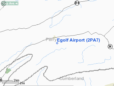
Location & QuickFacts
| FAA Information Effective: | 2008-09-25 |
| Airport Identifier: | 2PA7 |
| Airport Status: | Operational |
| Longitude/Latitude: | 077-17-58.9440W/40-20-00.3040N
-77.299707/40.333418 (Estimated) |
| Elevation: | 610 ft / 185.93 m (Estimated) |
| Land: | 0 acres |
| From nearest city: | 1 nautical miles SE of Landisburg, PA |
| Location: | Perry County, PA |
| Magnetic Variation: | 10W (1985) |
Owner & Manager
| Ownership: | Privately owned |
| Owner: | C. A. Egolf |
| Address: | Po Box 1
Landisburg, PA 17040 |
| Phone number: | 717-789-3304 |
| Manager: | C. A. Egolf |
| Address: | Po Box 1
Landisburg, PA 17040 |
| Phone number: | 717-789-4470 |
Airport Operations and Facilities
| Airport Use: | Private |
| Wind indicator: | Yes |
| Segmented Circle: | No |
| Control Tower: | No |
| Landing fee charge: | No |
| Sectional chart: | Detroit |
| Region: | AEA - Eastern |
| Boundary ARTCC: | ZNY - New York |
| Tie-in FSS: | IPT - Williamsport |
| FSS on Airport: | No |
| FSS Toll Free: | 1-800-WX-BRIEF |
Airport Services
| Airframe Repair: | NONE |
| Power Plant Repair: | NONE |
Runway Information
Runway NW/SE
| Dimension: | 1300 x 40 ft / 396.2 x 12.2 m |
| Surface: | DIRT, |
| |
Runway NW |
Runway SE |
| Traffic Pattern: | Left | Left |
|
Radio Navigation Aids
| ID |
Type |
Name |
Ch |
Freq |
Var |
Dist |
| RV | NDB | Stroh | | 407.00 | 10W | 25.5 nm |
| EUD | NDB | York | | 254.00 | 11W | 31.5 nm |
| BZJ | NDB | Bellgrove | | 328.00 | 10W | 34.7 nm |
| HGR | VOR | Hagerstown | | 109.80 | 07W | 46.0 nm |
| AOO | VOR | Altoona | | 108.80 | 07W | 46.0 nm |
| HAR | VORTAC | Harrisburg | 072X | 112.50 | 10W | 10.7 nm |
| SEG | VORTAC | Selinsgrove | 041X | 110.40 | 08W | 33.4 nm |
| RAV | VORTAC | Ravine | 093X | 114.60 | 11W | 34.7 nm |
| THS | VORTAC | St Thomas | 097X | 115.00 | 07W | 38.4 nm |
| PSB | VORTAC | Philipsburg | 102X | 115.50 | 10W | 47.2 nm |
| LRP | VORTAC | Lancaster | 120X | 117.30 | 09W | 48.0 nm |
| MDT | VOT | Harrisburg International | | 110.00 | | 25.9 nm |
Images and information placed above are from
http://www.airport-data.com/airport/2PA7/
We thank them for the data!
| General Info
|
| Country |
United States
|
| State |
PENNSYLVANIA
|
| FAA ID |
2PA7
|
| Latitude |
40-20-00.304N
|
| Longitude |
077-17-58.944W
|
| Elevation |
610 feet
|
| Near City |
LANDISBURG
|
We don't guarantee the information is fresh and accurate. The data may
be wrong or outdated.
For more up-to-date information please refer to other sources.
|
|


