 |
|
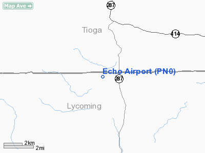
Location & QuickFacts
| FAA Information Effective: | 2008-09-25 |
| Airport Identifier: | PN0 |
| Airport Status: | Closed Indefinitely |
| Longitude/Latitude: | 077-18-22.9180W/41-32-25.2560N
-77.306366/41.540349 (Estimated) |
| Elevation: | 1800 ft / 548.64 m (Estimated) |
| Land: | 25 acres |
| From nearest city: | 4 nautical miles SW of Morris, PA |
| Location: | Lycoming County, PA |
| Magnetic Variation: | 11W (1990) |
Owner & Manager
| Ownership: | Privately owned |
| Owner: | Anthony De Santo |
| Address: | Rd 1, Box 52-a
Morris, PA 16938 |
| Phone number: | 570-353-2922 |
| Manager: | Anthony De Santo |
| Address: | Rd 1, Box 52-a
Morris, PA 16938 |
| Phone number: | 570-353-2933 |
Airport Operations and Facilities
| Airport Use: | Open to public |
| Segmented Circle: | No |
| Control Tower: | No |
| Sectional chart: | Detroit |
| Region: | AEA - Eastern |
| Boundary ARTCC: | ZNY - New York |
| Tie-in FSS: | IPT - Williamsport |
| FSS on Airport: | No |
| FSS Toll Free: | 1-800-WX-BRIEF |
| NOTAMs Facility: | IPT (NOTAM-d service avaliable) |
Airport Communications
Runway Information
Runway 13/31
| Dimension: | 2400 x 130 ft / 731.5 x 39.6 m |
| Surface: | TURF, |
| |
Runway 13 |
Runway 31 |
| Traffic Pattern: | Left | Left |
| Obstruction: | | 100 ft pline, 1650.0 ft from runway |
|
Radio Navigation Aids
| ID |
Type |
Name |
Ch |
Freq |
Var |
Dist |
| PIX | NDB | Picture Rocks | | 344.00 | 09W | 31.2 nm |
| EL | NDB | Halos | | 269.00 | 09W | 43.8 nm |
| ALP | NDB | Alpine | | 245.00 | 12W | 48.5 nm |
| SFK | VOR/DME | Stonyfork | 023X | 108.60 | 08W | 10.6 nm |
| FQM | VOR/DME | Williamsport | 091X | 114.40 | 09W | 26.8 nm |
| ULW | VOR/DME | Elmira | 033Y | 109.65 | 12W | 35.6 nm |
| SLT | VORTAC | Slate Run | 086X | 113.90 | 08W | 29.9 nm |
| MIP | VORTAC | Milton | 029X | 109.20 | 09W | 42.5 nm |
| ETG | VORTAC | Keating | 107X | 116.00 | 10W | 42.5 nm |
| ELZ | VORTAC | Wellsville | 051X | 111.40 | 09W | 45.3 nm |
| PSB | VORTAC | Philipsburg | 102X | 115.50 | 10W | 48.7 nm |
| SEG | VORTAC | Selinsgrove | 041X | 110.40 | 08W | 48.9 nm |
Remarks
- (ARPT STATUS) ARPT CLSD INDEFLY.
- PROVDD VFR; A CLEAR 20:1 APCH/DEP PATH; OBSTRUCTIONS INDICATED ON LAYOUT SKETCH ARE REMOVED/LOWERED/RELOCATED; USE THE 20:1 RATIONALE FOR APCH SFC; AND THLD IS DSPLCD AND MKD.
Images and information placed above are from
http://www.airport-data.com/airport/PN0/
We thank them for the data!
| General Info
|
| Country |
United States
|
| State |
PENNSYLVANIA
|
| FAA ID |
PN0
|
| Latitude |
41-32-25.256N
|
| Longitude |
077-18-22.918W
|
| Elevation |
1800 feet
|
| Near City |
MORRIS
|
We don't guarantee the information is fresh and accurate. The data may
be wrong or outdated.
For more up-to-date information please refer to other sources.
|
|


