 |
|
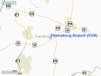
Location & QuickFacts
| FAA Information Effective: | 2008-09-25 |
| Airport Identifier: | 9G8 |
| Airport Status: | Operational |
| Longitude/Latitude: | 078-46-30.8780W/40-27-40.3590N
-78.775244/40.461211 (Estimated) |
| Elevation: | 2099 ft / 639.78 m (Surveyed) |
| Land: | 113 acres |
| From nearest city: | 3 nautical miles SW of Ebensburg, PA |
| Location: | Cambria County, PA |
| Magnetic Variation: | 09W (1985) |
Owner & Manager
| Ownership: | Publicly owned |
| Owner: | Borough Of Ebensburg |
| Address: | 300 W High St
Ebensburg, PA 15931 |
| Phone number: | 814-472-7166 |
| Manager: | Val Carmosino |
| Address: | 300 West High Street
Ebensburg, PA 15931 |
| Phone number: | 814-471-0346
HOME 814-886-8712. |
Airport Operations and Facilities
| Airport Use: | Open to public |
| Wind indicator: | Yes |
| Segmented Circle: | Yes |
| Control Tower: | No |
| Lighting Schedule: | DUSK-DAWN
ACTVT MIRL RY 07/25 & TWY LGTS - CTAF. |
| Beacon Color: | Clear-Green (lighted land airport) |
| Landing fee charge: | No |
| Sectional chart: | Detroit |
| Region: | AEA - Eastern |
| Boundary ARTCC: | ZOB - Cleveland |
| Tie-in FSS: | AOO - Altoona |
| FSS on Airport: | No |
| FSS Toll Free: | 1-800-WX-BRIEF |
| NOTAMs Facility: | AOO (NOTAM-d service avaliable) |
| Federal Agreements: | NGY |
Airport Communications
| CTAF: | 122.800 |
| Unicom: | 122.800 |
Airport Services
| Fuel available: | 100LL |
| Airframe Repair: | NONE |
| Power Plant Repair: | NONE |
| Bottled Oxygen: | NONE |
| Bulk Oxygen: | NONE |
Runway Information
Runway 07/25
| Dimension: | 3204 x 50 ft / 976.6 x 15.2 m |
| Surface: | ASPH, Fair Condition |
| Weight Limit: | Single wheel: 12500 lbs. |
| Edge Lights: | Medium |
| |
Runway 07 |
Runway 25 |
| Longitude: | 078-46-43.3330W | 078-46-08.7050W |
| Latitude: | 40-27-31.6380N | 40-27-49.0350N |
| Elevation: | 2080.00 ft | 2098.00 ft |
| Alignment: | 57 | 127 |
| Traffic Pattern: | Left | Left |
| Markings: | Basic, Fair Condition | Basic, Fair Condition |
| Obstruction: | 55 ft trees, 1150.0 ft from runway, 181 ft right of centerline, 17:1 slope to clear | 96 ft trees, 1927.0 ft from runway, 296 ft right of centerline, 18:1 slope to clear |
|
Runway 11U/29U
| Dimension: | 1636 x 150 ft / 498.7 x 45.7 m |
| Surface: | TURF-DIRT, Fair Condition |
| |
Runway 11U |
Runway 29U |
| Longitude: | 078-46-51.0790W | 078-46-30.0780W |
| Latitude: | 40-27-41.2590N | 40-27-39.2590N |
| Alignment: | 97 | 127 |
| Traffic Pattern: | Left | Left |
| Obstruction: | 18 ft trees, 60.0 ft from runway, 67 ft left of centerline, 3:1 slope to clear | , 50:1 slope to clear |
|
Radio Navigation Aids
| ID |
Type |
Name |
Ch |
Freq |
Var |
Dist |
| INP | NDB | Indiana | | 242.00 | 08W | 16.8 nm |
| BHU | NDB | Benje | | 382.00 | 07W | 23.3 nm |
| SYS | NDB | Stoystown | | 209.00 | 08W | 23.5 nm |
| MKP | NDB | Mc Keesport | | 287.00 | 07W | 46.5 nm |
| CBE | NDB | Cumberland | | 317.00 | 07W | 48.9 nm |
| RV | NDB | Stroh | | 407.00 | 10W | 49.2 nm |
| AOO | VOR | Altoona | | 108.80 | 07W | 23.1 nm |
| REC | VOR/DME | Revloc | 043X | 110.60 | 09W | 5.3 nm |
| JST | VORTAC | Johnstown | 077X | 113.00 | 06W | 9.1 nm |
| TON | VORTAC | Tyrone | 096X | 114.90 | 07W | 26.1 nm |
| IHD | VORTAC | Indian Head | 019X | 108.20 | 06W | 39.7 nm |
| PSB | VORTAC | Philipsburg | 102X | 115.50 | 10W | 44.9 nm |
| THS | VORTAC | St Thomas | 097X | 115.00 | 07W | 49.4 nm |
Remarks
Images and information placed above are from
http://www.airport-data.com/airport/9G8/
We thank them for the data!
| General Info
|
| Country |
United States
|
| State |
PENNSYLVANIA
|
| FAA ID |
9G8
|
| Latitude |
40-27-40.359N
|
| Longitude |
078-46-30.878W
|
| Elevation |
2099 feet
|
| Near City |
EBENSBURG
|
We don't guarantee the information is fresh and accurate. The data may
be wrong or outdated.
For more up-to-date information please refer to other sources.
|
|


