 |
|
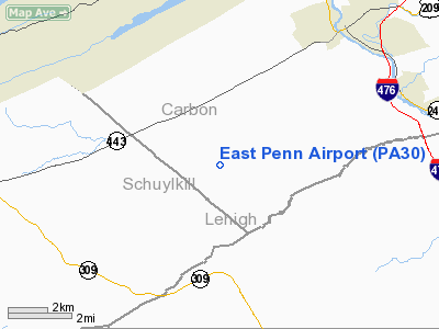
Location & QuickFacts
| FAA Information Effective: | 2008-09-25 |
| Airport Identifier: | PA30 |
| Airport Status: | Operational |
| Longitude/Latitude: | 075-46-28.6890W/40-46-00.3360N
-75.774636/40.766760 (Estimated) |
| Elevation: | 885 ft / 269.75 m (Estimated) |
| Land: | 28 acres |
| From nearest city: | 2 nautical miles NE of Andreas, PA |
| Location: | Carbon County, PA |
| Magnetic Variation: | 11W (1985) |
Owner & Manager
| Ownership: | Privately owned |
| Owner: | Mildred & Norman Rehrig |
| Address: | 1777 Ben Salem Road
Andreas, PA 18211 |
| Phone number: | 717-386-5307 |
| Manager: | Norman Rehrig |
| Address: | Rd 1, Box 160
Andreas, PA 18211 |
| Phone number: | 717-386-5307 |
Airport Operations and Facilities
| Airport Use: | Private |
| Wind indicator: | Yes |
| Segmented Circle: | No |
| Control Tower: | No |
| Landing fee charge: | No |
| Sectional chart: | New York |
| Region: | AEA - Eastern |
| Boundary ARTCC: | ZNY - New York |
| Tie-in FSS: | IPT - Williamsport |
| FSS on Airport: | No |
| FSS Toll Free: | 1-800-WX-BRIEF |
Airport Services
| Fuel available: | 80 |
| Airframe Repair: | NONE |
| Power Plant Repair: | NONE |
Runway Information
Runway 05/23
| Dimension: | 1320 x 300 ft / 402.3 x 91.4 m |
| Surface: | TURF, |
| |
Runway 05 |
Runway 23 |
| Traffic Pattern: | Left | Left |
|
Runway 10/28
| Dimension: | 1340 x 150 ft / 408.4 x 45.7 m |
| Surface: | TURF, |
| |
Runway 10 |
Runway 28 |
| Traffic Pattern: | Left | Left |
|
Runway 16/34
| Dimension: | 1250 x 100 ft / 381.0 x 30.5 m |
| Surface: | TURF, |
| |
Runway 16 |
Runway 34 |
| Traffic Pattern: | Left | Left |
|
Radio Navigation Aids
| ID |
Type |
Name |
Ch |
Freq |
Var |
Dist |
| LQX | NDB | Carbon | | 339.00 | 12W | 2.8 nm |
| HXM | NDB | Humbolt | | 366.00 | 10W | 16.7 nm |
| CYE | NDB | Crystal Lake | | 410.00 | 11W | 26.8 nm |
| UKT | NDB | Quakertown | | 208.00 | 12W | 29.9 nm |
| DYL | NDB | Doylestown | | 237.00 | 10W | 39.5 nm |
| BZJ | NDB | Bellgrove | | 328.00 | 10W | 40.7 nm |
| ING | NDB | Ambler | | 275.00 | 11W | 44.6 nm |
| NXX | NDB | Willow Grove | | 388.00 | 12W | 45.1 nm |
| NXX | TACAN | Willow Grove | 061X | | 10W | 44.8 nm |
| HZL | VOR | Hazleton | | 109.40 | 09W | 20.3 nm |
| ETX | VOR/DME | East Texas | 039X | 110.20 | 09W | 11.9 nm |
| CKZ | VOR/DME | Pennridge | 025Y | 108.85 | 12W | 31.7 nm |
| STW | VOR/DME | Stillwater | 033X | 109.60 | 11W | 43.4 nm |
| BWZ | VOR/DME | Broadway | 089X | 114.20 | 11W | 43.4 nm |
| SBJ | VOR/DME | Solberg | 076X | 112.90 | 10W | 48.4 nm |
| FJC | VORTAC | Allentown | 122X | 117.50 | 10W | 14.8 nm |
| LVZ | VORTAC | Wilkes-barre | 053X | 111.60 | 10W | 30.7 nm |
| PTW | VORTAC | Pottstown | 112X | 116.50 | 09W | 34.2 nm |
| RAV | VORTAC | Ravine | 093X | 114.60 | 11W | 39.7 nm |
| MIP | VORTAC | Milton | 029X | 109.20 | 09W | 43.3 nm |
| LHY | VORTAC | Lake Henry | 045X | 110.80 | 10W | 44.6 nm |
| LRP | VORTAC | Lancaster | 120X | 117.30 | 09W | 45.5 nm |
Remarks
- ARPT PURCHASED FOR USE BY FLYING CLUB-NOT OPEN TO PUBLIC BUT MEMBERS.
- EXISTED PRIOR TO 1959.
Images and information placed above are from
http://www.airport-data.com/airport/PA30/
We thank them for the data!
| General Info
|
| Country |
United States
|
| State |
PENNSYLVANIA
|
| FAA ID |
PA30
|
| Latitude |
40-46-00.336N
|
| Longitude |
075-46-28.689W
|
| Elevation |
885 feet
|
| Near City |
ANDREAS
|
We don't guarantee the information is fresh and accurate. The data may
be wrong or outdated.
For more up-to-date information please refer to other sources.
|
|


