 |
|
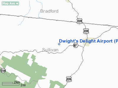
Location & QuickFacts
| FAA Information Effective: | 2008-09-25 |
| Airport Identifier: | PA71 |
| Airport Status: | Operational |
| Longitude/Latitude: | 076-27-43.7980W/41-31-15.2700N
-76.462166/41.520908 (Estimated) |
| Elevation: | 1717 ft / 523.34 m (Surveyed) |
| Land: | 0 acres |
| From nearest city: | 3 nautical miles W of Dushore, PA |
| Location: | Sullivan County, PA |
| Magnetic Variation: | 11W (1985) |
Owner & Manager
| Ownership: | Privately owned |
| Owner: | Dwight & Kay Stoltfus |
| Address: | Rd 2, Box 2546
Fleetwood, PA 19522 |
| Phone number: | 215-683-9259 |
| Address: |
|
| Phone number: | 215-944-0404 |
Airport Operations and Facilities
| Airport Use: | Private |
| Wind indicator: | Yes |
| Segmented Circle: | No |
| Control Tower: | No |
| Landing fee charge: | No |
| Sectional chart: | New York |
| Region: | AEA - Eastern |
| Boundary ARTCC: | ZNY - New York |
| Tie-in FSS: | IPT - Williamsport |
| FSS on Airport: | No |
| FSS Toll Free: | 1-800-WX-BRIEF |
Airport Services
| Airframe Repair: | NONE |
| Power Plant Repair: | NONE |
Runway Information
Runway 07/25
| Dimension: | 1990 x 90 ft / 606.6 x 27.4 m |
| Surface: | TURF, |
| |
Runway 07 |
Runway 25 |
| Traffic Pattern: | Left | Left |
|
Radio Navigation Aids
| ID |
Type |
Name |
Ch |
Freq |
Var |
Dist |
| PIX | NDB | Picture Rocks | | 344.00 | 09W | 18.4 nm |
| CYE | NDB | Crystal Lake | | 410.00 | 11W | 34.0 nm |
| HXM | NDB | Humbolt | | 366.00 | 10W | 38.3 nm |
| ALP | NDB | Alpine | | 245.00 | 12W | 45.2 nm |
| HZL | VOR | Hazleton | | 109.40 | 09W | 36.2 nm |
| FQM | VOR/DME | Williamsport | 091X | 114.40 | 09W | 17.9 nm |
| ULW | VOR/DME | Elmira | 033Y | 109.65 | 12W | 42.7 nm |
| SFK | VOR/DME | Stonyfork | 023X | 108.60 | 08W | 44.3 nm |
| MIP | VORTAC | Milton | 029X | 109.20 | 09W | 31.3 nm |
| LVZ | VORTAC | Wilkes-barre | 053X | 111.60 | 10W | 37.9 nm |
| CFB | VORTAC | Binghamton | 059X | 112.20 | 10W | 40.9 nm |
| LHY | VORTAC | Lake Henry | 045X | 110.80 | 10W | 44.2 nm |
| SEG | VORTAC | Selinsgrove | 041X | 110.40 | 08W | 47.9 nm |
Remarks
Images and information placed above are from
http://www.airport-data.com/airport/PA71/
We thank them for the data!
| General Info
|
| Country |
United States
|
| State |
PENNSYLVANIA
|
| FAA ID |
PA71
|
| Latitude |
41-31-15.270N
|
| Longitude |
076-27-43.798W
|
| Elevation |
1717 feet
|
| Near City |
DUSHORE
|
We don't guarantee the information is fresh and accurate. The data may
be wrong or outdated.
For more up-to-date information please refer to other sources.
|
|


