 |
|
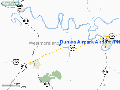
Location & QuickFacts
| FAA Information Effective: | 2008-09-25 |
| Airport Identifier: | PN66 |
| Airport Status: | Operational |
| Longitude/Latitude: | 079-21-49.1360W/40-25-32.2440N
-79.363649/40.425623 (Estimated) |
| Elevation: | 1220 ft / 371.86 m (Estimated) |
| Land: | 0 acres |
| From nearest city: | 3 nautical miles NE of New Alexandria, PA |
| Location: | Westmoreland County, PA |
| Magnetic Variation: | 08W (1985) |
Owner & Manager
| Ownership: | Privately owned |
| Owner: | Robert H Whittaker |
| Address: | Rd 1 Box 26
New Alexandria, PA 15670 |
| Phone number: | 412-668-2431 |
| Manager: | Paul R. Whittaker |
| Address: | Rd 1 Box 25
New Alexandria, PA 15670 |
| Phone number: | 412-668-7007 |
Airport Operations and Facilities
| Airport Use: | Private |
| Wind indicator: | Yes |
| Segmented Circle: | No |
| Control Tower: | No |
| Landing fee charge: | Yes |
| Sectional chart: | Detroit |
| Region: | AEA - Eastern |
| Boundary ARTCC: | ZOB - Cleveland |
| Tie-in FSS: | AOO - Altoona |
| FSS on Airport: | No |
| FSS Toll Free: | 1-800-WX-BRIEF |
Airport Communications
Airport Services
| Fuel available: | 100LL |
| Airframe Repair: | NONE |
| Power Plant Repair: | NONE |
Runway Information
Runway 05/23
| Dimension: | 2000 x 100 ft / 609.6 x 30.5 m |
| Surface: | TURF, |
| |
Runway 05 |
Runway 23 |
| Traffic Pattern: | Left | Left |
|
Radio Navigation Aids
| ID |
Type |
Name |
Ch |
Freq |
Var |
Dist |
| BHU | NDB | Benje | | 382.00 | 07W | 5.2 nm |
| INP | NDB | Indiana | | 242.00 | 08W | 18.4 nm |
| MKP | NDB | Mc Keesport | | 287.00 | 07W | 19.6 nm |
| SYS | NDB | Stoystown | | 209.00 | 08W | 29.0 nm |
| VV | NDB | Camor | | 299.00 | 08W | 37.0 nm |
| PNU | NDB | Washington County | | 255.00 | 08W | 40.3 nm |
| AOO | VOR | Altoona | | 108.80 | 07W | 48.9 nm |
| REC | VOR/DME | Revloc | 043X | 110.60 | 09W | 29.1 nm |
| AGC | VOR/DME | Allegheny | 037X | 110.00 | 09W | 32.3 nm |
| CIP | VOR/DME | Clarion | 076X | 112.90 | 06W | 43.5 nm |
| GRV | VOR/DME | Grantsville | 070X | 112.30 | 06W | 49.7 nm |
| JST | VORTAC | Johnstown | 077X | 113.00 | 06W | 25.1 nm |
| IHD | VORTAC | Indian Head | 019X | 108.20 | 06W | 27.1 nm |
| MMJ | VORTAC | Montour | 057X | 112.00 | 08W | 38.2 nm |
| EWC | VORTAC | Ellwood City | 105X | 115.80 | 08W | 45.5 nm |
Remarks
Images and information placed above are from
http://www.airport-data.com/airport/PN66/
We thank them for the data!
| General Info
|
| Country |
United States
|
| State |
PENNSYLVANIA
|
| FAA ID |
PN66
|
| Latitude |
40-25-32.244N
|
| Longitude |
079-21-49.136W
|
| Elevation |
1220 feet
|
| Near City |
NEW ALEXANDRIA
|
We don't guarantee the information is fresh and accurate. The data may
be wrong or outdated.
For more up-to-date information please refer to other sources.
|
|


