 |
|
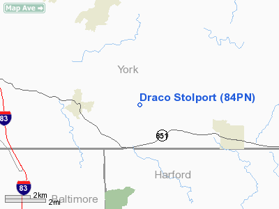
Location & QuickFacts
| FAA Information Effective: | 2008-09-25 |
| Airport Identifier: | 84PN |
| Airport Status: | Operational |
| Longitude/Latitude: | 076-32-07.8780W/39-45-09.3730N
-76.535522/39.752604 (Estimated) |
| Elevation: | 625 ft / 190.50 m (Surveyed) |
| Land: | 0 acres |
| From nearest city: | 2 nautical miles E of Stewartstown, PA |
| Location: | York County, PA |
| Magnetic Variation: | 10W (1985) |
Owner & Manager
| Ownership: | Privately owned |
| Owner: | Howard Merkel |
| Address: | Rd 3
Stewartstown, PA 17363 |
| Phone number: | 717-993-3360 |
| Manager: | Howard Merkel |
| Address: | Rd 3
Stewartstown, PA 17363 |
| Phone number: | 717-993-3360 |
Airport Operations and Facilities
| Airport Use: | Private |
| Wind indicator: | Yes |
| Segmented Circle: | No |
| Control Tower: | No |
| Landing fee charge: | No |
| Sectional chart: | Washington |
| Region: | AEA - Eastern |
| Boundary ARTCC: | ZNY - New York |
| Responsible ARTCC: | ZDC - Washington |
| Tie-in FSS: | IPT - Williamsport |
| FSS on Airport: | No |
| FSS Toll Free: | 1-800-WX-BRIEF |
Runway Information
Runway 07/25
| Dimension: | 500 x 30 ft / 152.4 x 9.1 m |
| Surface: | TURF, |
| |
Runway 07 |
Runway 25 |
| Traffic Pattern: | Left | Left |
| Obstruction: | 40 ft trees, 1000.0 ft from runway | |
|
Radio Navigation Aids
| ID |
Type |
Name |
Ch |
Freq |
Var |
Dist |
| EUD | NDB | York | | 254.00 | 11W | 18.7 nm |
| APG | NDB | Aberdeen | | 349.00 | 11W | 23.8 nm |
| MTN | NDB | Martin | | 342.00 | 11W | 28.2 nm |
| IUB | NDB | Institute | | 404.00 | 08W | 28.3 nm |
| FND | NDB | Ellicott | | 371.00 | 11W | 30.1 nm |
| BZJ | NDB | Bellgrove | | 328.00 | 10W | 41.1 nm |
| BUH | NDB | Anne Arundel | | 260.00 | 10W | 41.5 nm |
| GAI | NDB | Gaithersburg | | 385.00 | 09W | 45.6 nm |
| MTN | TACAN | Martin | 068X | | 11W | 26.0 nm |
| FDK | VOR | Frederick | | 109.00 | 08W | 43.9 nm |
| PPM | VOR/DME | Phillips | 021X | 108.40 | 09W | 24.1 nm |
| LRP | VORTAC | Lancaster | 120X | 117.30 | 09W | 24.8 nm |
| EMI | VORTAC | Westminster | 126X | 117.90 | 08W | 25.7 nm |
| BAL | VORTAC | Baltimore | 098X | 115.10 | 11W | 35.4 nm |
| MXE | VORTAC | Modena | 079X | 113.20 | 09W | 41.1 nm |
| HAR | VORTAC | Harrisburg | 072X | 112.50 | 10W | 41.2 nm |
| DQO | VORTAC | Dupont | 087X | 114.00 | 10W | 43.2 nm |
| RAV | VORTAC | Ravine | 093X | 114.60 | 11W | 48.2 nm |
| MDT | VOT | Harrisburg International | | 110.00 | | 28.7 nm |
Remarks
- RESTRICTED TO PERSONAL USE & GYRO-COPTER AIRCRAFT.
Images and information placed above are from
http://www.airport-data.com/airport/84PN/
We thank them for the data!
| General Info
|
| Country |
United States
|
| State |
PENNSYLVANIA
|
| FAA ID |
84PN
|
| Latitude |
39-45-09.373N
|
| Longitude |
076-32-07.878W
|
| Elevation |
625 feet
|
| Near City |
STEWARTSTOWN
|
We don't guarantee the information is fresh and accurate. The data may
be wrong or outdated.
For more up-to-date information please refer to other sources.
|
|


